Last Updated on 22 August 2024 by Cycloscope
Our Spiti Valley Bikepacking Tour – Road Conditions, Climate, Where to Sleep, Safety, Phone Signal – All You Need to Know
Our bike trip in the Himalayas began in Shimla, the capital of Himachal Pradesh, in the Himalayan foothills. From here we cycled the beautiful Spiti Valley to Kaza, tackled the difficult Kunzum Pass, and finally emerged on the Manali Leh Highway.
Disclosure: Some of our articles contain affiliate links. This comes at no additional cost for you and helps us keep this website up and running. (as Amazon Associates we earn commission from qualifying purchases)
It was undoubtedly one of the most beautiful trips of our lives. The majestic landscapes, the thousand-year-old culture, the people, the food. All these things make this little part of the world one of the most unique you can visit.
Obviously, the best season to visit this area is summer. The road is however kept in good condition, weather permitting, up to Kaza. We left at the beginning of June and apart from a little rain in the beginning, we encountered sun and good weather.
The summer season (June to September) is relatively short but is the best time to visit Spiti Valley. Daytime temperatures are pleasant, ranging from around 15°C to 25°C, but nights can still be chilly. The climate of Spiti Valley is characterized by its harsh winters, short summers, low precipitation, and high altitude conditions.
Acclimatization and Altitude Sickness
This road is not at very high altitudes like the Manali Leh, the highest point is the Kunzum pass (14,931 ft or 4551 m) but you still need to pay attention to the altitude problems, you will often be above 3000 (9842 ft) meters.
Altitude sickness arises when insufficient oxygen is obtained from the air at elevated altitudes, leading to symptoms like headaches, decreased appetite, and sleep disturbances. It commonly occurs when individuals unaccustomed to high altitudes rapidly ascend from lower elevations to 2500 meters (8000 feet) or above. For instance, driving over a high mountain pass, trekking to higher altitudes, or reaching a mountain resort may trigger symptoms such as headaches.
Traveling by bicycle naturally the ascent will not be as rapid as if you were traveling by car. At the same time, however, you will use more oxygen and even if the climb itself is not what you think, it will seem like you are making much more effort than normal.
Mild altitude sickness is a prevalent occurrence, and experts cannot predict who will experience it and who will not. Factors such as fitness level or gender do not influence the likelihood of developing altitude sickness.
In our case, Daniele had almost no problems while I suffered a bit. I don’t know if suffering from mild asthma contributed, but I often had a cough at night and difficulty breathing. A couple of times I took medicines bought in India (Diamox), and they made me feel better immediately.
The principles of acclimatization are outlined by three rules, adherence to which maximizes the process:
- Climb High, Sleep Low: Ascend to higher altitudes during the day but descend to lower altitudes for sleep. This gradual exposure allows the body to adapt more effectively to the reduced oxygen levels at higher elevations.
- Slow Ascent, Avoid Overexertion: Take a gradual approach to ascending to higher altitudes, avoiding rapid changes. This helps the body acclimate to the changing environmental conditions. Overexertion should be minimized to prevent undue stress on the body during the acclimatization process.
- Hydrate, Hydrate, Hydrate: Maintain proper hydration levels by consistently drinking an ample amount of water. Staying well-hydrated aids in coping with the physiological challenges posed by higher altitudes and supports the acclimatization process.
There are many military bases along the way, if you feel sick go to them, they know how to treat the symptoms and they are the only ones who can help you. Unfortunately, many Indian tourists do not take any precautions and there are deaths every year. Alcohol doesn’t help, so don’t drink. The small shops along the road sell oxygen canisters,
Road Conditions and Climate
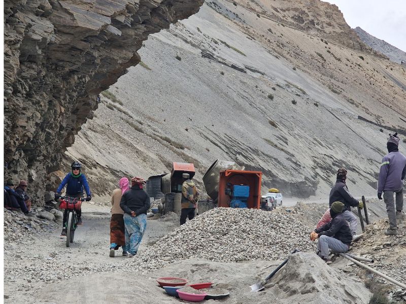
The road condition from Shimla to Kaza is quite good. Most of the road is asphalted except for a few parts where there is work in progress. Given the harsh climate, there is often work to fix the road, especially after the winter.
The Spiti Valley road, although undergoing improvements in recent years, still faces challenges in terms of road construction and maintenance. Steep gradients, narrow passages, and loose soil make it difficult to establish stable road infrastructure, increasing the risk of landslides. Deforestation, improper land use practices, and the presence of numerous glaciers can contribute to landslides through glacial retreat, ice melt, and the release of debris onto the valley floor. We met more than a few landslides along the road, you just have to wait, usually, a couple of hours, as they clean up the passage.
Consider that the Kunzum Pass road opens between late May and early June, depending on the conditions. You can check the status of the roads here.
Phone Signal, Electronics, and GPS
The signal is quite good, we had Airtel India and we had reception in the villages while along the road not all the time. We heard that BSNL (the national carrier) has better reception in remote places). In larger villages you can find wifi in hotels and guest houses, it doesn’t always work but it’s enough to check essential things.
Expenses and ATM
There are ATMs in the main villages but they don’t always work with international cards and the withdrawal limit is quite low, usually 100,000 rupees. We recommend bringing enough cash for the trip with you. Paying by card is not very common, and even if you book via Booking.com or similar the payment is managed by the hotel, and is usually cash.
Equipment for the Manali Leh Bike Tour
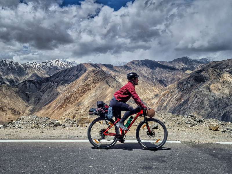
We decided to tackle this trip by bicycle very light, without bringing any camping equipment, especially given the Manali Leh Highway, which requires a lot of effort especially due to the altitude, less weight to carry, and more lightness for our legs.
Our equipment for the Spiti Valley Bikepacking Tour:
- Sigr Wind Jacket
- Sigr Cycling Shorts + T-Shirt
- Saddle Bag
- Top Tube Bag
- Handlebar pack
- Thermic Water Bottle
- Winter Pants (bought at a local market)
- Rain Pants
- Bontrager Helmet
- Bike Pump
- Bike Puncture Repair Kit
- 1 Bike Tube
- Lubricant
- Merino wool base layer
- Wool Socks (for the night)
- Power Bank
- Sleepers
- Sun Cream (we use the surfer sunblock)
- Cycling Waterproof Winter Gloves
Where to Sleep in the Spiti Valley
There are guest houses, hotels, and homestays everywhere along the road. You will have no problem finding a place to sleep. In contrast, especially along the first part of the road, there are not many wild camping opportunities.
While on the Manali Leh, we regretted not having been able to camp in wonderful places, along the Spiti Valley we didn’t miss the tent much. The walls on the side of the road are vertical and landslides are commonplace. Other cyclists have told us that they have often camped on the flat roofs of local homes.
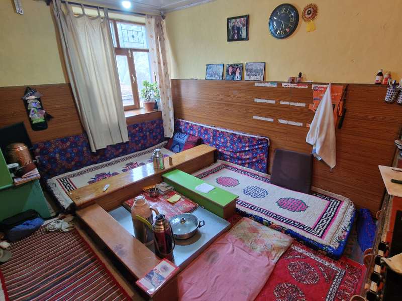
We have chosen the local Homestays, they are often traditional homes, they are very cheap, usually around 1200 rupee, dinner and breakfast are included and you will have the opportunity to interact with the inhabitants. In the main villages, you will also find hotels, usually with a restaurant, at slightly higher prices.
Our favorite homestays:
Festivals of Spiti Valley
Some of the festivals celebrated in Spiti Valley:
- Losar Festival: Losar marks the Tibetan New Year and is celebrated with much fervor in Spiti Valley. It usually falls in February or March, depending on the lunar calendar. The festival involves various rituals, including chanting, masked dances (Chham), and offering prayers for prosperity and good health.
- Tsheshu Festival: This festival is celebrated in the summer months, usually in June or July. It involves colorful masked dances performed by the monks at various monasteries across Spiti Valley. These dances depict stories from Buddhist mythology and serve as a form of religious teaching and entertainment.
- Gochi Festival: Gochi is a harvest festival celebrated by the locals in the month of September. It marks the end of the agricultural season and is a time for villagers to rejoice and celebrate the bounty of the land. Traditional folk songs, dances, and feasting are integral parts of the Gochi Festival.
- Gataur Festival: Celebrated in the month of February, Gataur is a unique festival dedicated to the worship of animals. Villagers gather to pay homage to their livestock, seeking blessings for their well-being and prosperity. The festival is characterized by rituals, prayers, and offerings to animals.
- Dakthok Tseschu: Dakthok Tseschu is a significant Buddhist festival celebrated at Dakthok Monastery in Spiti Valley. It usually falls in July and involves masked dances, prayers, and rituals performed by the monks to commemorate Guru Padmasambhava, the founder of Tibetan Buddhism.
- Sakya Tangyud Monastery Festival: This festival takes place at Sakya Tangyud Monastery in the village of Kaza. It typically occurs in June and features traditional Tibetan music, dance performances, and religious ceremonies. The festival attracts locals as well as tourists from around the world.
For a complete list of Festivals in the Spiti Valley check this website.
Permits for the Spiti Valley Road
You will need a permit for a part of the road, you can get it in Rekong Peo or Kaza, depending on your direction. We got it in Rekong Peo; the permit is quite easy to obtain. We went to an agent inside the tourist office building (here), filled out a form, paid, and waited a couple of hours.
Our Spiti Valley Bikepacking Tour
Day 1 Shimla to Kumarsain (92km)
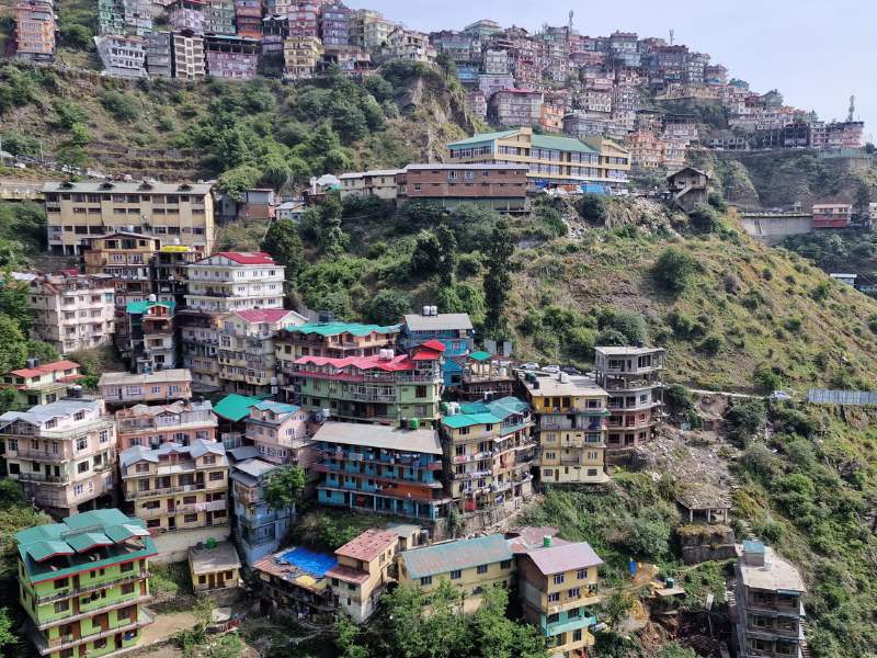
Shimla was a pleasant surprise. Everyone here walks with heavy breathing, stairs and steep climbs connect the houses in a maze of spectacular alleys. Originally established as a summer capital during British rule, its colonial architecture, including the iconic Viceregal Lodge, adds to its historical appeal.
In Shimla we had our bicycles checked @bikebros, they also rent bikes and organize bike adventures in the Himalayas. Also, they were very useful during our trip, we had some mechanical problems along the road and they were able to send us the spare parts we needed.
We left Shimla through a steep 8 km climb, the traffic was heavy and loud. We started our trip at the beginning of June, together with hundreds of thousands of Indian tourists. The main Indian holidays last about 2 weeks, if you can avoid that season. From Shimla there is an alternative road to reach the first pass, it is 5 km longer and less heavy, but we do not know about the traffic/road conditions.
After reaching 2700 there is a nice descent into apple and cherry valley, all the fruit trees are covered with nets to protect them from the hail which often strikes hard here. Another nice climb up to the ski resort of Narkanda, busy even without snow, before starting the steep forested descent that from 2600msl will bring us down to only 800, where our journey up to the 5000 meters will really begin.
Day 2 Kumarsain to Jeori (67km)
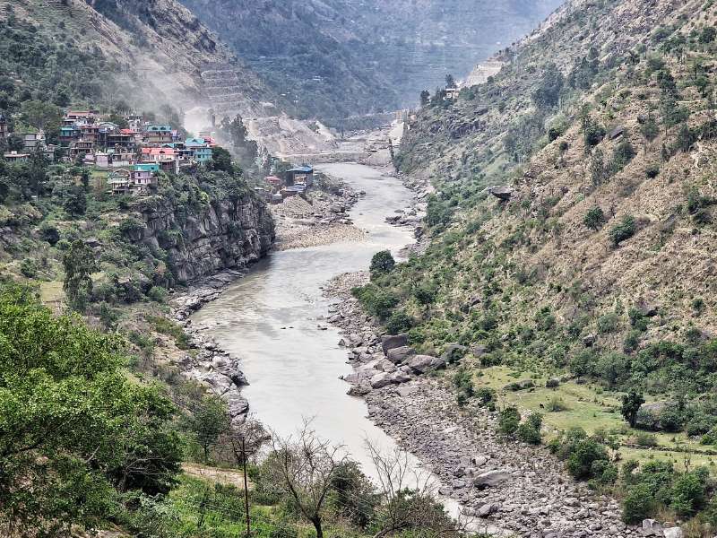
We reach the valley of the Sutlej River, which we’ll follow upstream for the next few days, from 850 to 3000 meters. The first impact is quite sad, a big hydropower project is in motion here, a plan to flood all this area of the valley (you can see the level the water will reach in the last 2 pics). The road is dusty and chaotic.
Once past the provisioned inlet of the dam to be though, everything becomes quieter, and slowly the natural beauty of the landscape starts to sink in. The power of the river, the snowcapped peaks, the colorful houses, and the occasional statue of Hanuman ji.
The Padam Palace in the super-busy town of Rampur is worth a quick stop, although closed. It once served as the Winter Capital of the former princely state of Bushair.
The climb is gentle and gradual, but the weather is less so. A sudden outburst of rain surprises us not far from the day’s goal, but it doesn’t last long and our gear holds on. In this section, you are still quite low and rain is not rare.
Day 3 – Saini to Raang (61km)
First thing in the morning is a Hindu temple with hot springs inside, there are pools for men and for women where to bath.
The road in this section is mesmerizing, with vertical drops of hundreds of meters, passages carved in the mountains, and the omnipresent river with its mighty power. Beekeepers sell honey at every curve, while blacksmiths hammer iron tools as they did a thousand years ago.
Landslides are also everywhere though, quite scary honestly. First, we meet a fresh one and we have to wait for about 90 minutes for the machines to clear the road. Then we witness one live, a huge blast like an explosion and big stones rolling down the cliff, dust rising high and making the air unbreathable. Luckily it was on the other side of the river.
Day 4 – Raang to Rekong Peo (21km)
Short day with the steep climb to the town of Rekong Peo where we need to apply for the so-called “Inner Line Permit”. For the next 200km, the road will go pretty much along the border with Tibet, or as the Chinese call it “Tibet autonomous region of China”.
This is one of several areas that have seen skirmishes in recent and less recent years between the armed forces of India and PRC, indeed the area is heavily militarized and somehow restricted. What we are going to cross used to be part of Tibet, and the culture, costumes, and faces confirm that.
The permit is quite easy to obtain. We went to an agent inside the tourist office building (here), filled out a form, paid, and waited a couple of hours. While you wait you can take a detour to the ancient city of Kalpa, supposedly the summer abode of Shiva himself.
Day 5 – Rekong Peo to Pooh (71km)
In the morning the sun shines and the snowcapped peaks appear clear and crisp, it has snowed up there in the night and the white of the snow is soft and brilliant.
From Rekong Peo, the first section of the road is quite remote and there’s nowhere to eat for 20+km. The landscape is even more rugged than before, vertical walls of grey stone and no vegetation give it an otherly-planet vibe.
For lunch we eat momos in a place managed by two kids, one might be 10 and the other 13/14. The day proceeds smoothly until the final climb to the village of Pooh.
Day 6 – Stuck in Pooh
We had to stay a couple of days in Pooh because our new derailer had just broken, and we had to wait for the shipment from Shimla. The owner of the hotel we were staying (Om Hotel and Restaurant) was bringing a group of university students to visit some remote traditional village so, we ended up joining the group for a very nice side trip.
The Ropa Valley is a dead-end road about 20km South of Pooh, the valley is gorgeous and full of apple trees, so it would make a great detour, and we are going to suggest it in our guide.
The village of Ropa has three different styles of architecture: the oldest is one is entirely in wood, without nails, all parts adjoining; the second oldest is stone dry-walls intertwined with timber layers to make them elastic and resistant to earthquakes; the third is modern bricks and cement, not locally sourced, not energy-efficient.
The second place we visit is the town of Labrang, with its mysterious fort from the 14th century. Here we get reminded why we’ll never want to take any transport here in the Himalayas. The road is super-narrow, with plenty of hairpin bends and no guardrail whatsoever, every time we meet another car someone has to go just a few centimeters from the abyss.
Another good reason why bikepacking is the best way to travel the Himalayas.
Day 8 – Pooh to Nako (38km)
After some kilometers, the actual restricted area of the “Inner Line” starts, where the road forks, taking the right we’ll be in Tibet in 10km, too bad those borders are not for us to use. A few more km and we bid farewell to the Sutleji river, which instead is free to go to Tibet, well it’s actually coming from there.
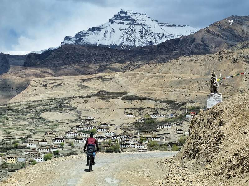
The junction here is one of the waters, with the Spiti coming in, its color greener and cleaner. We are officially cycling in the Spiti Valley!
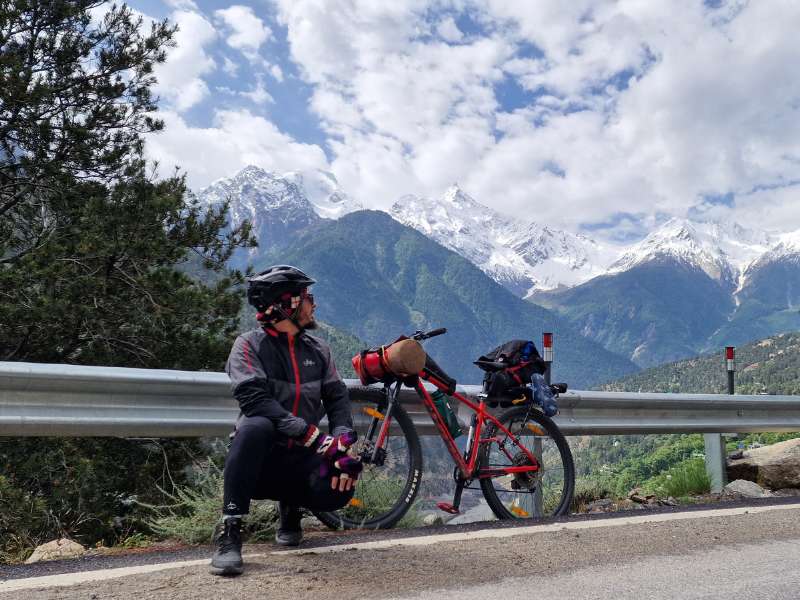
The first real pass is in front of us, a steep climb that will bring us from 2800 to the 3600 meters of Nako village, and beyond to 3800. The views are incredible as usual, the sun is striking and we have to smear one more dose of surfer’s zinc on our already burned noses and hands.
A thousand meters in a day is not a small gain at this altitude, indeed we begin to feel a little weird once past 3200. I arrive in Nako with no voice and some pain in the lungs.
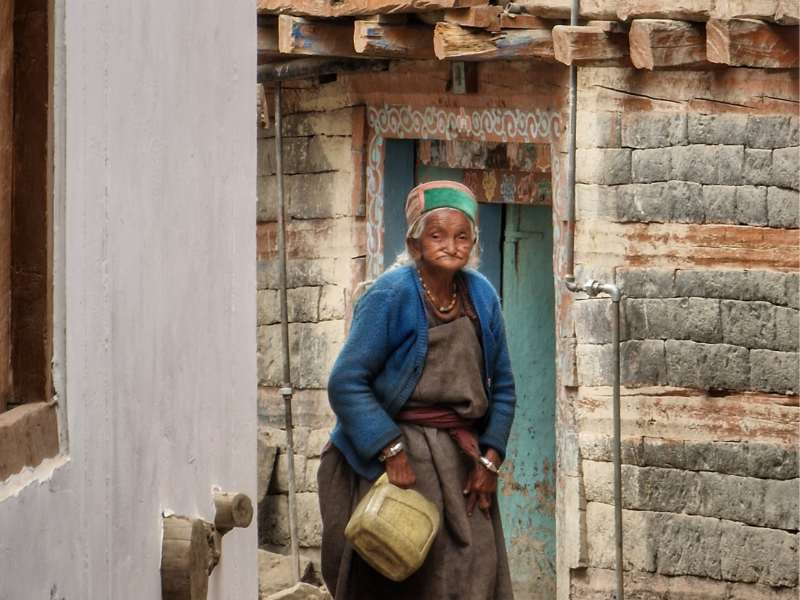
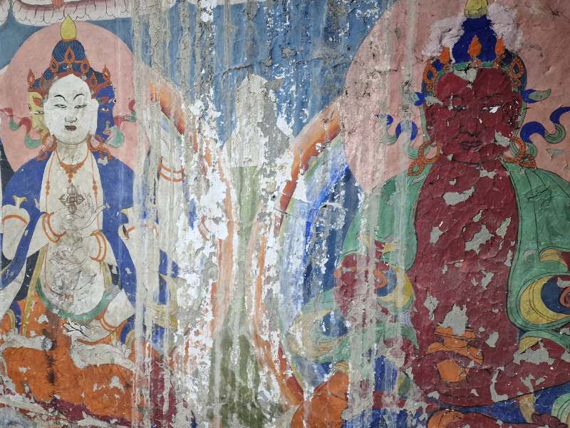
Nako is a beautiful little village, with its old traditional stone houses and a tiny monastery of a thousand years, whose wall paintings are embedded with real gold.
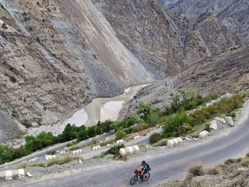
Day 9 – Nako to Tabo (63km)
Leaving Nako we still have 250 meters to climb to the unnamed pass at 3850msl, the air is thin and quite chill in the morning. The descent is psychedelic with unbelievable colors, it reminds us of the rainbow mountain of Zhangye in China.
Everywhere around are the real heroes of the Himalayas, men and women constantly fixing the road, cleaning the loose rocks, and building walls to protect from landslides, they are BRO, and they make our trip possible.
Down the Spiti Valley is greener than expected, with the ubiquitous apple trees and willows and buckthorns and freshly planted barley fields.
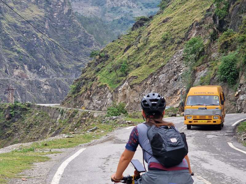
The road gets narrower and narrower, with unprotected drops and a constant passage of tourist minibusses that make it quite scary at times. Add that to barely balancing overhanging boulders and unstable dunes of silt and you’ll get why those are often referred to as some of the most dangerous roads in the world.
Day 10 – Tabo to Shichiling (25km)
We opted for a short day and sleeping at the river level before the steep climb that will take us to Dhankar and Lhalung (3800msl) tomorrow. For the first time in this trip we regret not having a tent, finally, there are indeed a few great wild camping spots, which were non-existent on the steep and unstable valley of the Sutleji.
Rock formations similar to the famed fairy chimney of Cappadocia dot the landscape amidst the colorful rocks and snow-covered peaks. The road though is super narrow, and the flow of tourist minibuses, taxis, self-driving tourists, and motorbikers is constant and annoying. We spot many Himalayan Griffon Vultures, humongous with their 3-meter wingspans.
We stop early, refreshing by the river after lunch with the spiciest soup in the world.
Day 11 – Shichling to Lhalung (23km)
As if there wasn’t already enough climb in our planned route, today we went for an uphill diversion.
A series of tight switchbacks brought us up to the tiny village of Dhankar, with its 9th-century Gompa (Buddhist Monastery) nestled between Rocky pinnacles. A great suggestion from afar but maybe not totally worth the 600-meter elevation gain… But that’s not the end of this detour.
A scary dirt road with vertical drops brings us to the idyllic hamlet of Lhalung, all its houses in the characteristic style of the Spiti Valley: stone foundations and Adobe bricks, washed with lime paint and topped with a roof of straws and mud.
Here there’s another old monastery, much less famous than the previous one. We find it closed but a small thousand-year-old woman tells us not to worry, she disappears and comes back with the keys, which she gives to us! We can open these ancestral chambers and enjoy them all by ourselves
We stay with a gentle local family, they tell us how the snow hasn’t been falling as it should in the last years, while a new phenomenon has made its appearance: rain
This valley is so fragile, that a change like this can cause disaster. Indeed a village has been totally washed away by a landslide due to a sudden and unexpected burst of rain.
Day 12/13/14 – Lhalung to Kaza and rest days
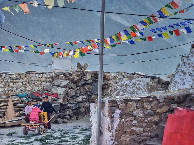
Despite being above 3000msl for 5 days, and having slept at 3800 already twice, arriving in Kaza we find ourselves quite out of breath. Kaza is the main town of the Spiti Valley and the end destination for many of the tourists coming here, only the most adventurous dare go onwards.
Kaza must have been a nice place not long ago, now mass tourism has destroyed it. Dusty like a permanent building site, cheaply made guesthouses popping up everywhere without any urban planning or regulations.
At least we get to taste some local delicacies (must-go are Hotel Deyzor & Restaurant owned by a bicycle tourer couple and Café Piti for authentic Tibetan Cuisine.
Day 15 Kaza to Chicham
Ready to leave the dusty comfort of Kaza. There are two roads to get to Losar, the last village of Spiti Valley: one is the “highway” gently sloping upwards, and the other one is a backroad with a steep climb above 4000 meters in the middle.
Our choice goes for the back road, so we begin the climb to the first stop of the day, the Key Monastery, the biggest Buddhist center of Spiti. It’s prettier in the pictures than it’s live, although the meditation cave has a strong energy.
Then there’s Chicham Bridge, claiming to be the highest bridge in Asia, not sure about that, but still quite vertiginous on a stunning canyon.
We end the day in the picturesque village of Chicham, where we learn that snow has been so scarce this winter that soil is dry and crops give between 5% and 10% of what they’re supposed to. A very meager season that’ll leave many families stranded.
Day 16 – Chicham to Losar [37km]
We’ve been on the road since 2014, riding through more than 50 countries, but what we saw today in these short 37km hardly compares to anything we’ve had the privilege to admire before.
In a single glance: the purple slopes of silt, the shaded pinnacles of phantasmagoric castles, the green winding river and its wide azure bed, the orange grass, the yellow sand, and the white snowy peaks.
So what should have been a short ride becomes a long mesmerizing dream, an experience we try to taste as slowly as possible, trying to postpone forever its end.
So no, it seems there’s no limit to beauty
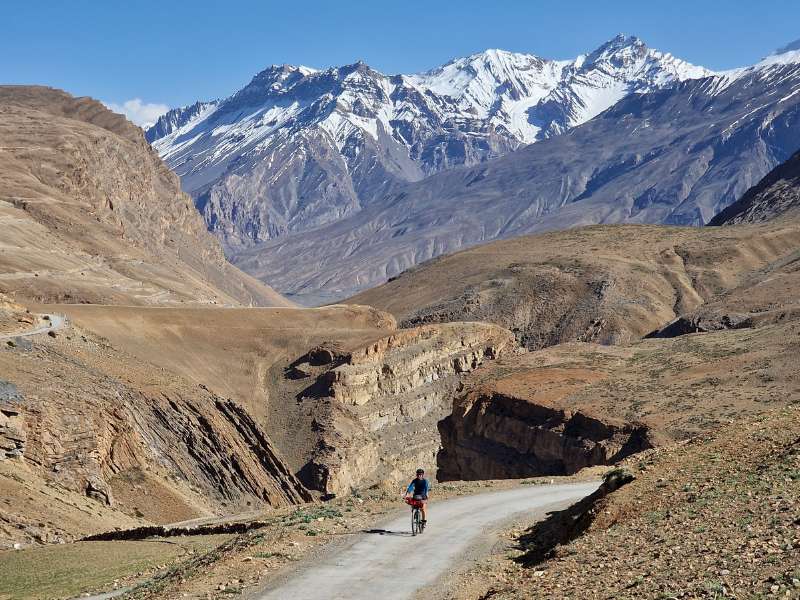
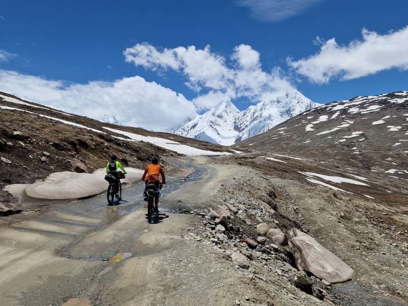
Day 17 – Losar to Batal [34km]
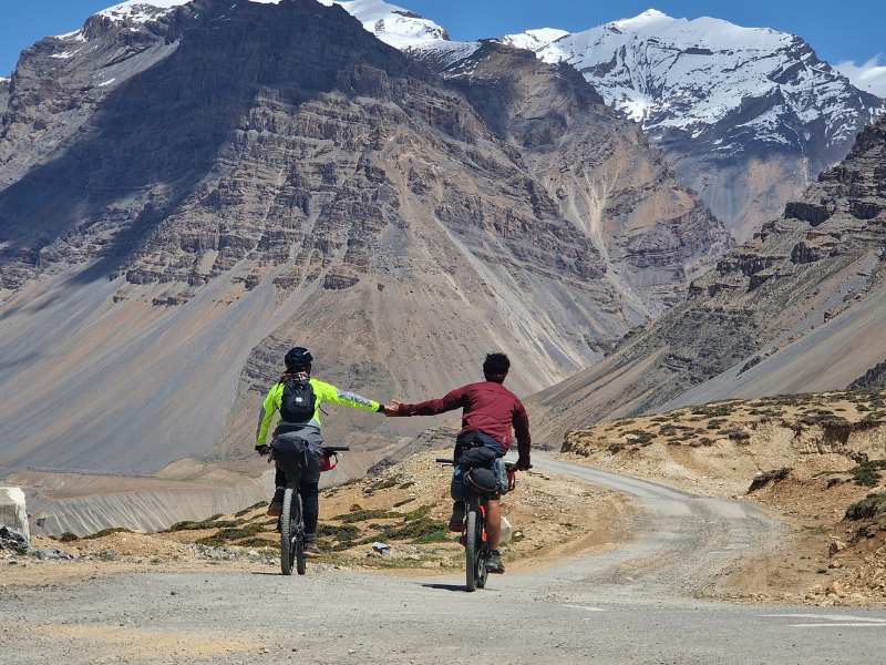
About 8km from Losar we kiss goodbye to the mighty Spiti River and to the tarmac with it. The way from this valley to the next, the one of the Chandra River, goes through one of the harshest mountain passes of Himachal Pradesh, the 4560m tall Kunzum Pass.
For the first time, the snow is not above us, but below, and soon right by our side, taller and taller as we struggle towards the top. The trail up Kunzum from Losar ends up being not too bad. On top, of the mandatory stupas, bells, and tourists taking selfies.
The situation changes on the way down, the surface on these narrow and scary switchbacks facing the abyss of the fast-flowing Chandra river below is not that of a road. Large stones and water flowing fast from the snow walls melting.
A few tourist minibusses get stuck, I would be terrified of being on one of those. As if the day isn’t already dire enough, there’s a storm approaching, we fear snow but instead, it begins to rain, very unusual here.
So freezing our asses off on this slow and technical descent we abandon the project of reaching Chandrataal, a glacier lake that would need us to detour about 16km (+16 back eventually).
We reach the temporary settlement of Batal right when the rain starts to pour much harder. In this lunar landscape, we sit and savor hot masala chai in the mythical dhaba of Chaca and Chachi, a local couple who offer shelter to weary travelers.
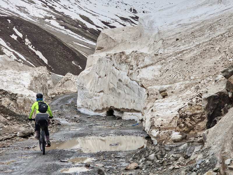
Day 18 – Batal to Chattru (34km)
On paper today is a gently sloping downhill along the Chandra river… Too bad some of it is basically INSIDE the river.
The day begins leaving the lunar plains of Batal riding through the riverbed, large pebbles, and wide puddles before reaching the first humongous snow tunnel.
Ice walls more than 10 meters tall high flanking the so-called road while quickly melting and flowing on the track… At least it’s cloudy and cold so they do not melt too fast.
It’s a ride on water and stones, challenging even for our mountain bikes, much less so for Matteo’s light tourer, whose brand new brake pads (put up two days ago) are finished to the bone less than halfway to Chattru. Several cars and motorcycles are stuck on steep wet slopes or deep river fords, it’s crazy that this isn’t considered a 4×4-only road.
Towards the early afternoon we reach a greener section where huge herds of goats and sheep pop up from nowhere, the shepherds seemingly as good climbers as their animals, we spot them strolling on impossibly steep slopes.
We’d like to push it to the end of the dirt road, to the junction with the Manali-Leh highway which is only 19km away, but after a late lunch km Chattru, we decide to call it a day. There are a couple of scenic campsites where to enjoy the golden hours.
Day 19 – Chattru to Sissu
We wake up to the news of a landslide blocking the road, they say there’s enough space for a two-wheeler to pass but not for anything bigger. Good! Less traffic!
We feel refreshed and ready to tackle the remaining 19 km of hell, it shouldn’t take that long…Too bad there are more river crossings in this section than there were in the previous 70km, and there were a lot.
Some thunderous waterfalls crash straight on the poor road before precipitating in the ravine… Doesn’t feel very safe.
A car of Indian tourists is totally stuck in one of those falls. Three boys try to remove big rocks from underneath the car while three ladies in high heels and summer clothes write their names on the snow, one wears a t-shirt saying “city life”. The car is blocking the passage almost completely but not for a herdsman with a few hundred sheep and a dozen horses, they just go through almost trampling the vehicle and its passenger.
Several shepherds are settled in tents for the summer, bringing their flocks for transhumance as they did for centuries. Another rental car is abandoned under another fall, and the front axle is totally gone.
Although the mix of green blue and white in the landscape is stunning, the final climb is a massacre… And it really feels like a stage of the Giro d’Italia when we finally reach the tar and there are hundreds of cars and police and everyone stops us and asks questions like they’re interviewing the winners.
We are at the bottom of Rohtang Pass, a very tourist spot, where people from the lowlands come to take selfies in the snow wearing ski suits.
We are back on the tarmac and it feels great even if the road is super-crowded. A quick descent and a short uphill lead us to the tourist town of Sissu, famous for its horrible artificial lake where people rent pedal boats, go figure. There’s a bakery though, and the apple pies are simply delicious.
Here we start our Manali Leh Adventure!