Last Updated on 14 January 2025 by Cycloscope
Manali Leh Highway – Bikepacking the Himalayas
Road Conditions, Climate, Where to Sleep, Safety, Phone Signal – All You Need to Know
We cycled the Manali Leh Highway in June 2023. The Indian government is currently investing a lot of money to bring tourists to the area, probably too many, they are building tunnels, and fixing roads in the region. This guide is accurate to June 2023 and the conditions and route will be changed over time. Older guides suggest that there are many river crossings and rough terrain; bridges and infrastructure have since been significantly developed and as of 2023 we were able to complete the route with our feet only getting wet once or twice.
Disclosure: Some of our articles contain affiliate links. This comes at no additional cost for you and helps us keep this website up and running. (as Amazon Associates we earn commission from qualifying purchases)
The Manali Highway joins the town of Manali to the town of Leh, running from Himachal Pradesh through to the Ladakh region of Jammu and Kashmir. Jammu and Kashmir is a semi-autonomous state of India and borders both Pakistan and China.
We started from Shimla and cycled the amazing Spiti Valley before popping up on the Manali Leh, a great way to acclimatize. We also took a detour and cycled the Lakes Region (Tso Moriri) for which you’ll need a permit easily obtainable in Leh. From Leh, we proceeded to Kashmir and finished our bicycle tour in Srinagar. In this post, we’ll focus only on the Manali Leh part of our bikepacking itinerary.
In this guide we’ll talk about:
- Manali Leh Highway – From Where to Start.
- When the Manali Leh opens.
- Road Conditions + Climate.
- Phone Signal and Electronics and SIM card.
- Where to Sleep.
- Food and Water.
- Equipment.
- Medicine per altitudine.
- Autostop.
- Festival.
- Flying Rocks and other dangers
- Best Season
- GPS and navigation
- Permits
- Expenses and ATM
- Our Manali Leh Highway step by step
Manali Leh Highway – From Where to Start

Instead of starting from Manali, we started from Shimla, the capital of Himachal Pradesh. We crossed the Spiti Valley and arrived on the Manali Leh via the Kunzum Pass, undoubtedly the most difficult part of our bike trip in the Himalayan region. The positive side is certainly the acclimatization, Shimla is about 2200 meters high and you climb very slowly.
Starting from Manali (at around 2000 meters), however, you will immediately have to cross the Rohtang Pass, at 3978 meters above sea level. Consider that the Rohtang Pass does not open at the same time as the Manali Leh Highway, in 2023 they opened in mid-June. There is a tunnel from Manali that avoids the pass, it is not allowed to cycle through it although we know that several cyclists have done it. We honestly think it is quite dangerous so we do not recommend it. If you start your trip before the opening of the pass you can take a lift through the tunnel.
There is a dabha to sleep in Marhi, 20 km from Manali, just before the start of the pass, at around 3100 meters. If you decide to cycle the pass in one day from Manali, it is a fairly brutal elevation gain to tackle in a single ride, furthermore, the Rohtang pass is very busy during the summer season, so much so that it is often closed in one of the two directions due to too many cars. Cyclists are usually allowed even if the road is closed to cars.
If you don’t have time to cycle Spiti Valley and your focus is only on the Manali Leh Highway, our advice is to start from Manali anyway.
Some blogs suggest going the opposite direction, from Leh to Manali. Do not do this if you are not acclimatized; the acclimatization schedule from Leh to Manali is dangerous. You would start at 3500 m and rise to the high point of 5300 m on your second or third day, which is a bad altitude sickness risk. The Leh to Manali direction would require multiple rest days at Leh and taking higher elevation walks to achieve acceptable acclimatization.
Acclimatization and Altitude Sickness
Altitude sickness arises when insufficient oxygen is obtained from the air at elevated altitudes, leading to symptoms like headaches, decreased appetite, and sleep disturbances. It commonly occurs when individuals unaccustomed to high altitudes rapidly ascend from lower elevations to 2500 meters (8000 feet) or above. For instance, driving over a high mountain pass, trekking to higher altitudes, or reaching a mountain resort may trigger symptoms such as headaches.
Traveling by bicycle naturally the ascent will not be as rapid as if you were traveling by car. At the same time, however, you will use more oxygen and even if the climb itself is not what you think, it will seem like you are making much more effort than normal.
Mild altitude sickness is a prevalent occurrence, and experts cannot predict who will experience it and who will not. Factors such as fitness level or gender do not influence the likelihood of developing altitude sickness.
In our case, Daniele had almost no problems while I suffered a bit. I don’t know if suffering from mild asthma contributed, but I often had a cough at night and difficulty breathing. A couple of times I took medicines bought in India (Diamox), and they made me feel better immediately.
The principles of acclimatization are outlined by three rules, adherence to which maximizes the process:
- Climb High, Sleep Low: Ascend to higher altitudes during the day but descend to lower altitudes for sleep. This gradual exposure allows the body to adapt more effectively to the reduced oxygen levels at higher elevations.
- Slow Ascent, Avoid Overexertion: Take a gradual approach to ascending to higher altitudes, avoiding rapid changes. This helps the body acclimate to the changing environmental conditions. Overexertion should be minimized to prevent undue stress on the body during the acclimatization process.
- Hydrate, Hydrate, Hydrate: Maintain proper hydration levels by consistently drinking an ample amount of water. Staying well-hydrated aids in coping with the physiological challenges posed by higher altitudes and supports the acclimatization process.
There are many military bases along the way, if you feel sick go to them, they know how to treat the symptoms and they are the only ones who can help you. Unfortunately, many Indian tourists do not take any precautions and there are deaths every year. Alcohol doesn’t help, so don’t drink. The small shops along the road sell oxygen canisters, I don’t know if they are really useful or more of a souvenir but if it makes you feel calmer, bring one with you. During the summer season, there are many tourists, and in case of emergency, you will find a lift.
When the Manali Leh opens
The Manali Highway is not accessible throughout the year. Typically opening in the first week of May, its availability can be delayed by weather conditions. In 2023, despite an early opening, the road had to close due to unexpected snowfall. The season generally concludes in October, as the snowfall persists, and clearance is not anticipated for the next 6 months.
Rohtang Pass becomes accessible later in the year and may require bypassing through the tunnel if you’re traveling too early. In 2023, it opened on June 14 (the same applies to Kunzum Pass if approaching from Spiti Valley). Unlike older information suggesting Rohtang Pass opens simultaneously with the Manali Highway, this is no longer accurate. Due to the construction of the tunnel, an additional month is now required after the highway opens for Rohtang Pass to be fully operational.
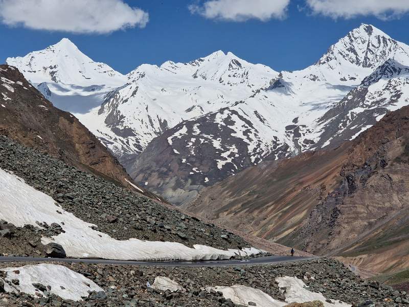
Road Conditions and Climate
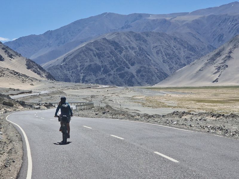
During our journey, daytime temperatures were high, while nights were notably cold. It’s crucial to safeguard against the sun by ensuring adequate coverage and using essential items such as lip balm and sunscreen. Ladakh, being a desert region, receives minimal rainfall. While unexpected rain events may occur, heavy rainfall during the dry season is unlikely when cycling.
Our cycling expedition took place in June with ideal weather conditions. However, in July, we encountered unusual weather patterns, including heavy rain and flooding near Manali, along with snowstorms in higher sections of the road, 300 tourists were stranded in Chandrataal. This unpredictability emphasizes the need for thorough preparation.
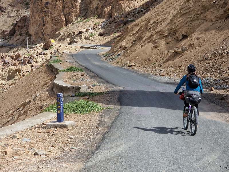
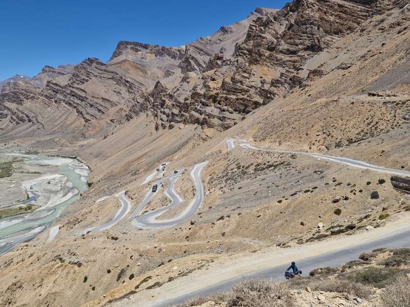
The road primarily consists of varying-quality asphalt, with an extended unpaved stretch from Zing Zing Bar to Pang. The entire route is manageable in a 2WD vehicle with low clearance and is easily traversed on a gravel bike.
Phone Signal, Electronics, and GPS
The Manali Highway consists of only 1 road and it is impossible to get lost. Navigation is not an issue. GPS and Satellite phones are not allowed. Your phone is enough for navigation. We used Komoot but I have to say that the elevation profile was almost always wrong.
About the phone, if you buy a SIM card in the rest of India, let’s say at Delhi airport, it will not work in Ladakh. The main Indian prepaid network providers will work until Jispa. From here, there is no signal for any prepaid provider. Post-paid SIM cards are only available to Indian citizens, as a foreigner you can get one in Leh but you will need an Indian citizen with you who must provide his identity proof.
In our case luckily the employees of the national company, BSNL, used their documents and we managed to obtain a SIM card. In Leh, as foreigners, you can buy an Airtel sim card, which however will only get a signal in Leh and Nubra Valley. You can find the BSNL here.
Let’s say that buying a SIM card in Leh doesn’t make much sense, we did it because from Leh we headed east, to the lake region. And it was quite useless, there was no signal anywhere, except for a few rare occasions when we managed to receive a Whatsapp message.
Wifi is not available between Jispa and Leh. Satellite phones and drones are illegal. Our GPS was seized in Srinagar Airport (Kashmir), even if it is not a satellite they do not know the difference. If you do not fly you are probably fine.
Jio is the only company that has a signal, there are towers in the military bases but as a foreigner, it was not possible to buy a SIM card. You can ask the Dhaba managers to open their hotspots if you need to check messages, not always work.
Mains power is unavailable from Jispa. There are generally 12 V solar systems that have been rigged up and can be used to charge phones or devices, but you will have to pay for them.
Expenses and ATM
The cost of the trip is budget-friendly, with expenses varying significantly based on personal preferences. Opting for the most economical approach involves camping and preparing your meals. Despite not cooking and opting for decent accommodations, I still found the trip to be cost-effective.
Meal expenses typically range from 150 to 500 INR, depending on the location. The food itself will not vary tho, prepare yourself to eat rice and dhal all the time, paratha for breakfast, and Chinese noodles and momos if you are lucky. Accommodation costs vary based on quality and remoteness, ranging between 300 and 1500 INR per person per night. Snacks become pricier farther from towns but remain in line with Indian prices.
There are no card payment facilities along the route; all transactions are in cash. From Jispa to Leh, there are no ATMs, and relying on ATM functionality outside of Manali or Leh is not recommended. It’s advisable to carry all the cash needed for the trip, which should be withdrawn in Manali.
Equipment for the Manali Leh Bike Tour
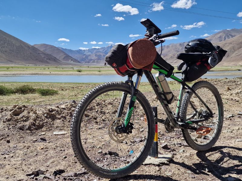
For the first time we pedaled very lightly, without camping equipment and we didn’t have any difficulties even if we were sorry not to be able to camp in wonderful spots. Cycling at altitude is harder than hiking because you need to keep up a minimum pace to not fall over. Any excess weight affects your performance at altitude more so than on normal mountains.
There are no bike repair points on the route, however, if something can be rigged together there will be savvy locals who could help out. You will not be able to buy any bike-specific spares, such as a tube or a chain, so you need to bring everything that you might need. In the event of a total bike breakdown, you could likely ask someone for a lift to the nearest town and would not be completely stranded.
Our equipment for the Manali Leh Highway:
- Sigr Wind Jacket
- Sigr Cycling Shorts + T-Shirt
- Saddle Bag
- Top Tube Bag
- Handlebar pack
- Thermic Water Bottle
- Winter Pants (bought at a local market)
- Rain Pants
- Bontrager Helmet
- Bike Pump
- Bike Puncture Repair Kit
- 1 Bike Tube
- Lubricant
- Merino wool base layer
- Wool Socks (for the night)
- Power Bank
- Sleepers
- Sun Cream (we use the surfer sunblock)
- Cycling Waterproof Winter Gloves
Where to Sleep
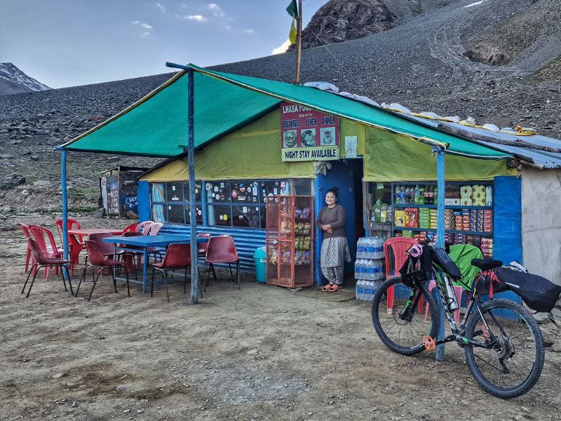
Dhabas are temporary shelters of dry stone and plastic canvas, giving rest and food to the weary pilgrims of the mountains, mostly truck drivers and cycle tourers (two categories akin to each other somehow, I won’t elaborate further). In summer those brave entrepreneurs settle in the highest corners, between passes, in freezing conditions, to offer food, essential goods, and a bed to sleep in… sometimes almost clean, sometimes very dusty and dirty. It’s because of them that we can do this route without camping gear.
During the summer season, which varies every year depending on when the roads are opened and cleared of snow, many dhabas are set up in strategic places to accommodate truckers and travelers. Usually every 40 or 50 km you will find one. They are very cheap, from 200/300 rupees for a bed and 500 per person for a double. In some small villages, there are also rooms available, and even some showers. If you don’t have a shower, they’ll heat a bucket of hot water for a little extra to get some of the dirt off you.
We have always opted for a private room if possible, the price difference is not much if you are a couple. Traveling alone, however, is not economically convenient but often hygienically it is. Some dhabas are very clean, some are really disgusting and some are acceptable. There are usually several dhabas in the same place, check them out before choosing one. If you slap the bed and a dust storm arises, look for another one if possible.
Furthermore, some have the bed section separate from the restaurant and in others, the beds are in the restaurant. Either way, everyone will go to sleep soon enough.
Where we slept:
Sissu – Hobknob Hotel (Wi-Fi available)
Keylong – Hotel Tashi (Wi-Fi available)
Patsio (Deepak Taal) – Dabha (Hot water available)
Sarchu (Wild Adventures Temporary Camp Sarchu) – (Hot water available)
Whisky Nala (Private Room in Container)
Pang – (Private Room in a Dabha) (Hot water available)
Debring – Pang Intersection Point Guest House (Very good food + 1000 for a private ensuite)
Upshi – Pangon Hotel (Private ensuite room)
Leh – Guest House (All available)
Hitchhiking in The Himalayas
During the summer season, finding a ride in case of need is quite simple. Several tourist minibusses and local pickups are traveling the highway. if possible, opt for local transport (you will recognize them, just look at the license plate). Tourist buses drive quite dangerously and if you don’t absolutely need them I would recommend avoiding them.
Festivals in Ladakh
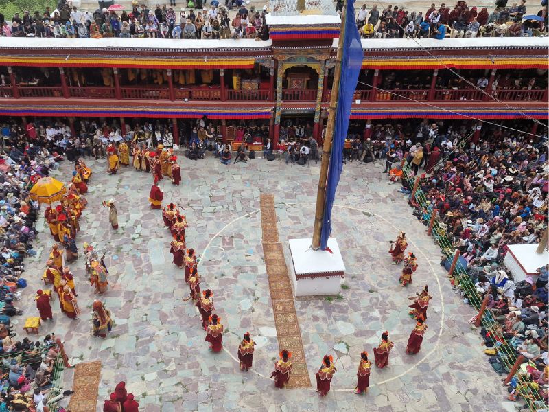
There are many festivals around the Himalayas region, both in winter and summer. We have been at the Hemis Monastery Festival, an annual event celebrated at the Hemis Monastery in Ladakh, India. The Hemis Monastery is one of the most famous and largest monasteries in Ladakh, belonging to the Drukpa Lineage of Tibetan Buddhism.
During the festival, the monastery comes alive with colorful rituals, masked dances, music, and cultural performances. Monks perform sacred Cham dances wearing vibrant costumes and intricate masks, depicting various deities, demons, and animals. These dances are believed to ward off evil spirits and bring blessings to the spectators.
Check this link to see the 2024 events in Ladakh.
Flying Rocks
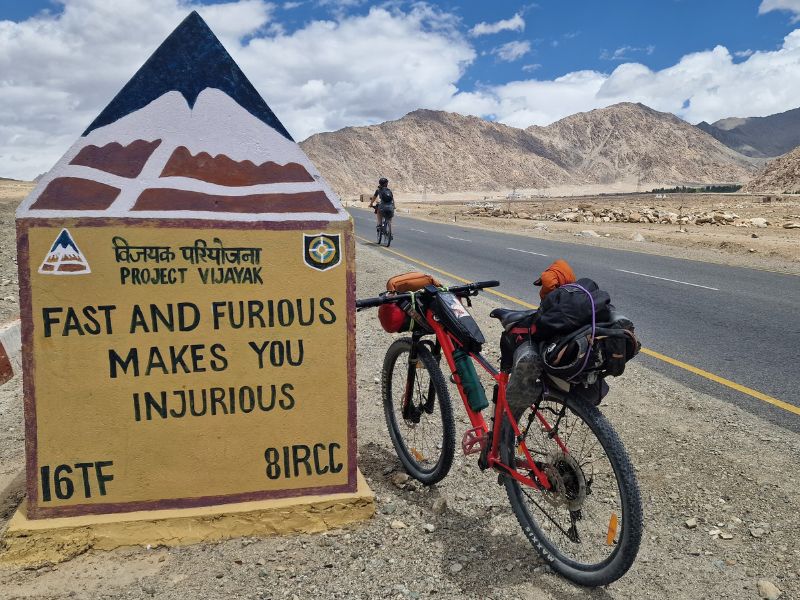
Along the way, you will see several signs warning you of the possibility of landslides and flying rocks. It happens. As far as I understand, due to the temperature difference between day and night, the small rocks that cover the mountains may be literally shot like bullets. Happened to me a couple of times, it’s not funny. The only thing you can do if you find yourself in the middle of the flying rocks is to pedal as fast as possible out of it. And always wear a helmet.
Permits
You don’t need a permit to cycle the main Manali – Leh Highway. You need one for a portion of the Spiti Valley, the Lakes area, the Aryan Valley, and some Mountain Passes. We’ll talk about those permits in the specific articles since this guide only focuses on the main road.
Our Manali – Leh Highway Itinerary and Blog
Chattru to Sissu
We tackle the remaining 19 km of hell on the Kunzum Pass Roas, several shepherds are settled in tents for the summer, bringing their flocks for transhumance as they did for centuries. We pop up on the tar at the bottom of Rohtang Pass, a very touristic spot, where people from the lowlands come to take selfies in the snow wearing ski suits. The police had closed the road going up, apparently, there was “more traffic than in Delhi!”.
Here we say goodbye to the Spiti Valley and our Manali – Leh started, we are back on the tarmac and it feels great even if the road is super-crowded. A quick descent and a short uphill lead us to the tourist town of Sissu, on the right bank of Chandra River. Nothing special, there’s a bakery though, and the apple pies are simply delicious. Most importantly, there are many places to sleep, from temporary camping to guest houses and hotels. Sissu is located at 3120 meters, a good place to acclimatize if you are coming straight from Manali. We can even decide to stay for a couple of nights if you feel a bit funny.
Sissu to Keylong [34km]
So let’s begin what we could call the second part of our Himalayan tour, the Manali – Leh Highway, one of the highest roads in the globe. In 407 km we’ll be crossing four passes at around 5000 meters, with the last being the highest at 5350msl. For starters we’ve been set back quite a bit, as we are restarting from 3200 meters, pretty low for our recent standards, it’s nice to see farmland again though: apples, apricots, barley, green peas.
The smooth tarmac is a welcome novelty, less so the heavy vacationer’s traffic. Despite those signs of human presence, the valleys are stunning as usual, with a million tall waterfalls free-falling from the glaciers above. Getting close to the town of Keylong, the traffic lessens a little and the iconic Himalayan ravines are back.
Keylong to Patsio [47km]
This is a single, 80km long climb from 3200m to the 4950 of Baralacha La, our first pass on the Manali to Leh highway.
The gradient is gentle and the landscape changes gradually, observing the Bhag River one can clearly see the signs of the glaciers that formed this valley thousands of years ago. Flows of silt cast like lava near the last permanent settlement of Darcha, from here the signal is lost, we’re in the remote plateau of what used to be the Kingdom of Ladakh.
Tonight we’ll sleep with these three gentle ladies, who even gave us a bucket of hot water to wash the dust and sweat away. Refreshed, we go for a nearby walk at sunset and we find super odorous wild oregano.
Patsio to Sarchu (62km)
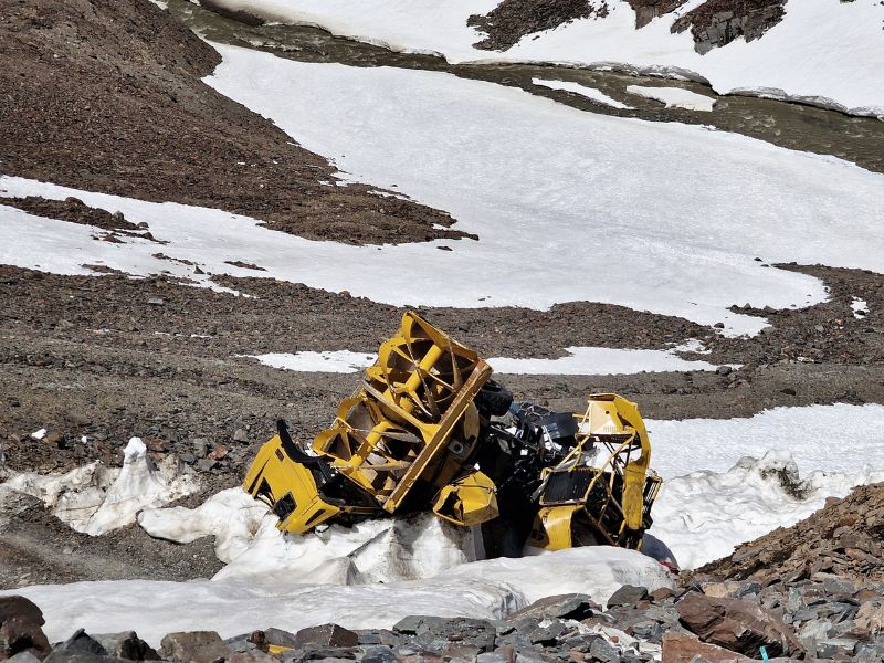
This is Baralacha La, the first pass on the Manali-Leh highway at 4850msl. It felt never-ending, going up these switchbacks, more and more snow poured sides, until near the top the crowd of tourist playing in the snow, some parking their cars on it to take pictures and then being unable to get back on the road.
At the Pass, our happiness and satisfaction were met by the pretty and original depictions of Shiva, Hanuman, Kali, and Saraswati, together with the usual interviews. The way down started quite technical, not many cars proceeded forward from the pass, most heading back towards Manali after the ritual selfies. Down the ravine, several crashed vehicles that fatally slipped on the ice.
The descent is dirt and rocks and melted snow forming freezing rivers for the first 10km or so, then it becomes more gentle when meeting the Tsarap River valley with its big population of marmots. A canyon so cool that there’s an endless strip of campsites along it, before the tin and plastic village of Sarchu.
Sarchu to Whiskey Nala [53km]
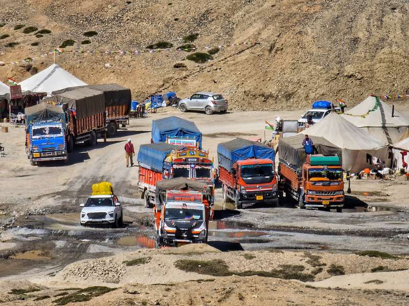
One pass a day keeps the doctor away. After waking up to a meager breakfast but a gorgeous view we ride the 5km left to the shabby summer village of Sarchu. Everything is temporary here, open only in summer as a logistics stop for truck drivers and tourists.
The road now goes through a stunning valley, mostly flat for 20something km, with those fairy pinnacles reminding of Cappadocia, BRO even entertains us with the usual signs and two great bridges, Brandy Bridge and Whiskey Bridge… and then arrives the Gata Loops. The Gata Loops are one of the most dreaded sections of our journey, 21 never-ending steep switchbacks, where all the trucks seem to decide to meet at once, at the peak of noon.
The climb is an austere meditation among the honks and bumps, past the ghost temple where everyone throws plastic bottles for no reason, over the loops where the road still climbs, even steeper, leading us to the second pass of this section, NakeeLa Pass (altitude 15,547 ft | 4738 meters). Exhausted, we arrive at the horrible dusty hamlet of Whiskey Nala (everything is alcoholic here, but no alcohol in sight). Here I bathe in the freezing river because the woman refuses to give me a bucket of hot water… “I pay ma’am!” But no way.
We sleep in a former BRO container that has never been cleaned since it existed… Probably the dirtiest “accommodation” in our 9-year-long touring career.
Whiskey Nala to Pang [30km]
Another short but stunning day. We leave the dusty and freezing caravanserai of Whiskey Nala to immediately start the climb to the next pass, this is finally the time to touch the 5000 meters! Wow, it feels great, we’ve never been so high! After the pass of Lachulung La, there shall be the well-deserved downhill, and indeed it’s there but in the form of a dusty and rough dirt road, plenty of vehicles crashed in the ravine are evidence of its dangerousness.
A few more km along a half-frozen river and suddenly we are in Tatooine, the landscape looking like the desert world where Luke Skywalker grew up in Star Wars. We could expect some sparse desert skiffs but instead here’s a truck traffic jam, we are in India after all. Despite so, we reach the next summer camp at Pang quite early, we have time for laundry before the 3 Americans and Hans catch up with us. Nice to have the company of other cyclists tonight.
Pang to Debring (52km)
Today, after climbing the hill out of Pang (4800m), we reached the Moray Plains, a long flat section of high-altitude desert. It was nice to have a day of flat road, although it was maybe one of the most boring sections so far. The most interesting thing was a family that seemed to be of Rajasthani nomads sitting in the very middle of nofu*kinwhere, looking completely out of place.
Reaching the tenet hamlet of Debring before lunch, we saw the summer camps of the local nomads, who still do transhumance like they’ve been doing for hundreds of years… Plenty of yaks, goats, horses, and sheep. Here the Tibetan flags flap in the wind at the top of every dabha, reminding us how the people feel about their heritage. Amidst a small sand tornado, we meet again with the other cyclists on this road, in the homestay of Mister Karma.
Debring to Upshi (85km)
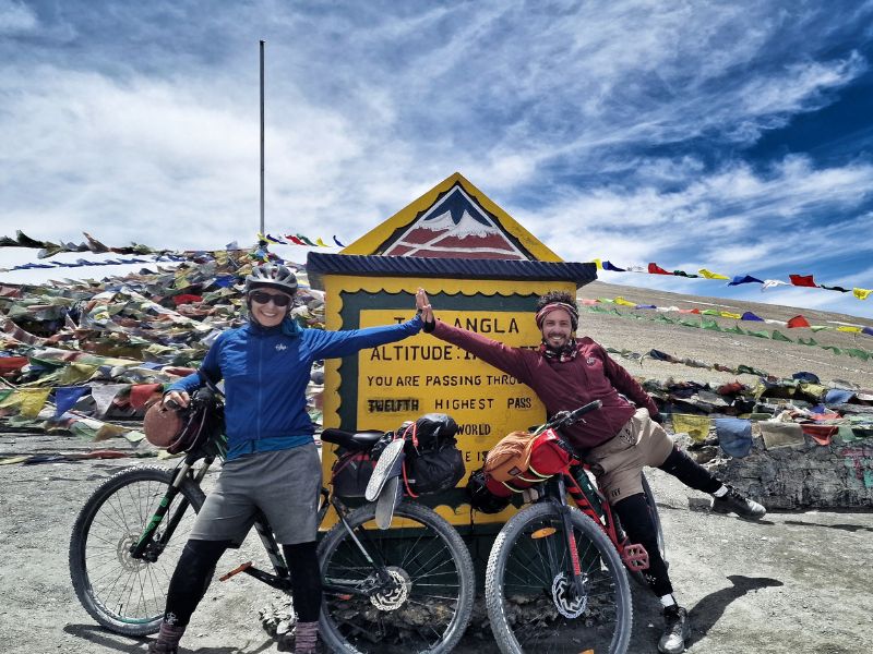
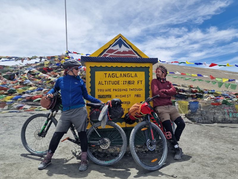
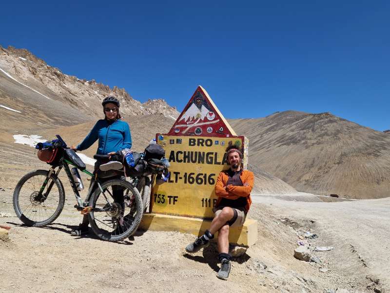
Today is the day for the big one. With its 5450 meters (17,482 feet) Taglang La is one of the highest passes in the world, and it does feel like it. I had the very genial idea of drinking two beers yesterday and now I also feel the lack of air… I allow myself a diamox and here we go.
The pass is very desolate, I smell a rotten carcass, turn around and there is a lone wolf not too far from me, it runs away when it realizes that I saw it. It takes several hours to reach the top, from here the landscape opens up into a new version of Ladakh. We are finally out from the harshest and barely inhabited areas, we are diving at full speed into the ancient Buddhist culture of this remote region.
Whitewashed stupas line the road through idyllic hamlets, and green barley and yellow canola fields wave under the wind. The river flows impetuously through yet another unbelievable landscape, mountain crests jagged like the back of a stegosaurus. It has been a long day when we finally reach the village of Upshi, where we can finally meet with the next big river, the mythical Indus… where human civilization began.
Upshi to Leh (46km)
The scenery is not so inspiring for these last 46 km and traffic is quite intense. The real stars of the day are the many ancient Gompas along the way. We decide the climb up two of them, Thiskey and Stakna.
The monasteries in Ladakh follow the teachings and practices of Tibetan Buddhism. The region is home to numerous monastic communities where monks and nuns engage in meditation, study Buddhist scriptures, and perform religious ceremonies.
Ladakh is predominantly influenced by Tibetan Buddhism, also known as Vajrayana Buddhism. This form of Buddhism is a branch of Mahayana Buddhism, and it emphasizes the use of tantra and various esoteric practices to achieve enlightenment. Tibetan Buddhism has deeply influenced the culture, art, and way of life in Ladakh for centuries.
Centuries ago Ladakh was indeed entwined within the vast tapestry of Tibet. The two lands shared a cultural and spiritual kinship, fostering a connection that transcended borders and spanned the high mountains. Tibetan influence permeated the monasteries of Thiskey and Stakna, leaving an indelible mark on their traditions and beliefs.