
Last Updated on 30 November 2025 by Cycloscope
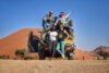
Bicycle Touring in Zimbabwe
All the most essential tips for organizing a cycle tour in Zimbabwe, complete with our itinerary map and GPX track
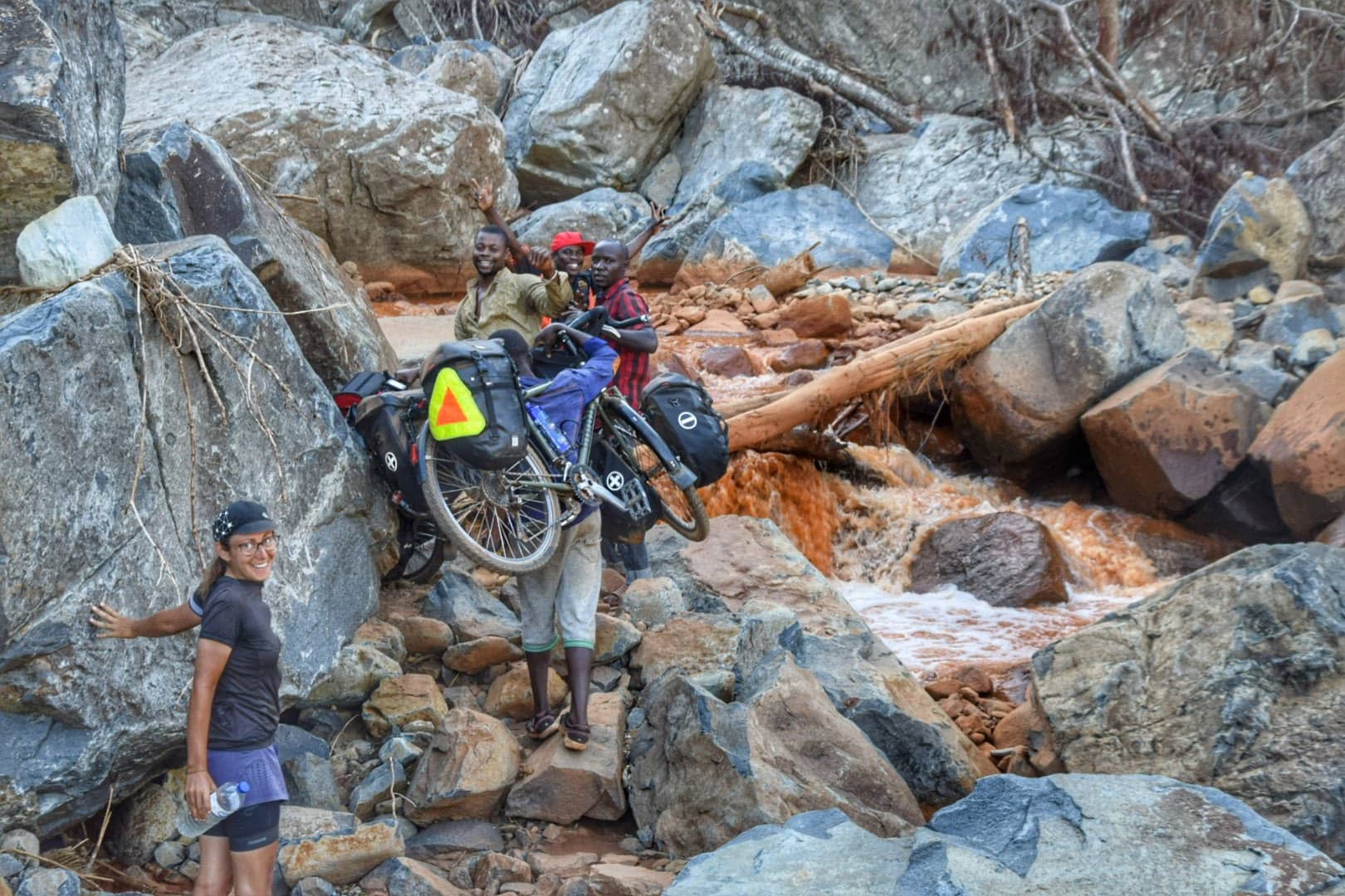
Not many bike travelers choose Zimbabwe as a cycling destination, even among the more adventurous bicycle tourers riding the Cape to Cairo route; many skip this beautiful and fascinating country. Cycling in Zimbabwe was one of the highlights of our bike trip through Africa.
Disclosure: Some of our articles contain affiliate links. This comes at no additional cost for you and helps us keep this website up and running. (as Amazon Associates we earn commission from qualifying purchases)
From the border of Espungabera (Mozambique), we entered Zimbabwe near Chipata. For most of our trip, we were above 1000 meters in the eastern part of the country, and then down to the valley just before the Zambezi River, which we crossed to reach Zambia. The mountains of Zimbabwe really surprised us, with beautiful landscapes, friendly, welcoming people, and plenty of nature.
We have been across the eastern part of Zimbabwe in June, in winter. At night, temperatures can be slightly above 0, while during the day they are delightful for cycling, around 25 degrees. Therefore, it is essential to equip yourself with the appropriate temperature range.
Winter coincides with the dry season, so it rarely rains and is the perfect time to travel by bicycle. In this article we will give you all the most vital information to organize a bike trip in Zimbabwe and the itinerary we have followed, you can follow our route with any other means of transport.
Are you planning a trip to Africa?
You may also be interested.
Cycling South Africa, a bike trip from Cape Town to St Lucia
Lesotho, the roof of Africa, guide and travel story
Cycling Mozambique, from Maputo to Vilanculos
Zimbabwe in a nutshell
- Climate: tropical, with a significant temperature difference between day and night in winter, especially in the highlands.
- Best period: winter (May to October)
- Mandatory vaccines: none
- Currency: Bond Notes. We will discuss it in more detail later in the article.
- Visa: 30 USD for 30 days and 45 USD for 60 days, double-entry, issued directly at the border or at the airport.
- Indispensable: anti-mosquito spray, the Tabard is the best
What to bring for a bicycle tour of Zimbabwe
At least half (but probably more) of this Zimbabwe itinerary is on gravel roads. A proper touring bicycle is highly recommended; thicker tyres (2″ would do) will significantly improve your comfort and handling. Camping gear is almost essential if you don’t want to break your bank.
A jacket and some warmer clothes are mandatory if you get to an altitude in the winter months. Bring all the essential tools and spares, as the only place where you’ll find some spares would be Harare, very expensive, and not well-stocked shops.
Some recent Zimbabwean history
Zimbabwe was one of the last African countries to gain independence in 1980. Until then, it was known as Southern Rhodesia, a British colony first founded and managed by a private company, the British South Africa Company, headed by the notorious capitalist Cecil Rhodes.
The first democratic elections of that year elected Robert Mugabe, ZANU leader. Mugabe’s story resembles that of Mandela, and he was an internationally acclaimed leader when he came to power. But, as often happened in the post-liberation period of many African countries, what seemed a promising future soon turned into a nightmare, especially for some segments of the population.
In 1983, to consolidate the predominant role of the majority ethnic group of which the president was part (Shona), Mugabe perpetrated a real genocide against the Ndebele population. What is called Gukurahundi went on for about 4 years and killed at least 20,000 people, while several thousand were sent to re-education camps. Unfortunately, the Western world has turned its back on giving much prominence to the news, contrary to what happened a few years later, when the white population was hit.
After this phase, Mugabe decided to take it out on another group, the “whites” who lived in Zimbabwe. Most were farmers; their lands were confiscated, several were killed, and most fled to neighboring countries in early 2000.
However, the redistribution of land was far from fair. The lands with the most beautiful houses were given to friends and relatives of the president and his cronies, who had nothing to do with agriculture.
Some land was given to local populations, but without the whites ‘ technical knowledge, machinery, and even the money to buy seeds. The banks refused the loans, and as you cross the Zimbabwean countryside, you will see so many uncultivated and abandoned lands.
The expulsion of the whites from Zimbabwe, together with the money squandered for the Congo war, has been judged by history as the most critical cause of the country’s economic crisis. With no more agricultural production and no practical plan, exports fell by 40%.
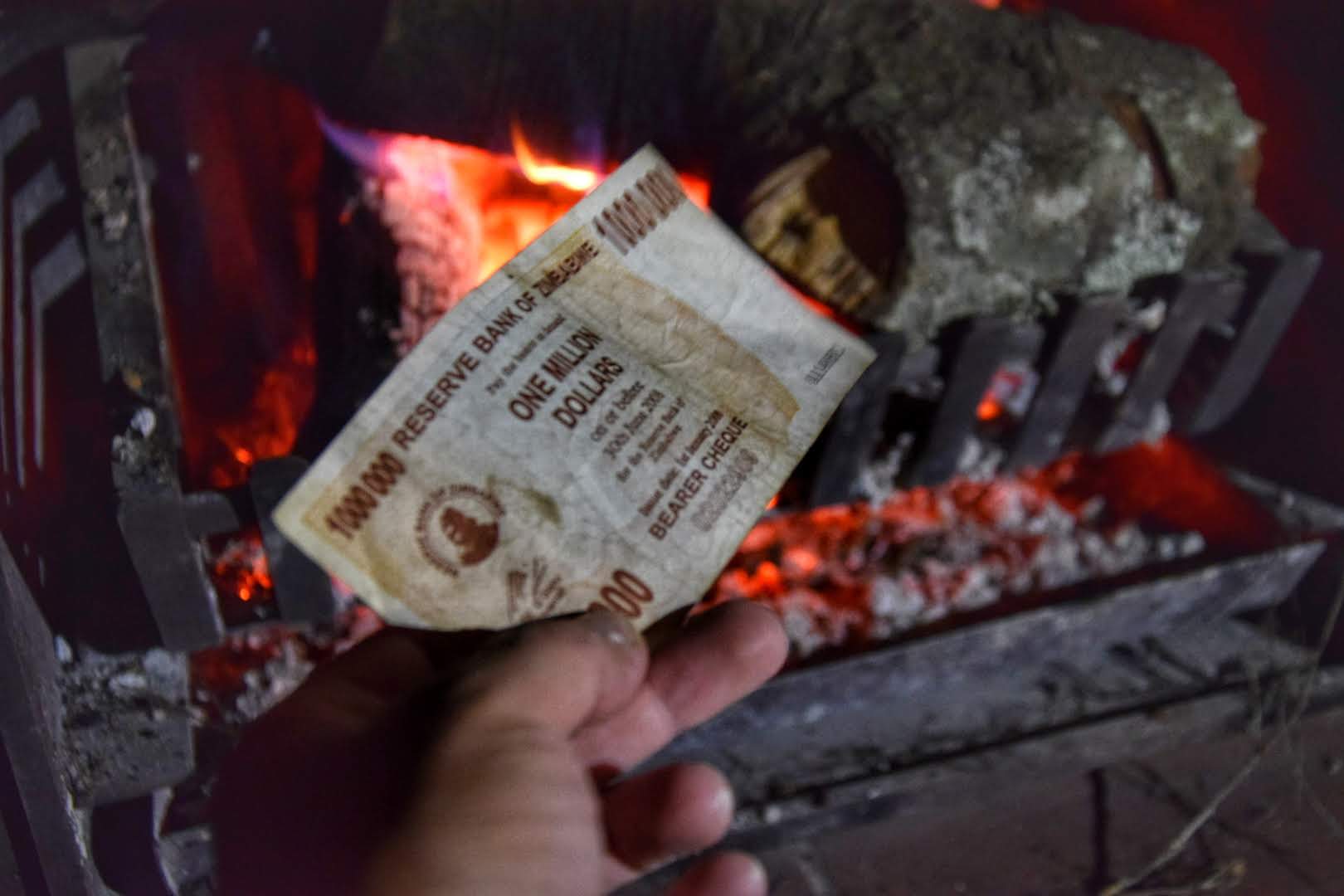
Not without accusations of fraud and violent protests, Mugabe was re-elected in 2008. Meanwhile, inflation skyrocketed, in 2015 Zimbabwe withdrew its national currency from circulation, the Zimbabwean Dollar, then too devalued (the highest value banknote had reached a denomination of 100,000 billion).
The exchange rate was 250,000 Zimbabwean dollars for one US dollar for banknotes printed before 2009, while for banknotes printed in that year, the exchange rate was 175 million Zimbabwean dollars for five US dollars. In 2017, a peaceful coup ended the Mugabe era; he was then 93 years old.
At this point, all foreign currencies were made legal, and the American dollar became the de facto currency of the country. The government also brought into circulation the so-called Bond Notes, an artificial currency valid only for trading within Zimbabwe.
According to the plans, an American dollar had to correspond to a Bond, but things went very differently. Thus, different values were assigned to bonds depending on whether they were purchased from the bank or on the black market. The value can change even during the same day.
In 2019, Zimbabwe banned the use of foreign currency. The problem was that there were not enough Bond Notes, and, despite having the money in the bank, they could not be withdrawn.
In 2024, they introduced Zimbabwe Gold (ZiG) as the official currency, but in practice, USD is still used and accepted more than ZiG.
Where to sleep in Zimbabwe while traveling in Zimbabwe by bike
Guest Houses and Hotels
In every medium-sized village, there is usually a guest house. The average price per night for a good-quality double room is around 20 USD. The rooms are generally clean. If there are no guests or no electricity, the water heater is often kept off, and you may need to wait a few hours before you can take a hot shower.
We have not often seen accommodation for locals like in Mozambique or Malawi, but it does exist. We happened to find some, but sometimes they are not reported, and we need to ask the people of the town if there is one in the surroundings. The only time we wanted to sleep in one of these accommodations, it was full. We were asked to camp in the courtyard and offered a free price.
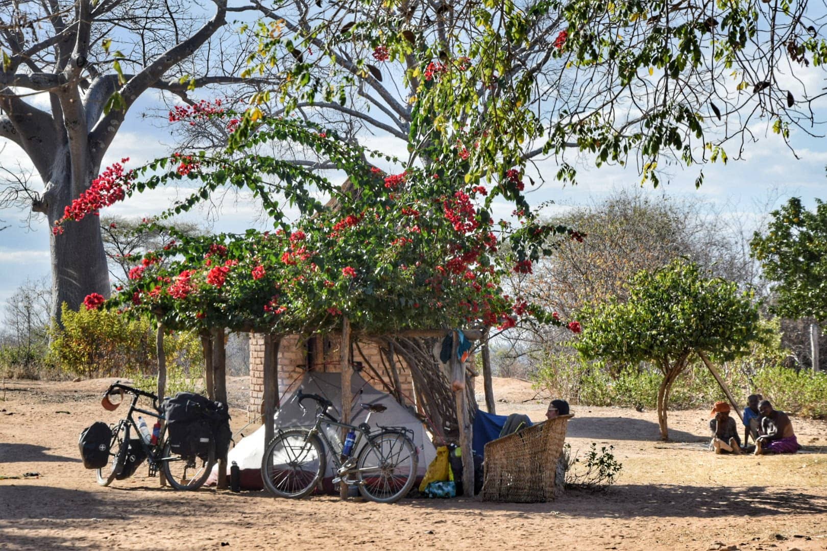
Wild camping and hospitality in Zimbabwe
Zimbabwe is a very welcoming country, where we met the most educated and cultured people on our trip in Africa so far, probably because the only good thing Mugabe did was build the school. Zimbabwe is the African country with the highest literacy rate.
As for free camping, it is not difficult to find a secluded spot, especially in mountain areas with fewer villages. We camped, asking the locals for permission to pitch the tent in their yard, and it was always granted. We find it more peaceful and safe, and a great way to get in touch with the inhabitants, although it is virtually guaranteed that you will be woken up by the house cock at 4 am.
Where to get Water when cycling in Zimbabwe
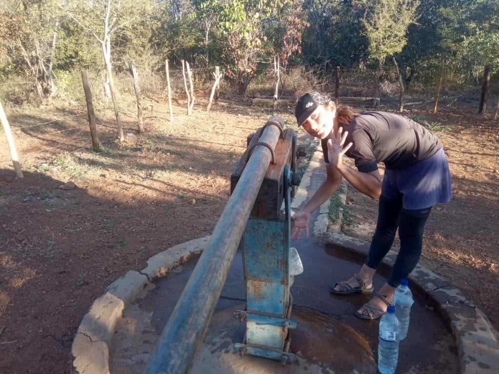
Water in Zimbabwe is generally drinkable, especially in the mountains, but it is always better to ask before drinking tap water. In larger villages and towns, where there is running water, it is almost always drinkable, if you do not feel safe you can boil water, many hotel rooms are equipped with a kettle, or you can get a good filter for the water, we use this.
In all the villages there is at least one collective well, the water is not always drinkable, but if you are at altitude it is usually good, ask the locals, and if you are not sure filter it. However, it is always good to cook.
Restaurants and food in Zimbabwe
Unfortunately, outside the big hotels, the food in Zimbabwe is one thing: sadza (a maize-based dish similar to Italian polenta), served with vegetables (cabbage or pumpkin leaves) and chicken or goat. Given the lack of food, the meat dose is often minimal, more or less a bone with a few grams of flesh. Outside the cities, you will not find anything to eat but this.
The bread is, at the time of writing, tough to find. Even in the larger cities, it is necessary to wait in line at the supermarket early in the morning before the supplies run out. In Harare, apart from bread, you will find everything you need, so stock up on supplies before heading to the countryside. For us, the best solution was to cook independently, using some packets of pasta and canned legumes.
Supermarkets and Alcohol
Beer is the most common drink; it costs about 1 dollar a bottle. Together with the most popular South African brands (Castle, Black Label), you’ll also find the nicer Windhoek (Namibian) and the local Zambesi, also better than the South African counterparts.
All other imported spirits, like wine, are expensive due to high taxes. The locals drink a locally produced gin, but we have never tried it.
Outside the cities, there are no supermarkets. Still, there are small shops where you will find necessities and beer (the only product available even in the most remote places of the country, economic crisis or not). With the financial crisis going on, some shops may lack also the basics, bread was impossible to find in June 2019, of course, the situation is in constant evolution.
Language
Everyone in Zimbabwe speaks English so that you won’t have any communication problems. Schools, many TV channels, and the judicial and parliamentary systems are in English.
However, the most widely spoken local language in the country is Shona, spoken by around 70% of the population, followed by Ndebele, spoken by 20%. A total of 16 official languages are recognized in Zimbabwe.
Connectivity – Local SIM card and Internet in Zimbabwe
WiFi is not widespread but is generally available in guest houses. If you are staying in Zim for a while or need to access the internet often, the best idea is to buy a local SIM card. Buying data traffic is relatively inexpensive, but in more remote areas, the signal is usually weak or absent. The most convenient thing is to buy the “daily” options.
The leading telephone operator is EcoNet, by activating the SIM Card you can also activate the EcoCash account, a virtual payment method that is very common in the country (due to the lack of cash we mentioned earlier).
There are many kiosks where you can then deposit some money into your account and use it to pay just about anywhere. Just type in a code followed by the payee’s phone number to send money. You can find more information on the official site.
Entry Visa for Zimbabwe
The entry visa is issued directly at the border, wherever you decide to cross. The tourist visa is valid for 30 days. Check the expiration date printed on your passport. The single entry costs 30 USD and the double entry 45 USD. Keep in mind that, especially at the most remote borders, they don’t have to change.
You will be asked to fill out a form where you will enter the destination address, but no one will check; we have written the name of the nearest campsite. It is possible to request an extension of the visa from the immigration office up to 2 times (for a single-entry visa). The extension is free.
Cycling the Roads of Zimbabwe
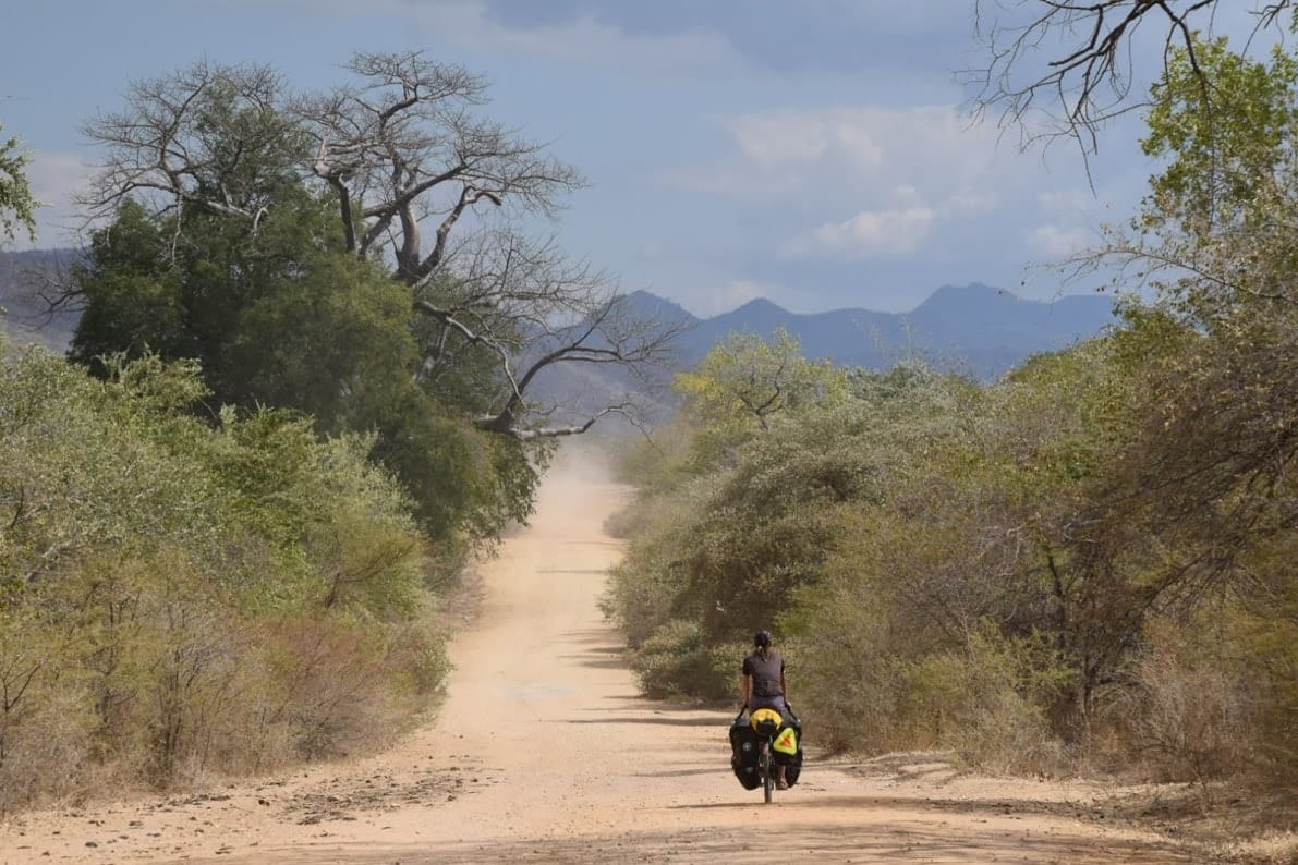
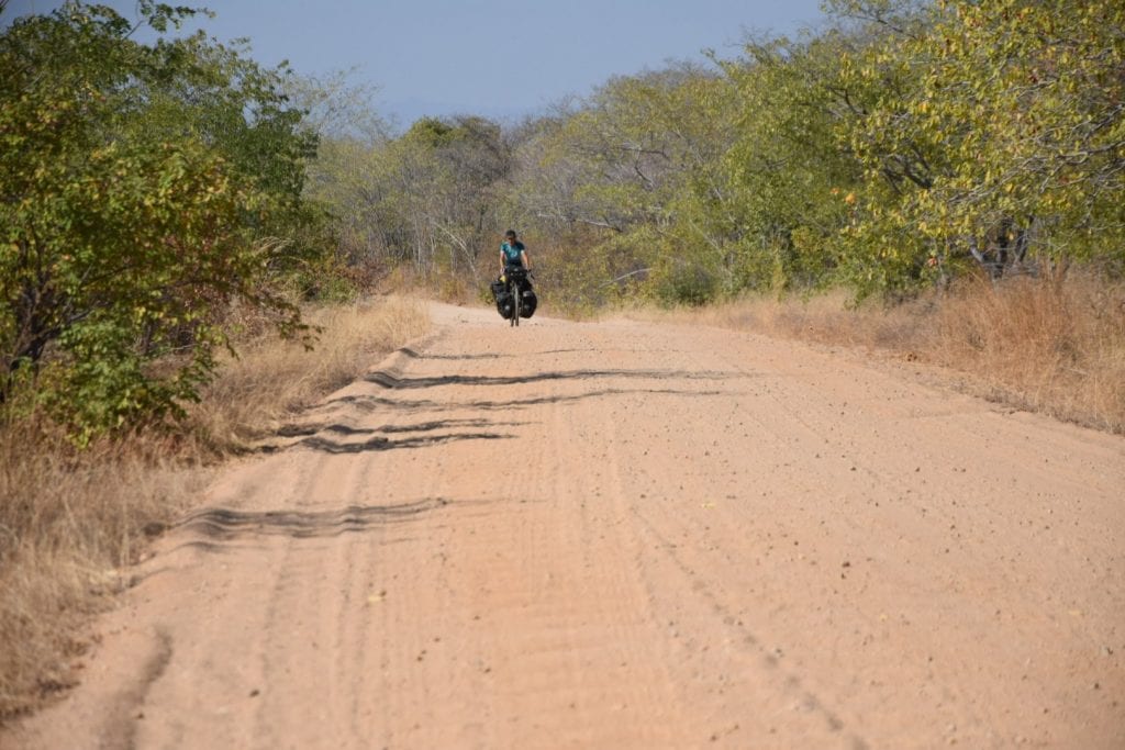
It cannot be said that the roads in Zimbabwe are in good condition. The paved roads are generally good, but the dirt roads can be quite corrugated and a pain for you and your bicycle. The situation could significantly deteriorate during the rainy season.
Along the way, we came across several sandy roads, but let’s say we looked for it a bit. Traffic on secondary roads is very scarce and sometimes completely absent, thanks to the fact that petrol is hard to find.
Safety in Zimbabwe
Zimbabwe is a generally safe country. Due to the severe economic crisis and 95% unemployment, there are several protests that the government often represses with violence. Stay away from any event.
There have recently been episodes of theft in major cities, particularly in crowded places such as markets. Not being able to withdraw cash from the ATM, thieves know tourists are obliged to carry a certain amount of money.
Malaria and TseTse flies in Zimbabwe.
Most of Zimbabwe lies on a plateau at an average altitude of 1200 meters above sea level. This dramatically reduces the risk of malaria, especially during the dry season. The Zambezi Valley is lower and risks are pretty high all year round, if you plan to visit Mana Pools or any area of the Zambesi Valley you might want to consider some precautions.
As you should know, there is still no vaccine for malaria. However, one has been tested recently, so the only way to avoid the nastier forms of malaria is to take prophylaxis.
Keep in mind that taking malaria Prophylaxis won’t prevent you from getting malaria! What prophylaxis does is to protect from the most deadly forms (like brain malaria) and to soften the symptoms if you get it – Elena got malaria in Congo while taking the prophylaxis!
Moreover, most doctors do not recommend taking any malaria prophylaxis for more than three months in a row, because the drug could permanently damage the body. If your stay is short-term, though, we definitely advise taking malaria tablets.
If you don’t want to take the prophylaxis, be sure to cover your body at dusk and spray a ton of repellent. Look for guesthouses with mosquito nets.
We recommend buying some Cortem as an emergency backup. Still, it’s best to head to one of the many local clinics if you feel sick… go as soon as you exhibit the first symptoms – they’ll test you for free and treat you cheaply; no one knows malaria better than those doctors.
If you are traveling to remote areas, consider buying a self-diagnosis malaria kit to test yourself; these are said to be reliable. If it’s positive, get to a health center as quickly as possible or take your Cortem.
TseTse flies are also a danger in the Zambezi Valley of Zimbabwe, there’s not much you can do about that but avoid Tsetse-infested areas. Check this article for tips about tsetse fly prevention.
Currency and Economic Situation in Zimbabwe
We already spoke about the economics in Zim in the history chapter at the beginning of this article. The situation changes quickly, so the best thing to do is contact your embassy to find out what to do. Another option is to join Zimbabwean Facebook groups or the WhatsApp group for cycling in East Africa (send us a message and we’ll send an invitation).
Right now, it’s highly recommended to bring US dollars with you; although not officially accepted, you’ll easily find someone willing to take them. Dollar banknotes printed before 2009 are very rarely accepted.
Our Bike Tour of Zimbabwe – itinerary, map, and GPS track
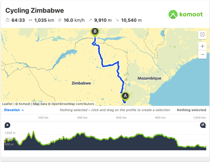
This is our 1,000km very hilly itinerary of Zimbabwe. It is pretty off the beaten path, not touching any of the country’s most popular tourist attractions, like Mana Pools National Park or Victoria Falls.
We honestly think, though, that this is probably the best route for a bike trip in Zimbabwe, never dull, always scenic, diverse, and engaging.
The elevation gain of about 10,000 meters and the predominance of gravel roads make this bike ride definitely not a beginner’s affair. You’ll sweat a lot, but it will be worth it.
What to See in Zimbabwe – by bicycle or not
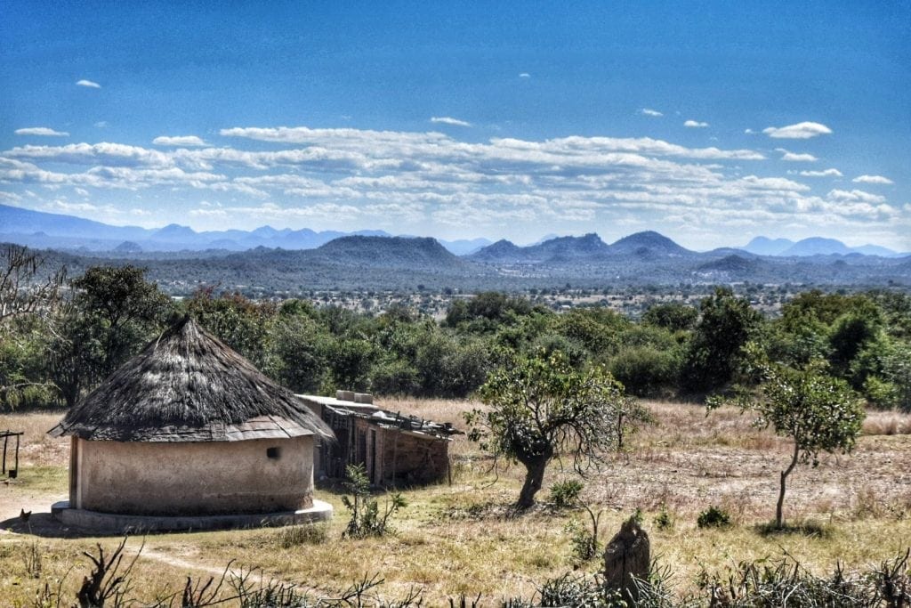
The entire eastern part of Zimbabwe, along the border with Mozambique, is very scenic. It is mostly above 1,000 meters and reaches up to 2,000, offering beautiful views, a cool climate, and very few mosquitoes, which here means a much lower chance of contracting malaria.
The list of places not to be missed in Zimbabwe below is based on what we have seen along the route we have cycled. There are, of course, other beautiful places to visit, some very famous like Victoria Falls (which we have seen from the Zambian side) and the Mana Pools National Park. What we have seen is a Zimbabwe that is less known to tourists, but really deserves to be promoted.
If you are looking for the real Zimbabwe and want to follow a route outside the usual tourist circuits, this list could be for you. The sections not mentioned below, the A2 from Mutoko to Harare, and the dirt road from Nyanga to Mutoko are the least interesting sections of this cycle route.
The A2 from Mutoko to Harare is a boring and rolling up and down tar road with variable traffic – nothing of interest, but a good section to hitchhike if you want to speed up your bike trip.
The dirt road from Nyanga to Mutoko can be divided into two sections. The first 70km after leaving Nyanga are beautiful, with expansive views of the lower valleys and their kopjies. The second section is a shortcut through thick bush and abandoned farmland, a very challenging road with loads of sand and corrugation and a little charm.
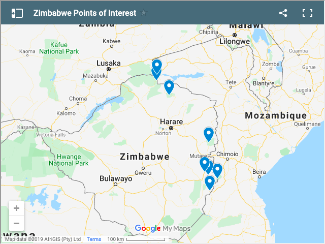
Zimbabwe Points of Interest on Map
The following map shows the location of the points of interest mentioned in this blog article.
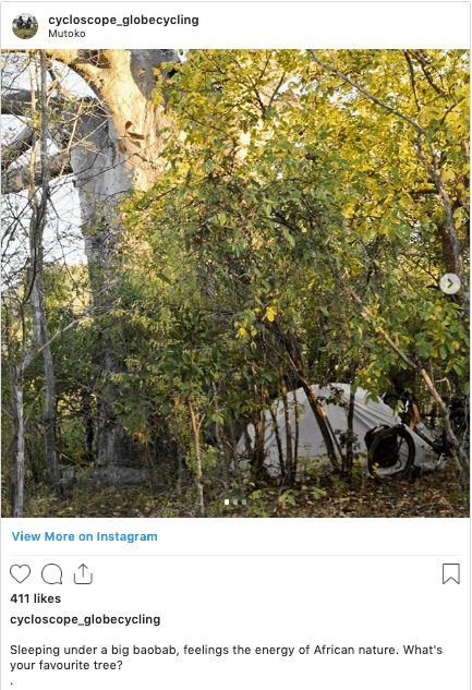
Chirinda Botanical Forest Reserve
After about fifteen kilometers from the border of Espungabera (Mozambique), you can take a dirt road towards the campsite inside the protected forest of Chirinda. Chirinda Forest is a patch of tropical jungle (the southernmost patch of subtropical rainforest in Africa) within the mostly dry mountains of Zimbabwe, it used to be much bigger but the usual logging companies have taken over during the years.
There is a sign pointing to the campsite, about 3 kilometers of dirt road in this dense jungle vegetation, and you will reach the heart of the forest. The Chirinda Campsite is in a beautiful location and run by a very kind guy; the chalet is spacious but a bit ill-maintained. Monkeys and lots of birds around, and we saw two very big hornbills.
Sleeping here is a bit expensive: the cottage costs 40 USD (but we paid 25), and the campsite costs 10 USD per person. There is no restaurant or food in general, so stock up before you arrive. They are equipped with gas bottles for cooking (but not always full) and a barbecue.
They made a fire and heated the water for the shower. The forest ranges from 900 to 1,200 meters above sea level and covers 1,000 hectares.
Chirinda Botanical Forest Reserve is close to the lively city of Chipinge, where we spent three joyful days meeting and befriending local Zimbabweans (guys at the Econet shop are amazing!).
Chimanimani Mountains and National Park
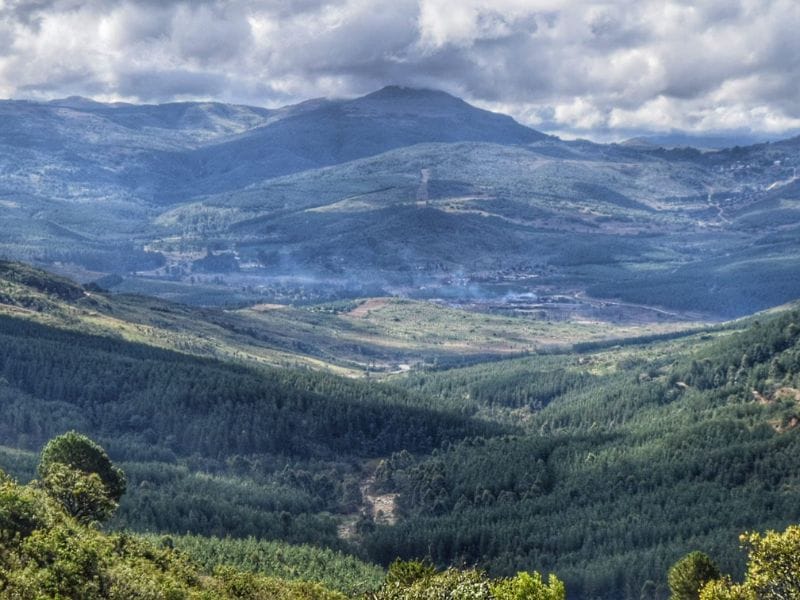
The Chimanimani Mountains are an outstanding natural feature of Zimbabwe. The scenic mountain massif of the Eastern Highlands reaches its heights here, and the backdrop of rocky pinnacles when approaching the town of Chimanimani is a pretty unique sight in Southern Africa
The Chimanimani district was severely hit by Cyclone Idai, which is another reason to visit this place and contribute to the local economy. The Chimanimani National Park offers many hiking possibilities in the mountains, even for several days.
At the Park office, located in the center of the country, you can ask for information on free shelters to sleep in (remember to ask for the key before entering the park, as they often forget it, and you risk finding the shelter closed). You can read interesting information in this article.
The Monumental Baobab Road: Nyanyadzi – Biriri

The Monumental Baobab Road is a name we just invented for this astonishing section of road. Driving along the A10 road heading north, you can take a dirt road near the village of Biriri that leads to the other paved road A9, a huge shortcut to get from Chimanimani to Hot Springs (see below).
It is an excellent dirt road, about 35 kilometers long. We did it during the dry season, if you travel during the rainy season ask the locals about the condition of the road.
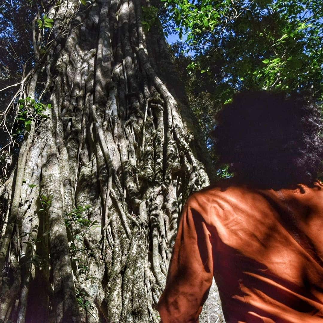
We only expected to take a shortcut but we were surprised by the beauty of the road, much of the route is along a beautiful river and there are thousands of baobabs, a good number of which are century-old monumental baobabs of impressive size and shape.
They spread out across the hilly landscape, rendering the scene quite alien, almost dream-like. We’ve seen loads of baobabs during our African trip, but believe us, this is something else.
Along the route, you’ll cross many small villages where people will be shocked to meet you—one of the most beautiful cycling days in Zimbabwe.
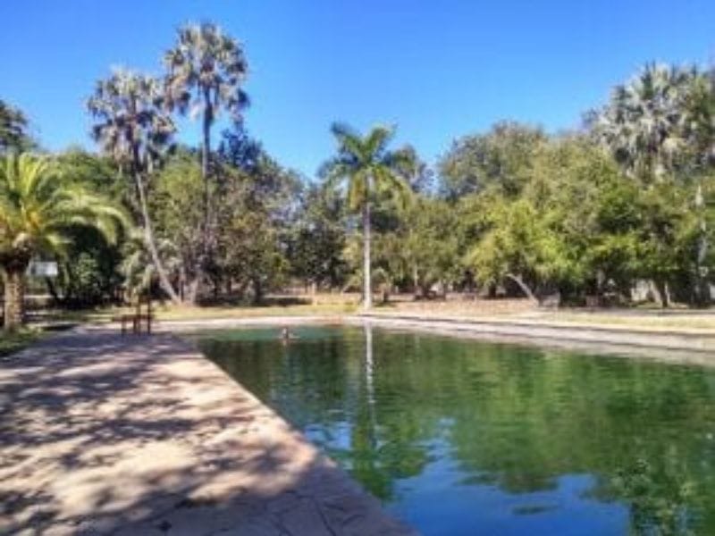
Hot Springs, Manicaland, Zimbabwe
Hot Springs is a town located in the valley down Chimanimani Town, only 80km away if you take the above-mentioned Baobab Road.
The small town offers nothing special; it was built around the nearby diamond mine, but the municipality runs a hot spring resort.
The place would be very nice, but it is a bit neglected (read the linked article above, and you’ll understand why). However, there are three beautiful swimming pools for swimming, filled with thermal water! The pool’s temperature is not hot but warm enough to swim in winter—an excellent stop for a night.
The manager will accompany you to see the spring where the water flows at 70 degrees, which locals believe is heated by sirens. A double room with a bathroom costs 10 USD, and the shower and taps deliver thermal water.
Nyanga National Park
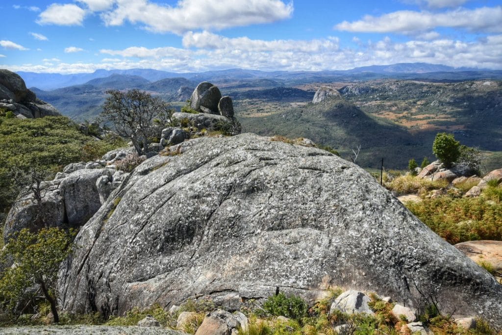
Nyanga National Park lies in the north of Zimbabwe’s Eastern Highlands. One of the first national parks to be declared in the country, it contains the highest land in Zimbabwe, with green hills and perennial rivers. Most of its terrain consists of rolling downland, sometimes lightly wooded, lying at altitudes between 1,800 and 2,593 meters.
Unfortunately, part of the park is occupied by manmade pine forests and managed by logging companies (?!), but the eastern part is still stunning. We advise leaving the A15 and taking the western road from Mutasa, a scenic route dotted with monolithic boulders piled in weird formations.
We cycled this secondary but paved road west of the main highway A15 to Sanyatwe, and then Juliasdale. Along the way, we slept at the Cedar Peak Cottage, which has a beautiful panoramic view of the valley, and we could have a long walk in the park without paying any fees. There are no shops or restaurants near the lodge but there is a nice gas cooker and a warm fireplace, bring your own cooking utensils.
Back on the A14, we headed to Nyanga, a pleasant road with very little traffic and some suggestive spots. Nyanga is the largest center in the area with many accommodations and restaurants.
It is possible to embark on various hikes in the Chimanimani National Park; among the most popular are those to the Chapungu and Nyangombe waterfalls. It is also possible to climb the highest mountain in the country, Mount Nyangani, and see the highest waterfall in the country, Mutarazi Falls.
North Zimbabwe Road Trip – Out of Harare to Mzarabani Wilderness Area, Zambesi Valley and Chewore Safari Park
From Nyanga we went to Harare, taking first the dirt road from Nyanga to Mutoko. The first 70km after leaving Nyanga are beautiful, with expansive views of the lower valleys and their kopjes. The second section is a shortcut through thick bush and abandoned farmland, a very challenging road with loads of sand and corrugation, a little charm.
The A2 from Mutoko to Harare is a boring and rolling up and down tar road with variable traffic – nothing of interest, but a good section to hitchhike if you want to speed up your bike trip.
Harare itself is a negligible city, suitable for a gear-up stop or to stock up on food. Getting out of the northwest, we took the A11 and then the A12 to Centenary (a former tobacco estate), not exciting but getting more and more interesting towards the Muzarabani Wilderness Area.
Muzarabani Wilderness Area
Muzarabani (Mavuradonha) Wilderness area covers approximately 600km2 of wild and rugged country along the Zambezi Escarpment. It is a national and regionally significant site, home to rich biodiversity, including a total checklist of 229 bird species and 41 species of large and medium-sized mammals.
The Mavuradonha Ecocamp is the only accommodation in the area. It’s a shame again, another stunning lodge almost gone to ruin. No more bar or restaurant or kitchen, you’ll need to be self-sufficient. The location, though, is beautiful, secluded in the forest.
Riding our bikes down the Zambesi Escarpment was one of the most epic moments of our African bike trip. With the wild forest around us and the limitless views of the wild valley, this really felt like archetypal Africa.
Chewore Safari Area
We followed the dirt road along the border with Mozambique to Kanyemba, on the Zambezi River, where it is possible to cross by boat to reach Zambia (only by bike or on foot, there is still no transport for cars). This road crosses the Chewore Safari Area.
Chewore Safari Area is a game management area, adjacent to Mana Pools National Park, reserved for recreational hunting. You can ride this road, but make sure to do it during the day; you don’t want to camp here at night, as there are lions and elephants.
The road conditions are not the best, and the closer you get, the more corrugated it becomes. Consider that you will meet two or three cars throughout the day; bring food, especially water. Don’t pedal or camp here at night; we saw many lion, other big cat, and elephant tracks.
Zambezi River

The mighty Zambesi River, where elephants and hippos still roam free, is home to busks of crocodiles that hunt in its dark waters. A landmark that is more emotional than geographical, a place with overwhelming energy… nature feels wild here, even if it isn’t totally. This is the pulsing artery of the Motherland.
Arriving in Kanyemba, we traveled another ten kilometers of dirt road to reach a beautiful lodge a few meters from the Zambezi River. An ideal place to relax, with a small pool and beautiful rooms overlooking the river.
From the terrace, you can see the hippos, and above all, they feel towards the sunset when they come out of the water to eat. The lodge has currently no name, to find it follow the sign for the fishing camp, here are the coordinates 15°39’07.4″S 30°22’01.0″E (-15.652044, 30.366941).
We heard many elephants and the screams of cotton farmers on the other side of the river in Zambia, who were yelling and making noise with pans and firecrackers, trying to chase them away before they destroyed the fields and even the houses themselves. We were told that in some areas, you can see elephants crossing the river. It is also possible to organize boat trips to the nearby gorges, always negotiating the price.
Are you planning a trip to Africa?
You may also be interested in
Cycling South Africa, a bike trip from Cape Town to St Lucia
Lesotho, the roof of Africa, guide and travel story
Cycling Mozambique, from Maputo to Vilanculos