Last Updated on 24 June 2024 by Cycloscope
Cycling Irland: a bicycle touring itinerary along the Wild Atlantic Way: Ring of Kerry, Connemara, Cliffs of Moher, Loop Head, Dingle. The best bikepacking route in Ireland!
One of the best-known routes in Ireland, for cyclists and non-cyclists, is the western part of the coast to the south of the island which includes the famous Cliff of Moher and the Ring of Kerry. Part of the very long (2500km) Wild Atlantic Way, which includes the whole northern and western coast, meanders along jagged cliffs, alien landscapes, and beautiful beaches.
Disclosure: Some of our articles contain affiliate links. This comes at no additional cost for you and helps us keep this website up and running. (as Amazon Associates we earn commission from qualifying purchases)
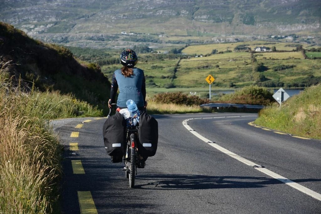
Several people had frightened us about the narrow streets and the traffic, especially in the summer. In fact, both things are true: narrow and poorly paved roads and many tourists with rental cars and campers make Ireland not exactly a destination for cyclists.
But even here it is possible to travel a few alternative routes and choosing the right roads will free you from the machines. Poor asphalt, instead you will never get rid of.
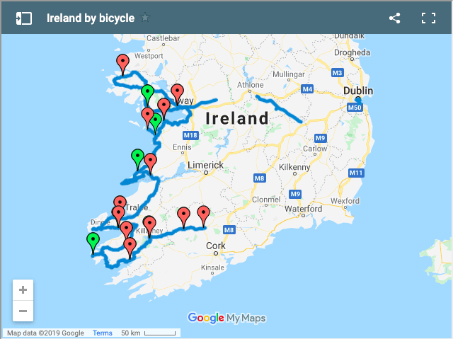
The map of our Ireland bike route is in the middle of the article
How to arrive by bike on the West Coast (Wild Atlantic Way)
People usually arrive in Ireland by landing/disembarking in Dublin, Cork or Rosslare (for those like us who arrive by ferry from Wales), and then starting their Ireland Itinerary from there.
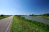
Whatever of these ports you’ll arrive at, the road that will take you to the west is rather boring to ride, flat and just pastures for miles and miles. If you don’t have too much time or do not want to ride boring roads busy with tourist motorhoming Ireland on rental vehicles, we recommend taking the train.
This itinerary starts in the Connemara National Park, so you could take a train or bus to the cozy city of Galway.
How to take the train with bikes in Ireland
It is always possible to load bicycles on Irish trains, the service is free. There are usually two stands per train or sometimes four. However, you need to make a ticket from the railway company’s website to reserve a bicycle seat. The site is www.irishrail.ie. The place for the bike can only be booked online, if you make the ticket at the automatic machine you cannot book for the bikes and the ticket costs twice as much.
We have tried to pay with Postepay (Mastercard) but the transaction has been refused, you can use a prepaid Irish account that you can open online (Revolut). When booking, you will select seats. Once the ticket is done, you must pick it up at the ticket office before leaving.
We took the train twice and both times the carriage indicated on the ticket was not the one used to transport bikes. You will see the symbol of the bike on the carriage. In general, however, Irish trains are very short, with 5 carriages in all. The bikes must be placed vertically in the appropriate racks.
Cycling the Connemara National Park / Connemara Ring
We took the train from Dublin to Galway and from there our itinerary started. Galway is one of the many nice little Irish towns, here you can stock up before leaving, even if there will be a few more shops along the way. In Galway, though, there are a couple of discount supermarkets (Lidl and Aldi) that will really save you money compared to regular Irish supermarkets. It’s worth spending at least a day here, check this list of free things to do in Galway.
From Galway we took the N59 or R336 road, the first 15 kilometers are quite busy, there is no bike path but a sidewalk that can be used by bike. From Spiddal the traffic starts to decrease and on your left, you will see several small roads leading to the sea.
The road to Inverin offers little chance of wild camping, maybe it’s possible on the beach but we have not checked.
Since the road turns north the landscape suddenly changes, becomes panoramic and there are far fewer houses.
Keep in mind to buy food before the turning point because then there are no more shops until Maam Cross (where there is only one hotel restaurant), the next shop is in Recess, and then nothing more until Clifden. We have camped in the bog between the midge flies between Derroe and Costelloe.
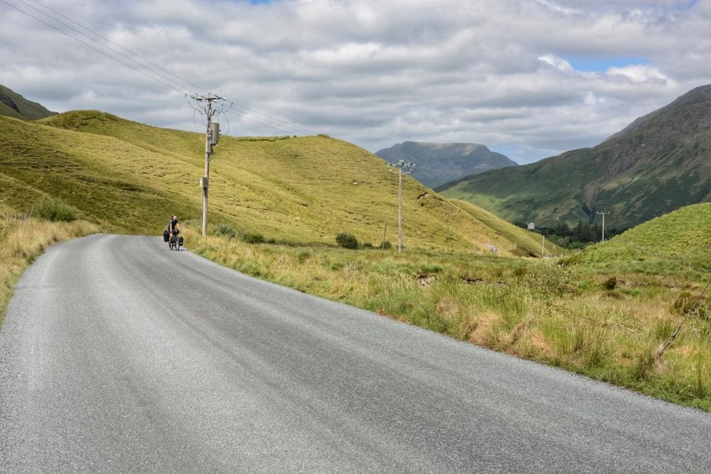
From Maam Cross, you start to see the mountains, in particular from Clifden to Moyard the landscape is very scenic. Even from Moyard at the junction with the R336 the scenery is beautiful but do not expect as much from the advertised Kylemore Abbey, ugly and expensive with an entry fee of 13 euros.
After passing the abbey you ride along the beautiful Killary Fjord to arrive at the nice village of Leenaun where there is also a shop. Leaving the fjord and Leenaun in the direction of Maum the road is very scenic, then returns to Maam Cross.
From here on the way back to Galway there is not much to see, the first part up to Oughterard is not impressive but quiet enough while from Oughterard to Galway the road becomes very busy even though most of the time you can ride in the lane of emergency. As you may have guessed there are not many cycling lanes in Ireland.
Check Review, Pictures and Things to Do in Connemara National Park
Doolin and Cliffs of Moher
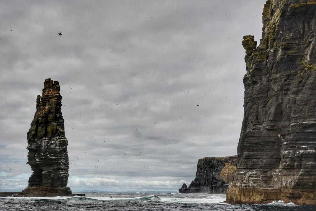
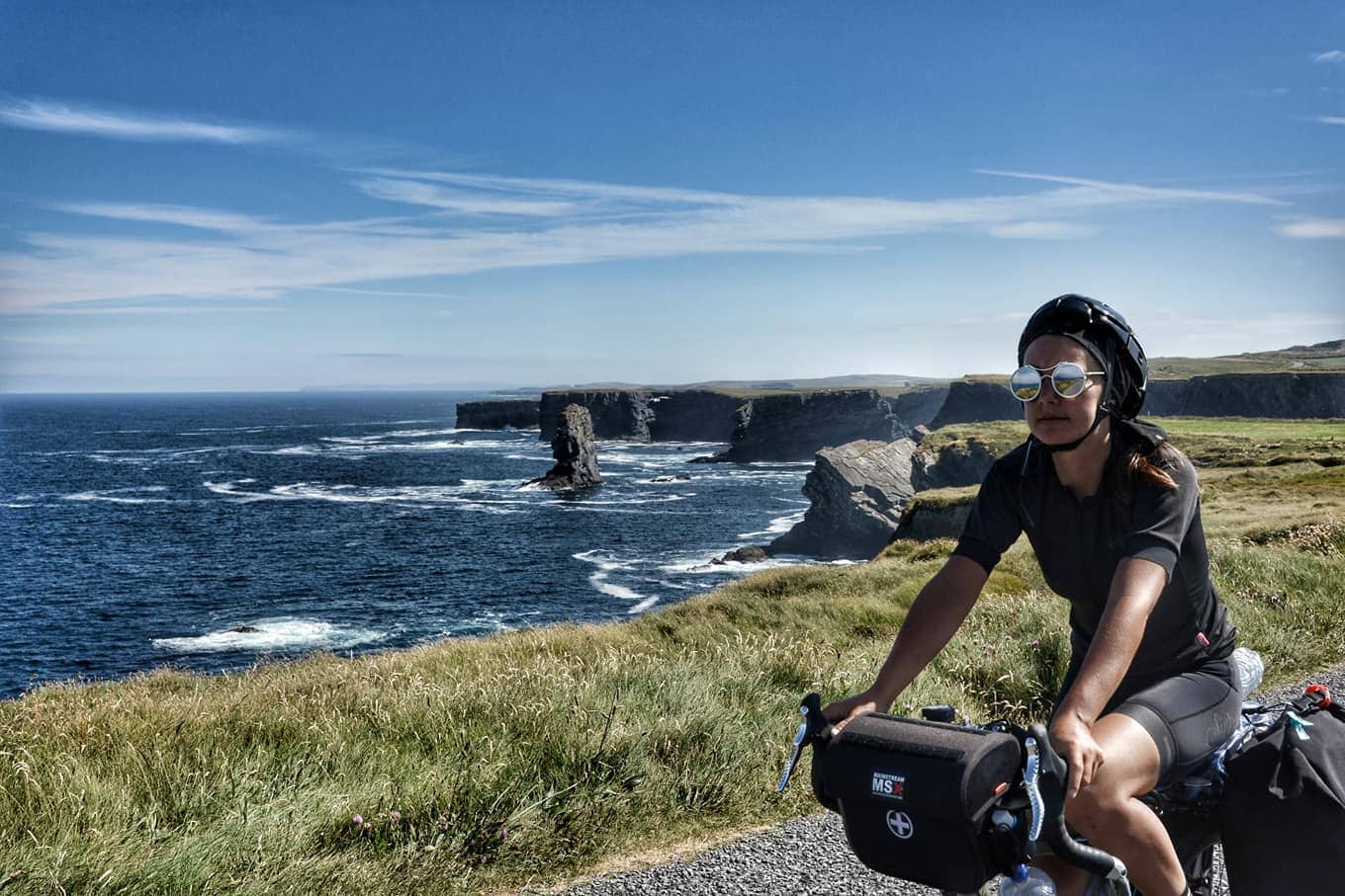
The Cliff of Moher is definitely one of the highlights not to be missed in Ireland. Most people arrive here on day tours from Dublin, but getting there by bike is a whole different thing.
The ticket to the cliffs costs 8€ if you buy it there, but by booking online the cost is halved to 4€. In reality, the cliff can also be accessed for free by entering the walking path at different points along the coast, just ask the locals.
From Galway, we cycled to Doolin along the N67, quite an ugly and busy road in the summer, after Kilcolgan gets nicer up to Ballyvaughan. All the villages that you’ll meet on the street have at least one shop, the water in this area is not drinkable, we don’t know if it was a temporary problem.
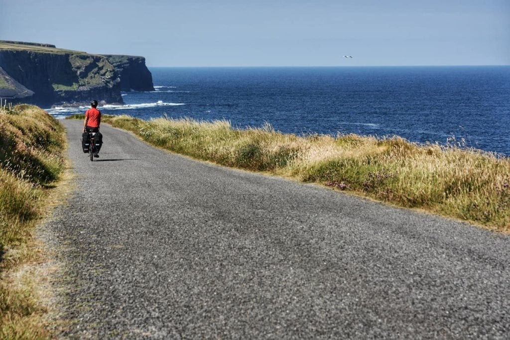
From Ballyvaughan take the coastal road R477, for the first kilometers the asphalt is not in excellent condition, after about 4 kilometers the panoramic view of the cliff begins. After the lighthouse at the head, there is a beautiful cliff where you can camp.
Arriving at the cliffs of Moher there is a path of 16 kilometers that runs along the cliff, the trail starts near the campsite of Doolin (20 euros for two people and the tent) near the pier where the boats depart.
If you don’t want to go all the way you can do the paved road by bike and get to Pollboj, you will find signs indicating the entrance to the trail which will take you directly to the most epic part of the cliff (for free).
Check the best places to stay in Dolin
Boat trips in Ireland: Cliff of Moher and Aran Islands
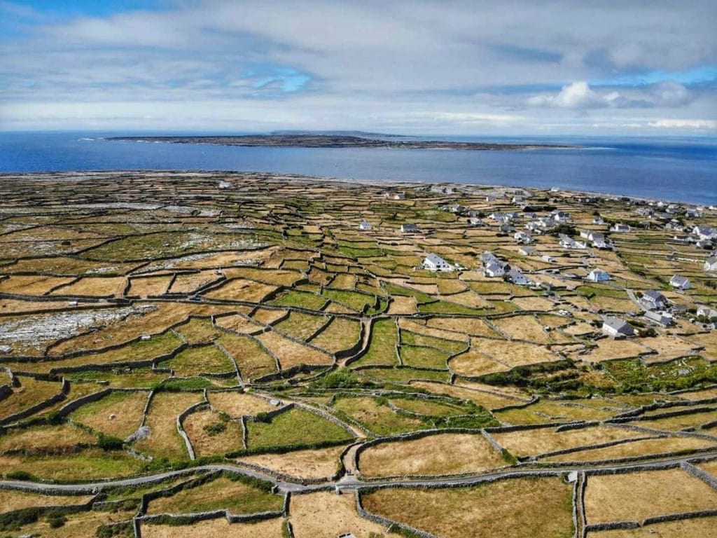
From Doolin several ferries depart during the day, and you can go to see only the cliffs from the sea, the ride takes about an hour and is really worth it. Or you can go first to see one of the Aran Islands and see the sea cliff on the way back, this solution costs 30 euros each. You can even camp on one of the islands, the bikes can be transported on the ferries.
We have visited the island of Inisheer, with its characteristic stone walls, apparently, there are also seals but we haven’t seen them. There is a beautiful beach of crystal clear water where the most daring can swim, behind the beach you can camp. Or rather, you could not, but many were camping.
At the port, you will meet some nice farmers with a tractor (or a horse) pulling a cart, they will bring you around the small island if you’re too lazy to walk. The island, however, is not very large and in about 3 hours you will see the most interesting parts.
Read the Reviews and book your Cliff of Moher Cruise
Spanish Point and Loophead
Continuing on the road you arrive at Spanish Point, a beautiful village where there is also a famous traditional Irish music festival, here you can camp on the beach.
From Spanish Point to Kilkee the road is in the middle of the fields and a little bit boring, when you arrive in Kilkee the Loophead begins, the initial part (north) is beautiful, and there is immediately a fairly epic cliff where you can camp, the road on cliff lasts about 5 kilometers and then you go through the interior in the middle of the fields until you get to the head where there is the lighthouse. On the road, you will meet only a single shop, in front of a church.
The path around the lighthouse is beautiful, the legend says that there was a mythical fight between a famous Irish hero and a powerful witch.
From the lighthouse along the south road, you come across a nice little beach of transparent water but the road is quite monotonous, alternatively, you can take the quickest road from the lighthouse and skip this part of the loop.
Road to Tralee and Dingle Peninsula
From Kilrush to Killimer nothing special, quiet road to the port from which you take the ferry that costs 5 euros each, the bikes travel for free.
From Tarbert, the town where you will leave the ferry, to Tralee you can choose to ride along the state road, even here the asphalt is not the best, or to follow the Atlantic Way, which here is anyway not spectacular and mostly away from the coast. Halfway to Tralee, on the state road N69, there is a very nice tourist village, Listowel.
From Tralee to Camp the road is busy, at least in the summer months, every now and then you see the sea, left the state you take the R560, there are several campsites to sleep or narrow streets that lead to the sea, here there are also easy places to free camp.
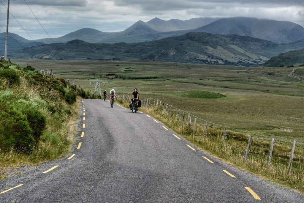
After about ten kilometers we start to climb towards the pass (or so they call it here) 400 meters s.l.m., the road is narrow and even here you will find traffic, the view is nice but not exceptional.
After the pass the road goes down to Dingle, very touristy town, we were told that we could not miss the Dingle peninsula and so we took the road to Ventry but we did not find it exciting so we came back and we headed to Annascaul on the highway slightly uphill.
After the village we took the R561 to Inch Beach, very beautiful strand, here there is a very basic and dirty camping, it costs 5 euros each.
Check the Best Places to Stay in Listowel
The Ring of Kerry
From Inch Beach to Castlemaine (village famous for the song “the wild colonial boy”), the road leaves the sea and plunges back into the boring countryside. At Killorglin we left the super busy highway and took the road to the Ballaghisheen Pass (it is called pass but it is 300 meters uphill), beautiful road, in this place was born the legend of Asheen.
After the descent to Cahersiveen we took the road to Portmagee, on one side the mountains and on the other Valentia Island, Portmagee is a very small and cozy village, it is 3 kilometers from the famous cliffs of Kerry, whose entrance costs 4 euros (and we have not identified ways to avoid it).
From here boats leave for Skellig Michael and the island of Puffin (and Lue Skywalker), the funny birds that live here.
Returning back to Cahersiveen we took the N70 state road to Waterville, a very cute town, unfortunately it rained and we did not enjoy it much, there are a couple of supermarkets where to store supplies.
Read here the detailed itinerary of the Ring of Kerry
From here you go up to 200 meters on a scenic road that we have not seen because of the epic fog and rain. We checked the images on the internet and the view should be beautiful.
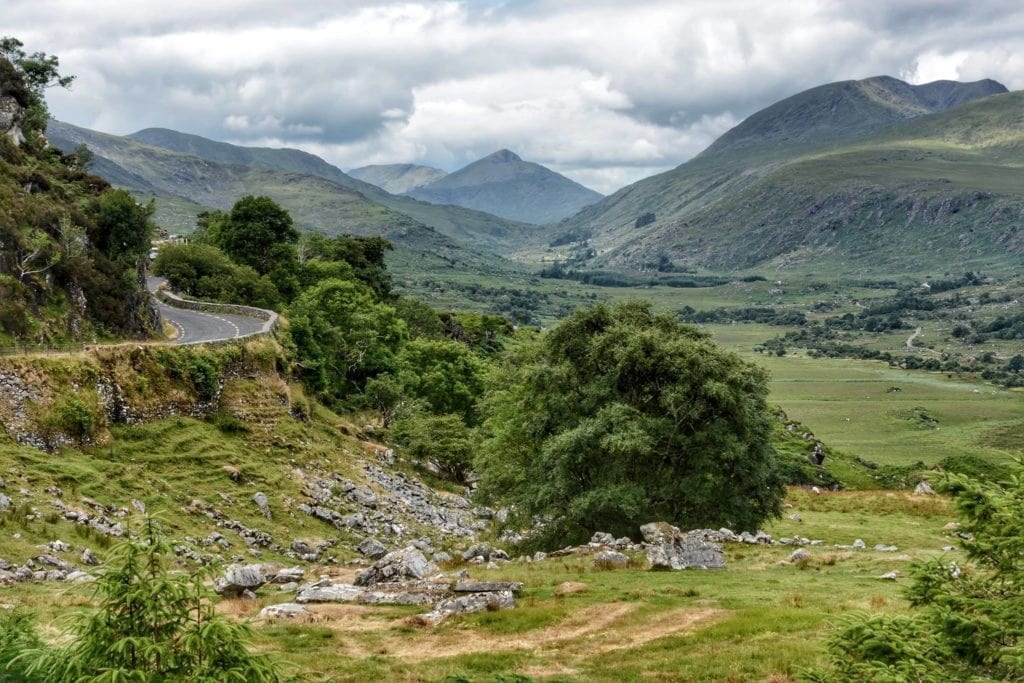
After descending to Caherdaniel the road continues along the coast. From Castelcove to Sneem the road leaves the coast and goes up a little, from here it is better to take the R568 and get off the highway, we took it from Blackwater bridge. From here to the step that is rejoined to the state road the scenery is beautiful.
Alternatively, from Blackwater instead of the R568, you can continue straight on the road that runs through the Black Valley and also comes out at Molls Gap.
From Molls Gap go down and start the Killarney National Park, very nice and with rivers and lakes suitable for canoeing, you should call a number and register your vessel (but it seems that nobody checks). On the way, you will meet a waterfall, a beautiful abbey, and panoramic points. Near Killarney, a very nice tourist village, there is also a campsite.
Check Also
- Cycling Norway – the Atlantic Way
- Finland by bicycle – everything you need to know and the best itineraries
- Cycling and Camping in Estonia – why you should think about it
- Cycling Poland – GreenVelo and EuroVelo routes (tips and maps)
- Cycling Slovakia – Why it Should Be Your Next Destination
- Cycling Croatia: How to Plan Your Bike Touring Trip
- Alpe Adria Cycle Trail – Hints, itinerary, map, GPS tracks, and sights
- Bikepacking Slovenia: Everything you need to know & a lot of cycling itineraries