Last Updated on 29 November 2025 by Cycloscope
An itinerary of the Eastern Cape, from Port Elizabeth to Lesotho
The last section of our cycling expedition in South Africa, before a strenuous parenthesis in mountainous Lesotho. From Port Elizabeth, on the coast, we headed north through the Eastern Cape to Lady Grey. We traveled several beautiful dirt roads, with no traffic, and were immersed in nature.
Disclosure: Some of our articles contain affiliate links. This comes at no additional cost for you and helps us keep this website up and running. (as Amazon Associates we earn commission from qualifying purchases)
This article describes our itinerary in the Eastern Cape, which we highly recommend to anyone who wants to see the best of this incredible region of South Africa.
Our journey was done on fully loaded bicycles, but here you will find helpful information for this route, no matter which means of transport you choose.
Our journey to South Africa started in Cape Town. Here are the other articles we wrote:
- Cape Town, what to see in the most beautiful African city
- From Cape Town to Hermanus, the Western Cape coast
- From Hermanus to Swellendam through Greyton and the Riversonderend nature reserve
- From Swellendam to Barrydale, the Little Karoo, and the Seven Passes Road
- Knysna, Alfred Pass, R62, Garden Route and Port Elizabeth
- Getting lost in Lesotho, a great road trip route
- Sani Pass, riding the highest road in South Africa
Check also our complete guide about
Cycling in South Africa – everything you need to know
Map and GPS track of our Eastern Cape Itinerary
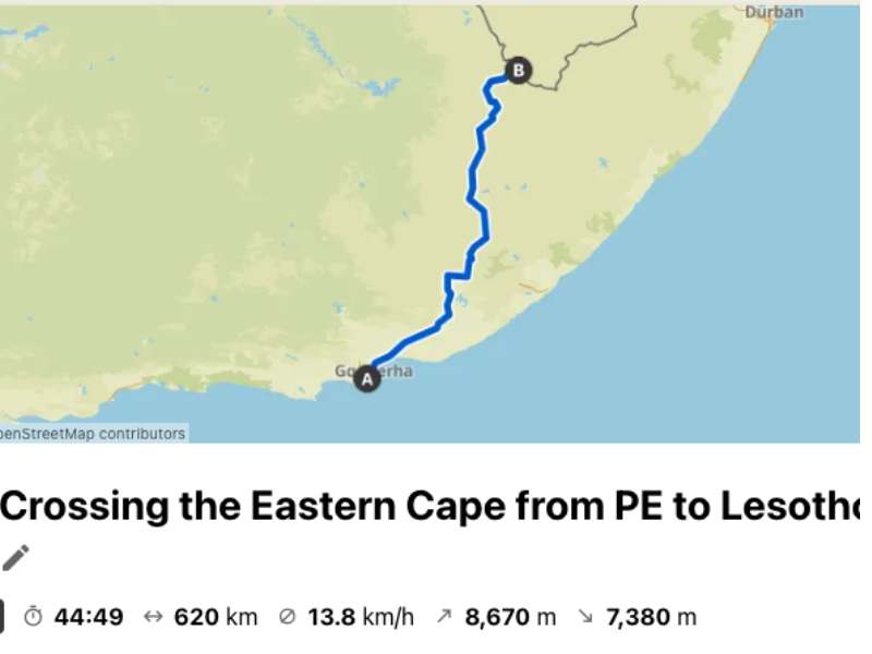
This 620km itinerary of the Eastern Cape leaves the coast at Port Elizabeth (which the locals abbreviate as PE) and goes deep into the interior.
It’s a very hilly route, with almost 9,000 meters of elevation gain, not easy on a bicycle but overall very doable even with a small car (be careful of some big potholes, especially on the dirt road).
As usual, we took it very easy and did it in 11 days (including two rest days in Hogsback). For those traveling by motorized means, we would advise at least 5 days, since there’s so much to see and do along this route.
From Port Elizabeth to Grahamstown through the dunes of Colchester (125km)
Setting off from where our previous stage ended, in Sardinia Bay, we cross Port Elizabeth. Not a very pleasant city to cut through on bicycles, rather large, with many factories and shops, but nothing that really fascinates.
We are back on the main road, the infamous highway N2, which has only a large side emergency lane that can be used as a “bike path”. This makes us feel safer, but the constant noise of cars and trucks is really unbearable.
However, there are not many alternatives, as apparently, you shouldn’t pass through Motherwell, an area they tell us is hazardous, even for those traveling by car.
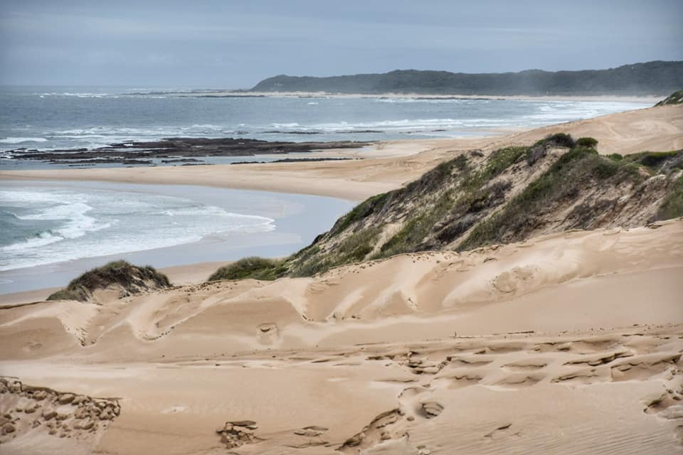
The traffic gets a little less intense as we cycle to Colchester, where the high dunes strike us. It is about 3 kilometers of dunes that separate us from the sea, a sort of small desert.
We decide to stop and explore this area a little. Colchester is a fairly touristy but tiny village where you will find places to sleep and a campsite. The main attractions here are:
The massive dunes on which you can do sand-boarding (yes, snowboarding on sand)
The Sundays River, which, on days without wind, is very calm and can be sailed by canoe or, if you don’t feel like rowing, with one of the boats that organize guided tours. You’ll sail through the dunes towards the river mouth (we attempted but capsized because of sudden wind gusts and our clumsiness)
Right where the gas station is, there is a restaurant and bar that handles all these things.
Amakhala Game Reserve
From Colchester, we continued on the N2 up to Grahamstown, but there are actually many more interesting dirt road alternatives, especially if you want to visit the Addo Elephant Park.
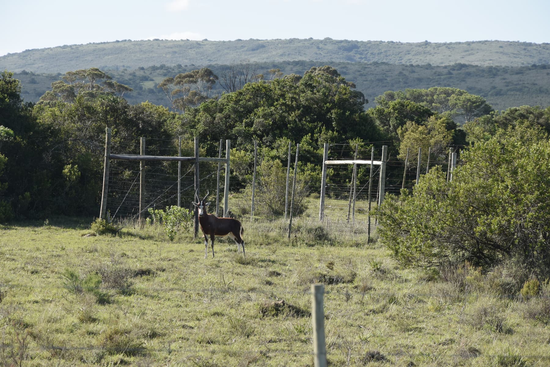
Anyway, from Colchester to Grahamstown, the N2 is not the highway it used to be; it looks more like a state road, and traffic is lighter. It passes along the Amakhala Game Reserve, and you will see many animals directly from the road, even the elephants if you are lucky.
We have seen numerous types of antelopes whose names we do not yet know, several zebras, ostriches, and a family of warthogs. Of course, you can also stop and sleep in the reserve and take a tour, but the costs were prohibitive for us.
From the Amakhala Game Reserve, the road is beautiful and wild. It begins to rise more pronounced, especially in the last 6km to Grahamstown.
Grahamstown (Makhanda), the city of churches
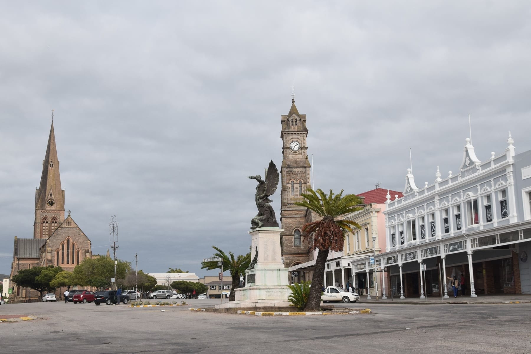
Grahamstown is a reasonably large town, today a university center. The city is very lovely, but also weird with all its churches of different architectural styles.
Today, his name has been changed to Makhanda in honor of a warrior, philosopher, and prophet Xhosa, who fought here against the English Colonel Graham. Colonel Graham was sent here from the colony of the Cape, hence the name of the city, and also the reason for its change.
The city was founded in 1812, after the fourth of the frontier wars (border wars) among the whites arriving from the west and the expanding Xhosa population from the northeast.
The Battle of Grahamstown was one of the most significant battles in the history of the Eastern Cape. Thousands of Xhosa warriors attacked, led by the prophet Makhana. 301 men repulsed them; Makhana was captured and drowned trying to escape from his imprisonment on Robben Island (where Mandela was imprisoned decades later).
Grahamstown is for us the first city in South Africa where we do not see many whites, and there are no “informal settlements”. The majority of the population, at least to the naked eye, is black; they are not rich; they live in more modest houses, made of brick, not metal sheets.
We are hosted by a couple through WarmShowers, they tell us that garbage has not been collected for about 3 months, and in fact, as soon as we leave the city center, we realize.
Here, the drought is real, like in many other areas of South Africa. Everyone at home recycles the water from the shower to flush the WC, normal actions that we should take in our everyday lif,e and not only when we find ourselves forced.
The R67 from Grahamstown to Alice through Fort Beaufort (102km)
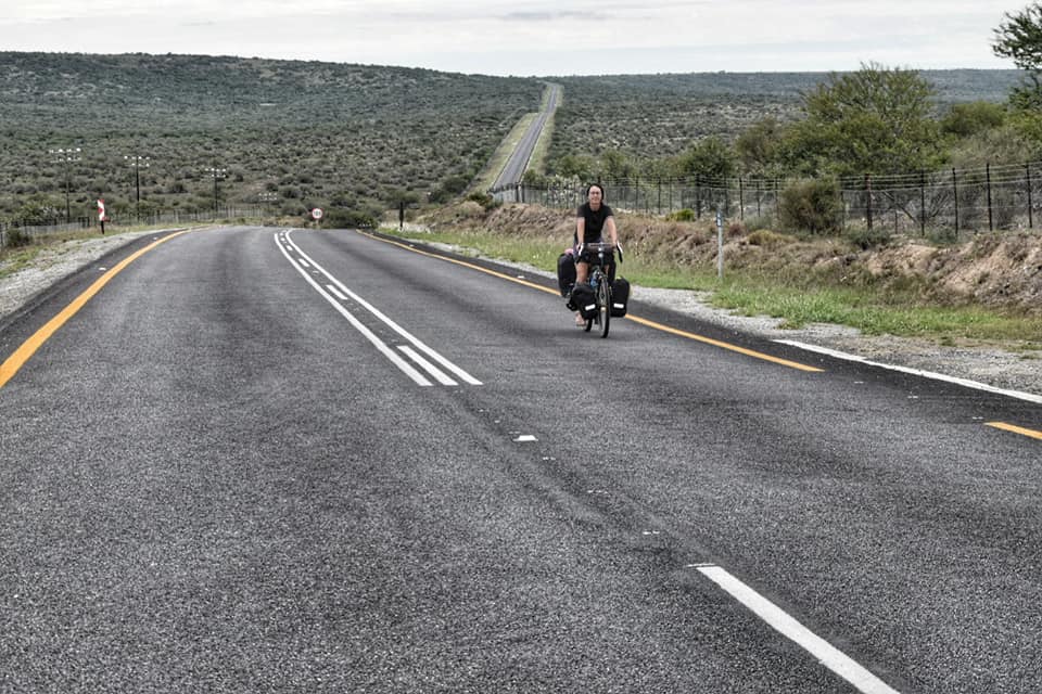
Leaving the city along the R67, urbanization completely disappears, and it will be so for the next 80 kilometers: no farms, only a small settlement with a dozen houses. There are no shops, and only a few cars pass by, so bring enough food and water if you ride this route.
In total, the elevation gain is about 1,000 meters; there aren’t challenging climbs, but the ups and downs really tired our legs. The landscape around it is beautiful, behind the constant barbed wire so as not to let the cows or, worse, the lions roam free, the land seems endless, and no houses are visible on either side.
On the eastern side, we admire the Great Fish River Nature Reserve, a very spectacular wilderness area. There’s a road going through the park, but unfortunately, it’s forbidden to bicycles, just like almost every road that goes through game reserves.
Fort Beaufort is a large town where you can find everything you need: a supermarket, beer shops, and a few guesthouses. Fort Beaufort has been the theater of several clashes during the long and bloody frontier wars. When we were there, the draught was not as bad as in other areas of the Capes, but load shedding was frequent and prolonged.
From Fort Beaufort, we took the R63 to Alice, and we regretted it, the road was much busier than we expected and there was no space at the side of the road, many cars really passed us at very little distance.
I must say, however, that after wearing my yellow safety vest (which reads ‘overtake at a distance of 1.5 m), the situation has improved quite a bit. Fortunately, this stretch is only about twenty kilometers, constantly up and down.
There is also an alternative dirt route from Fort Beaufort to Alice, located to the north and passing through villages along the way. We were almost going to take it when a guy stopped by to say we would’ve been robbed of the underwear down there.
I do not know if that is true; often, South Africans are overprotective and a bit exaggerated, but we took their advice, though.
From Alice to Hogsback (35km)
Alice is a vivacious city, which we thought we could cross quickly to take the R345 to Hogsback. Hogsback is located at an altitude of about 1200 meters, so the road is all uphill. The first 20km is light and not very exciting, going through a dry landscape.
From the junction with the road to Elundini, the terrain turns into grassland, up until the village of Hala, which is very scenic and from where the final climb begins. A detour to Elundini seems interesting; there’s also an eco-backpackers in there.
Up to here, the road is pleasant and dotted with many small villages, mainly inhabited by cattle herders. We have not seen any shops or restaurants, but you should probably be able to find at least one store that sells basic items.
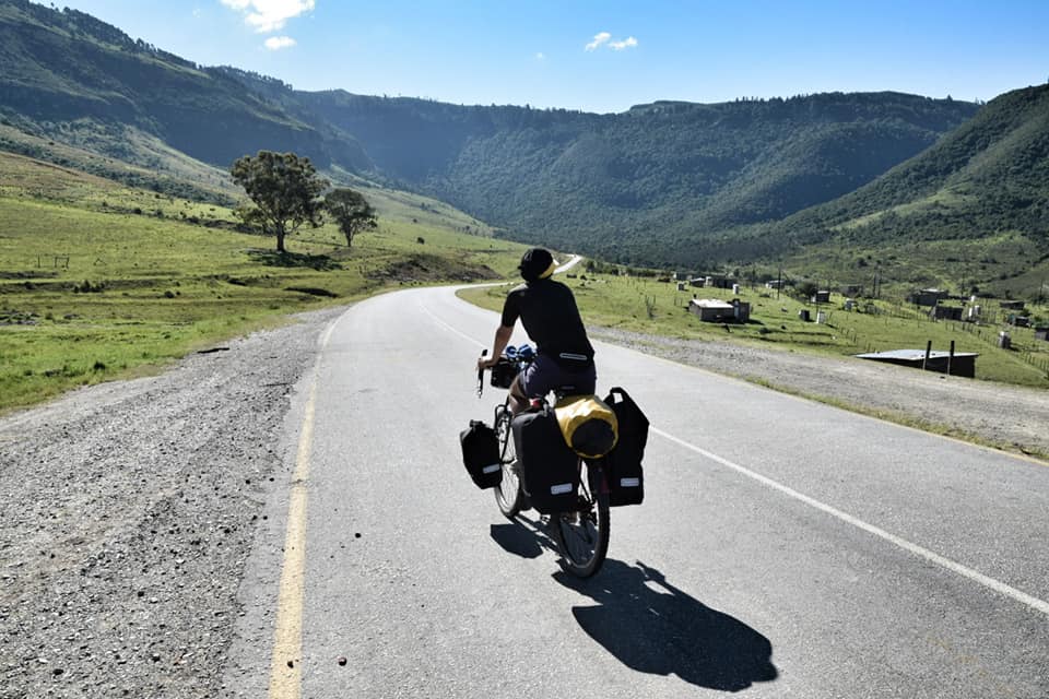
About ten kilometers from Hogsback, the real ascent starts, and the landscape changes completely, from almost arid to tropical. We are surrounded by forest and so many vervet monkeys, watching us silently, hidden among the trees.
The road climbs steadily at 7% and is often in the shade; there are magnificent views over the valley. One rasta trucker saw me focused and stopped to give me some free ganja, “for strength,” he said.
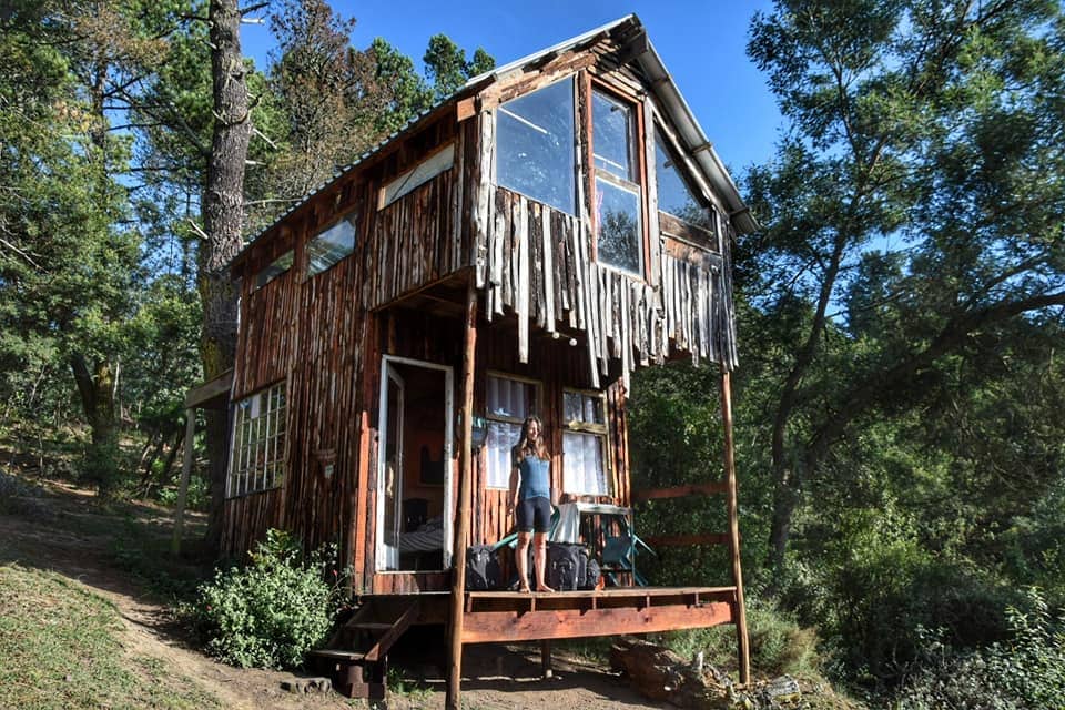
Hogsback is a sort of oasis town, set in the middle of a jungle. It’s a hippy destination with several nice eco-stays; there are several hikes from here, some even several days long.
Hogsback to Queenstown via Cathcart (100km)
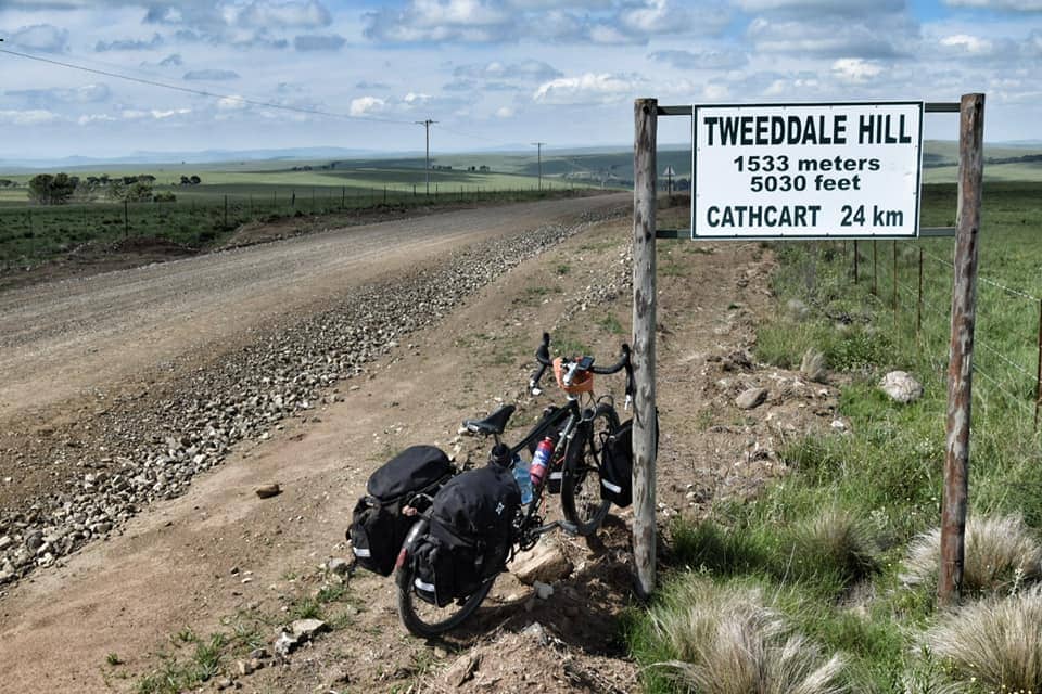
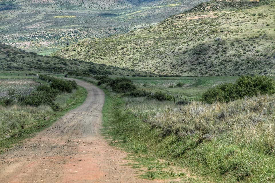
From Hogsback to Cathcart the R345 is not paved, the first part is not bad but then it gets worse, some sections are rocky and difficult to pedal, and with loaded bikes consider doing it in one full day. Very few cars pass here; we have met three in total today. Fortunately, one of these was driven by a gentleman who invited us to sleep in the local Cathcart church upon our arrival.
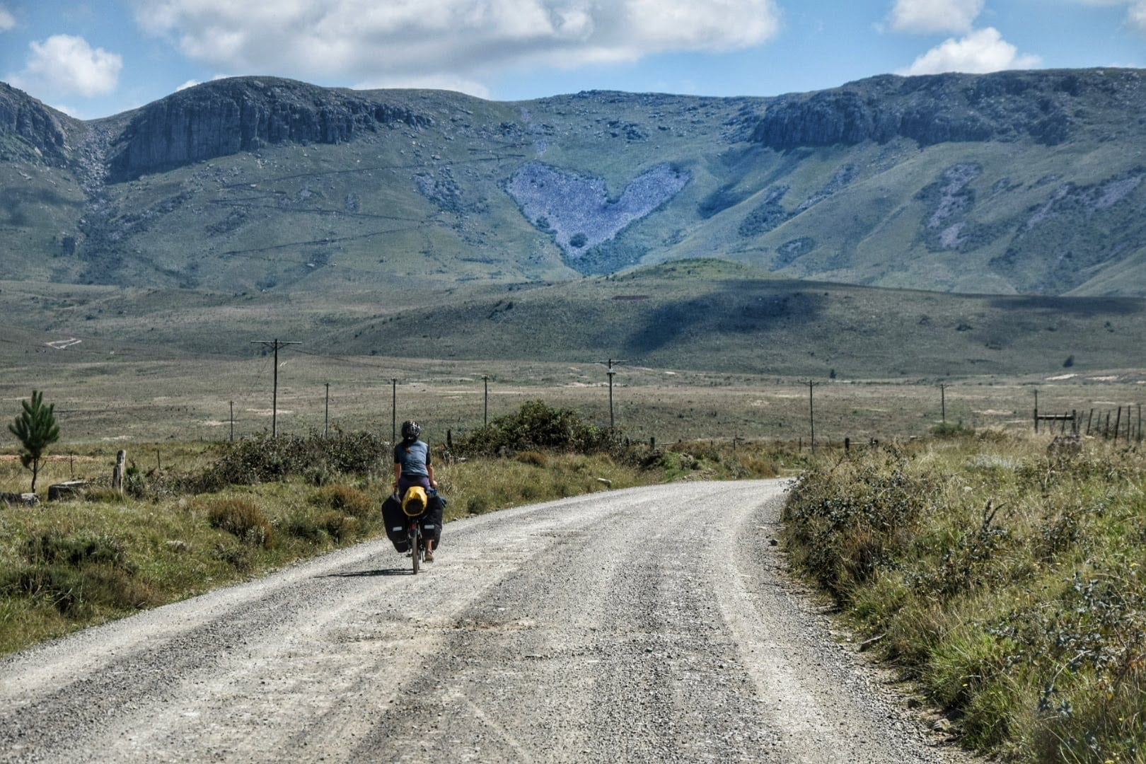
This section of the R345 is incredibly scenic; the landscape quickly turns back to grassland after leaving Hogsback. We are surrounded by mountains, rivers, and verdant valleys, a really photogenic landscape. It is the usual ups and downs, with the highest point at Tweeddale Hill at 1533 meters.
In Cathcart, a small town a little over a kilometer long, you will see an old English double-deck bus parked in a garden to your left, and there is also a sign. Please visit it; a lovely gentleman will welcome you and show you all his artistic creations, which are on the bus and in the garden.
He told us he had hosted several cyclists, so if you ask to pitch a tent in his yard, he will almost certainly allow it. In Cathcart, there are several guesthouses as well. From Cathcart to Queenstown, along Road 6, the asphalt returns, and the landscape is nothing special; the route is easy, with a few ups and downs.
Queenstown is a good place to rest and stock up on food, it was described to us as being a bit hectic but we found it safe enough. Maybe be careful at night during weekends, as many drunks are around, that’s very common everywhere in South Africa.
Cycling from Queenstown to Lady Gray via Dordrecht (176km)
From Queenstown, we follow the R392 to Dordrecht. The road is paved and one of the most beautiful of this overall incredibly scenic route.
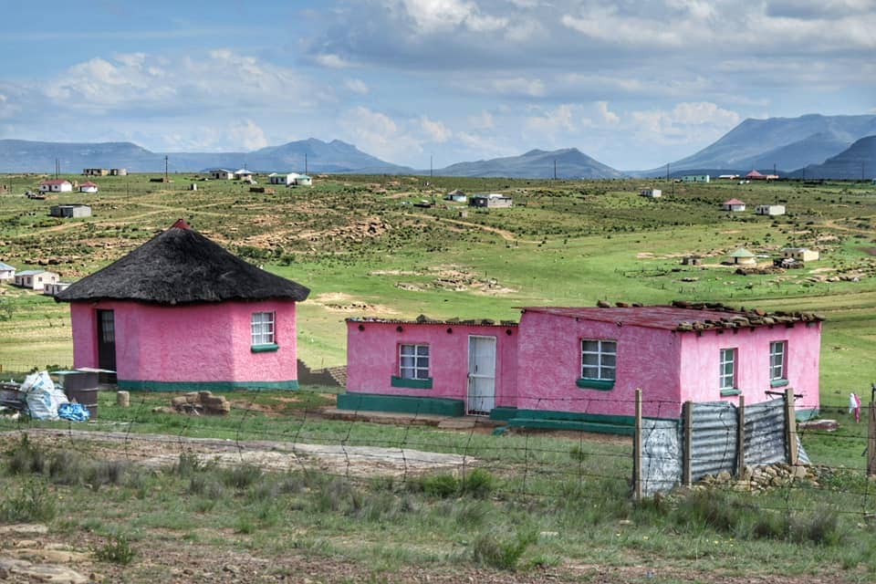
We see many traditional villages with colorful roundhouses. This is the huge Xhosa settlement of Bankies, set in a series of adjacent valleys. Very little information is available about this beautiful place. The Nonesi’s Nek pass, above 1700 meters, will get you out of this dream towards the town of Dordrecht.
In Dordrecht, a tiny village, there is a guest house next to the gas station where you can even eat pizza, but we didn’t try it. The local supermarket is very small.
From Dordrecht to Lady Gray, the R392 is not paved; in some parts, it is stony, and in others, it may not be easy in case of rain.
The surrounding landscape is charming up until the bridge over the Kraai River and there are several farms to ask for hospitality, after the bridge, there’s also a police station. The last part of Lady Gray is not as spectacular. Along this road, we met many wild baboons.
From Lady Gray to Palmietfontein, where the border with Lesotho is located, the road is paved and pleasant; there are some guest houses in Sterkspruit, the last place where you can buy cheese on the way to Lesotho.
Our journey to South Africa started in Cape Town, here are the other articles we wrote:
- Cape Town, what to see in the most beautiful African city
- From Cape Town to Hermanus, the Western Cape coast
- From Hermanus to Swellendam through Greyton and the Riversonderend nature reserve
- From Swellendam to Barrydale, the Little Karoo, and the Seven Passes Road
- Knysna, Alfred Pass, R62, Garden Route and Port Elizabeth
- Getting lost in Lesotho, a great road trip route
- Sani Pass, riding the highest road in South Africa