Last Updated on 23 December 2025 by Cycloscope
Epic bicycle touring adventure in the Balkans. We cycled through North Albania, Montenegro, Serbia, Kosovo, Macedonia, South Albania, and Greece
In this article:
- North Albania (GPX Map)
Durres
Tirana
Buna River – Velipoja Protected Landscape
Shkodër
Komani Lake Ferry + Valbona – Theth
Tamare – Selce
Vermosh - Montenegro (GPX Map)
Plav
Berane
Rozaje - Serbia (GPX Map)
- Kosovo (GPX Map)
Mitrovica
Pristina - Macedonia (GPX Map)
Skopje
Tetovo
Debar National Park
Ohrid Lake - South Albania (GPX Map)
Elbasan
Berat
Vlore
Dhermi
Sarande - A little bit of Greece (GPX Map)
Igoumenitsa
Albania
Disclosure: Some of our articles contain affiliate links. This comes at no additional cost for you and helps us keep this website up and running. (as Amazon Associates we earn commission from qualifying purchases)
We arrived in Albania by sea, opting for the ferry from Bari to Durrës – a comfortable choice if you travel with your own bicycle.
There are daily routes from Brindisi to Vlorë and Ancona to Durrës as well, with frequent departures year-round.
Traffic between Durrës and Tirana is heavy, with a chaotic main road. There is a parallel secondary road, but it doesn’t cover the entire route.
Near the port of Durrës, there is the bus station, with hourly departures to Tirana. You can take your bike on the bus if you want to skip this part.
Tirana
Tirana deserves a couple of days. What makes Tirana truly unique is its colorful and innovative architecture.
The former mayor (now Prime Minister) Edi Rama, an artist by training, transformed the gray post-communist city by painting buildings in vivid colors—reds, yellows, blues, and geometric patterns that lift the mood and symbolize rebirth.
Walking or cycling around, you’ll encounter rainbow façades that make every corner photogenic.
In recent years, Tirana has experienced a boom in modern architecture: bold skyscrapers like Downtown One, the “Eyes of Tirana,” and other high-rises around Skanderbeg Square and the New Boulevard.
Shkodër
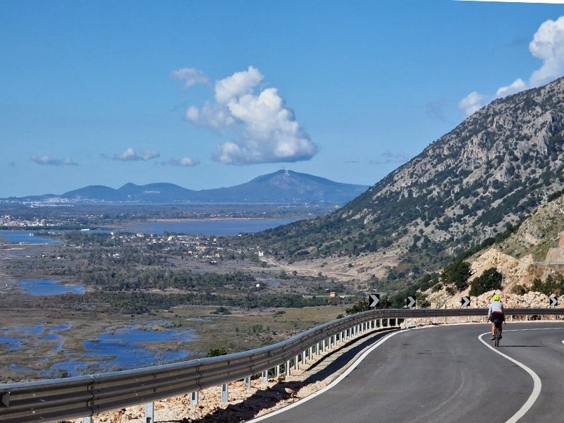
From Tirana, we head north toward Shkodër, where we explored the Buna River – Velipoja Protected Landscape, a vast natural area where river, lagoon, forest, and sea meet.
The Buna River (shared with Montenegro) flows gently through wetlands rich in birdlife before reaching the Adriatic, creating a calm, scenic corridor ideal for cycling, walking, and nature watching.
Following the coast southward, the landscape leads to Rana e Hedhun (meaning “Thrown Sand” in Albanian), a striking natural monument near Shëngjin.
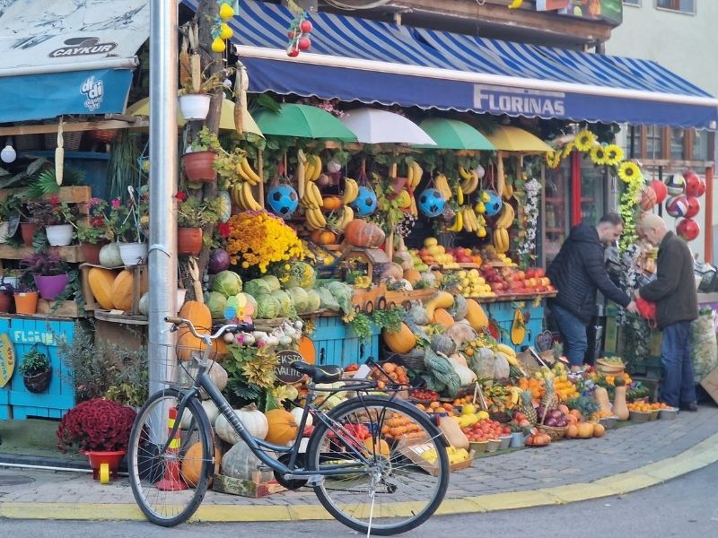
Shkodër is a nice but nothing special town. We found a room for €15 in a hostel near the pedestrian area.
It has a garden and a garage for our bikes, which we leave there for a couple of days while we go on the famous Valbona–Theth Hiking Trail.
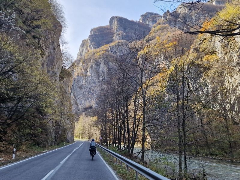
Komani Lake + Valbona – Theth Hiking Trail
This is one of the most beautiful short trips we’ve ever done in the mountains: Shkodër – Lake Koman ferry – Valbona – Theth trek.
We did it in late October, when the crowds are gone, the days are short (dark by 4 pm), but the autumn colours are absolutely incredible. The last ferry of the season runs on November 5, before the winter closure.
The first day started early: at 6:45, we caught the bus from Shkodër to the ferry departure point. Around 11:00, we set off on Lake Koman, and after about 2.5 hours of sailing, we reached Fierzë.
From there, a minibus took us straight to Valbona, arriving around 2 pm. The whole package (bus + ferry + minibus) costs just €20 per person and can be booked easily online at komanilakeferry.com – I can’t recommend it enough; everything was perfectly organized.
The Lake Koman ferry is one of those experiences that leaves you speechless: turquoise water carving through incredibly steep gorges, almost vertical cliffs – it feels like a Norwegian fjord but in Albanian style.
The boat stops several times to drop off or pick up locals on rocks in the middle of nowhere, and once we even paused to hand over two cold beers to people waiting on a rock!
On our ferry, there were cyclists and four motorcyclists who loaded their bikes (with a bit of effort) on the sides. In summer, there are bigger ferries that transport cars. The road from Fierzë to Valbona is just as spectacular, especially in autumn, with the trees exploding in color.
Valbona isn’t a real village – just scattered houses and guesthouses along the valley. We stayed at Hotel Margjeka, one of the closest to the trailhead, with an incredible view of the mountains and a great restaurant. Breakfast included, packed lunch prepared by them – perfect.
The second day was all about the classic Valbona-Theth trek: breakfast at 7:30, start at 8:00, and around 8 hours of walking with breaks. The trail is well marked (still, download an offline map like Komoot just in case).
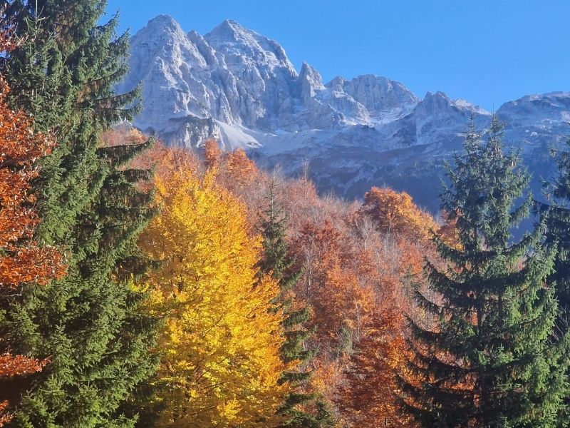
It begins gently along the river, then climbs gradually up to about 1,800 meters. The views over the Albanian Alps are postcard-perfect: jagged peaks, deep valleys, all made even more stunning by the autumn colors lower down.
As you go higher, the trees are bare, and the thick layer of leaves can be slippery. The ascent from the Valbona side is gentler than doing it the other way; the descent to Theth is steeper and more wooded, with fewer epic viewpoints.
We walked with an English couple we met at the hotel – great company and a bit safer. Even late in the season, there were other hikers, but the sense of peace was total.
On the third day, we wandered around Theth in the morning before catching the 11:00 minibus back to Shkodër. The village is growing fast, with new guesthouses popping up everywhere. We stayed in a lovely one, though a bit pricey at €35 for a double (by Albanian standards).
There are short trails to Grunas Waterfall or, if you have more time, the longer hike to the famous Blue Eye – that crystal-clear turquoise spring that’s pure magic. If you can, add an extra day: it’s absolutely worth it.
Tamare + Selce
From Shkodër, we set off toward Koplik on a moderately busy road with a good cycling lane; the first 25 km are flat and easy.
Beyond Koplik, we climb gradually to Hot, then tackle hairpin bends up to around 600 m, with spectacular views. At the top, a sandwich truck provides a perfect spot for a quick snack and beer before the steep descent.
We follow the Cemi River down to Tamarë, a small tourist village at 200 m nestled between mountains, with a few guesthouses. Here we try Albanian polenta and absolutely love it, in a peaceful mountain setting.
The next day, we continue climbing along the river to Selcë, a larger village but with only a couple of guesthouses. Heavy rain forces us to stop there.
We’d love to do multiday hikes from Selcë—like the classic trail to Vermosh Pass through traditional villages, deep valleys, and forests—but the wet weather makes it impossible this season.
Then the final climb to about 1,900 m. No rain, but the headwind is brutal; we often have to push the bikes. A few villages along the way have guesthouses if needed.
We reach the top, where an old man runs a tiny bar with his cat and a wood stove. We warm up with hot coffee, then start the descent as snow begins to fall (-2°C).
The road leads us to the Montenegro border.
We wrote a detailed article about Cycling in North Albania. You can read it here.
Montenegro

Our original plan was to enter Kosovo from Montenegro. There exists a high-mountain border crossing at Kuqishtë (Kosovo side) / Kućište (Montenegro side), along the rugged Accursed Mountains (Prokletije/Alpet Shqiptare), which is open to pedestrians and cyclists (with a prior permit required from the Kosovo police; you can get it in Plav).
Unfortunately, it was already closed for winter due to snow and harsh conditions. Besides the stunning beauty of this remote alpine area—which would have taken us deep into Kosovo’s dramatic mountain region—it would have allowed us to avoid entering Serbia altogether.
In practice, because Serbia does not recognize Kosovo’s independence and considers it part of its own territory, the rules around border stamps can create issues: if you enter Kosovo directly from Serbia, Kosovo authorities will stamp your passport with an entry (but Serbia won’t give an exit stamp, as they claim you never left Serbia).
If you later try to enter (or re-enter) Serbia from elsewhere, authorities might view it as an overstay or illegal presence, potentially denying entry. The safest way is to enter Kosovo from a third country (like Albania, North Macedonia, or Montenegro) if you plan to visit Serbia later.
Entering from Albania instead, at the Vermosh (Albania) / Grnčar (Montenegro) border crossing, the road is flat for several kilometers. We immediately notice that the number of stray dogs has multiplied tenfold compared to Albania, a common sight in many Eastern European countries.
Plav, Berane + Rožaje
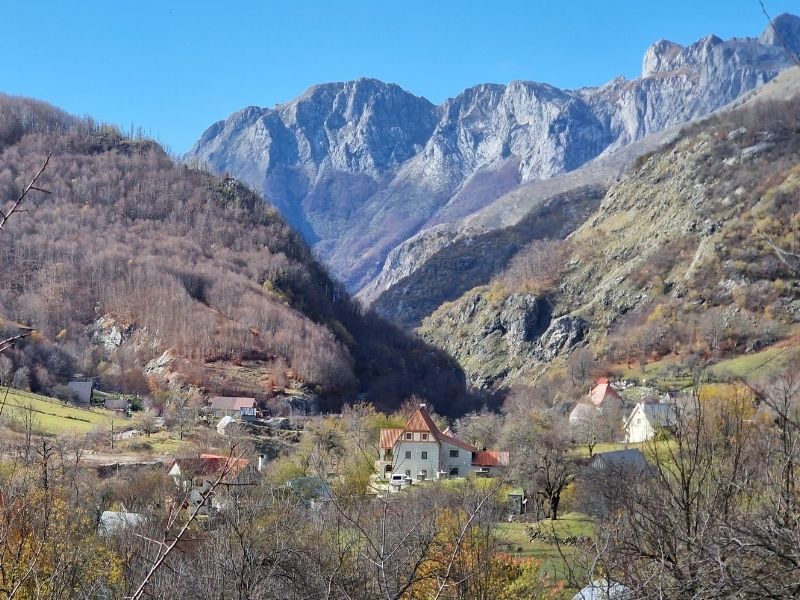
We arrive in the town of Plav (a small lakeside gem in northeastern Montenegro, surrounded by mountains and known for its Ottoman heritage and outdoor activities like hiking around Plav Lake).
Then we follow the scenic road along the valley—through idyllic rural villages and with very limited traffic—all the way to Berane. Berane has a pleasant pedestrian zone in the center and surprisingly good Neapolitan-style pizza.
From Berane, the road climbs steadily up to around 1,300 meters altitude at Rožaje (a small logging town with a strong Bosniak influence), then descends toward the Serbian border.
Tunnel in Montenegro
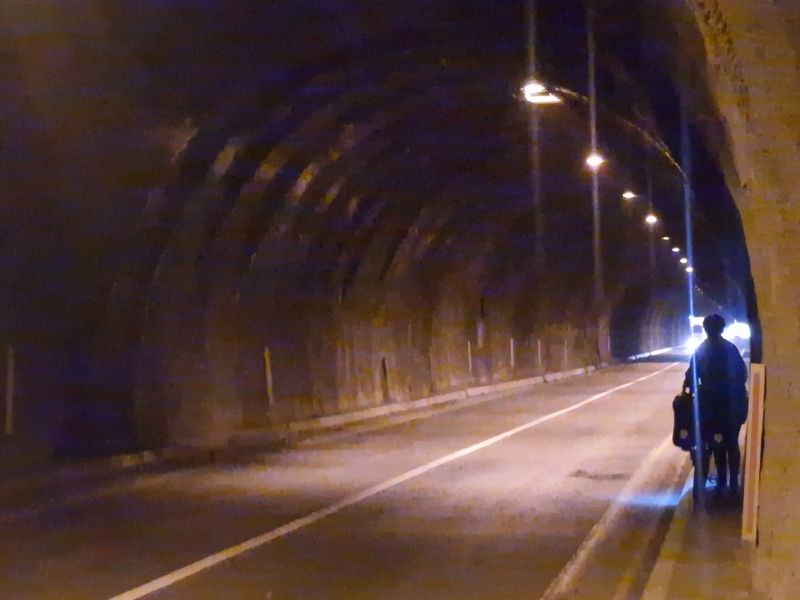
Before the descent, however, there’s a tunnel about 1 km long. There’s an alternative old road that climbs another 150 meters to bypass it, but we walked through it on the narrow sidewalk using headlamps (not the most pleasant experience).
From here toward the Serbian border (at Dračenovac / Špiljani, a straightforward crossing along the M-2/E80 road), a series of tunnels begins—some as short as 50 meters, others longer. They are mostly unlit, with very narrow sidewalks (often barely enough room for you and the bike side by side).
Some have old bypass roads winding around them, but many don’t. At times, we flagged down cars to ask them to light the way ahead and keep their hazard lights on for visibility to oncoming traffic; other times, we armed ourselves with torches and pushed through on foot.
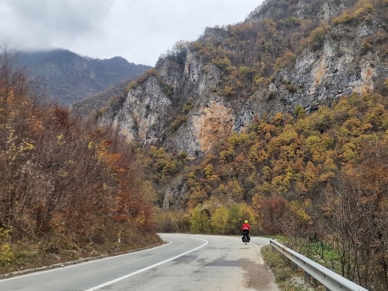
The road itself is truly beautiful, winding through dramatic gorges along the Ibar River with stunning mountain views, but all these dark, cyclist-unfriendly tunnels make it quite stressful.
Along the road (at the provided GPS coordinates), there’s an illegal dump site where garbage is simply thrown directly off the cliff into the river valley below—an unbelievable mess, especially shocking considering parts of this area fall within protected natural zones like the broader Ibar Valley landscapes.
At this roadside dump, at least 50 large stray dogs live in a pack, scavenging from the waste. As soon as they spotted us, they came running toward us—we were genuinely scared.
Luckily, right at that moment, a garbage truck arrived, distracting them as they chased it, and we hurried away as fast as we could.
Serbia

After crossing the border (at Dračenovac / Špiljani, a quiet and usually quick crossing for cyclists), we stop to sleep in a motel in Dobrinje, at around 800 meters altitude.
Even though it’s only early November, it starts raining and then snowing heavily, forcing us to stay put for an extra day.
Luckily, the next morning the sun shines brightly, and we set off again toward Kosovo, still accompanied by tunnels—though they start to become fewer and farther between.
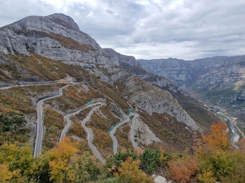
The road is incredibly scenic, winding through forested hills and deep valleys. From Ribariće, it begins to follow the stunning Gazivoda Lake (also known as Ujmani Lake on the Kosovo side), a large artificial reservoir created by the dam on the Ibar River.
The turquoise water contrasts beautifully with the surrounding mountains, and the route hugs the shoreline for many kilometers, offering peaceful views and light traffic—until reaching the Kosovo border at Jarinje / Brnjak (a smaller crossing that can sometimes have longer waits due to protests, but generally straightforward for cyclists).
Kosovo
We arrive in the city of Mitrovica, with Albanian flags everywhere and Albanian as the predominant language spoken.
The city doesn’t have much to offer in terms of sights, but it has a pleasant pedestrian area and is very affordable. We eat at an exceptional restaurant for a total of just 15 euros.
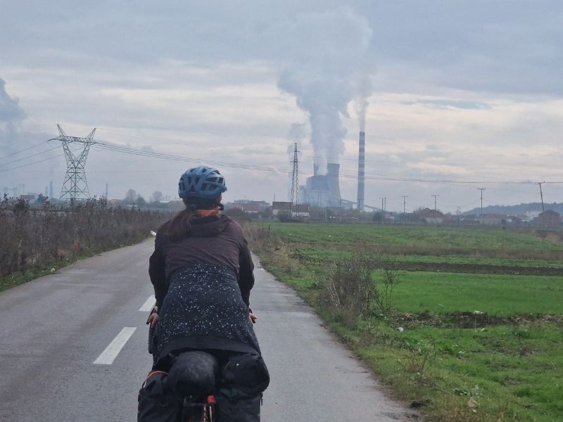
To leave Mitrovica and head toward Pristina, the capital, we start with a climb (to avoid the usual tunnel). The secondary road to Pristina is one of the most depressing we’ve ever cycled. Sure, there’s no traffic, but in exchange, stray dogs and garbage are literally everywhere.
At one point, we come across a coal-burning power plant complex. We later discover it’s the country’s main energy hub: the Kosova A and Kosova B thermal power plants, located in nearby Obiliq (Obilić).
These two aging lignite-fired facilities (Kosova A, dating back to the 1960s–1970s, Kosova B from the 1980s) produce over 90% of Kosovo’s electricity but are notorious as major sources of air pollution in Europe, surrounded by open-pit mines and ash dumps.
The people living in the nearby areas didn’t give us any sense of security at all. The final part of the road to Pristina joins the main highway, where there’s an emergency lane for cycling, but the traffic is truly heavy.
Pristina
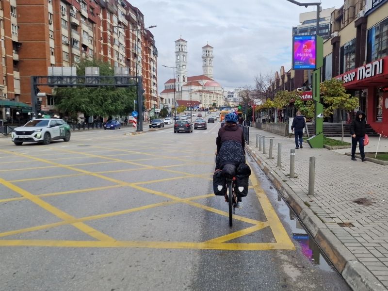
In Pristina, we stay for a couple of days, hosted by a WarmShowers host. The city doesn’t have much to offer in terms of sights as well.
There’s the usual pedestrian street (Mother Teresa Boulevard) lined with bars and restaurants—most serving more or less the same menu of burgers, pizzas, pasta, and Balkan grills—and often the food quality doesn’t match the fancy, modern design of the places.
Worth seeing are the statue of Bill Clinton, and the quirky National Library of Kosovo, famous for its brutalist architecture covered in a distinctive metal mesh that looks like a giant fishing net or chainmail.
The part we liked most was the bustling Green Market (Pazar i Gjelbër), which at least felt authentic, with locals selling fresh produce, cheeses, honey, and household goods in a lively, chaotic atmosphere.
We also enjoyed the street where traditional ceremonial clothing is sold—rows of shops displaying elaborate Albanian folk costumes like the xhubleta (a bell-shaped, pleated wool skirt worn by women in northern Albania and parts of Kosovo, now UNESCO intangible heritage), embroidered vests, tirgje (white felt caps for men), and richly decorated dresses with gold thread for weddings and festivals. These garments are still made by hand and bought for special occasions.
The most beautiful part of Kosovo is undoubtedly the mountainous west, along the borders with Albania and Montenegro—stunning rugged peaks, deep gorges, and hiking paradise. This flat central-eastern area is, honestly, skippable.
From Pristina, the only realistic way to reach North Macedonia by bike is the busy main highway (at least for the initial stretch), so we opt to take a bus to Skopje instead.
Macedonia

Skopje really surprises us big time! I don’t like looking up pictures of the cities I’m heading to, so I don’t spoil the surprise, but Skopje truly amazes us.
From the bus station, we take the bike path along the Vardar River: the city has a really well-developed and pleasant network of cycle paths, especially along the riverfront.
What we loved most were the statues, scattered everywhere in the city center. They are mostly part of the Skopje 2014 project, an ambitious urban redevelopment plan launched in 2010 by the government of the time to give the capital a neoclassical and monumental look, with hundreds of statues, fountains, bridges, and new facades.
The highlight is the gigantic equestrian statue of Alexander the Great (officially called “Warrior on Horseback”) in Macedonia Square, surrounded by lions and fountains.
The project was highly controversial: extremely expensive (over 500 million euros), accused of being kitsch and nationalistic, and above all, it irritated Greece, which considers Alexander an exclusive part of its Hellenic heritage.
To avoid further diplomatic tensions, many statues of ancient figures were given generic names (like “Ancient Warrior” for Philip II). After the change of government and the Prespa Agreement on the country’s name (North Macedonia), some plaques were modified to promote Greek-Macedonian friendship.
For the first time in our lives, we join an organized tour: they take us to the Millennium Cross, a gigantic 66-meter cross on top of Mount Vodno, built in 2002 to celebrate 2,000 years of Christianity. We go up by cable car from Sredno Vodno—an amazing panoramic experience with views over the whole of Skopje.
Then we visit a tourist complex styled like a traditional village (the so-called “Macedonian Village,” with hotels and restaurants recreating 19th–20th-century Macedonian architecture) near the church of St. Panteleimon in Gorno Nerezi.
The church, dating from 1164, is a Byzantine gem with extraordinary frescoes: considered among the most expressive of the Komnenian style, they even anticipate the Renaissance in their emotional depth and realism.
The most famous is the “Lamentation over the Dead Christ,” where Mary holds her son with a deeply human and touching grief, far from the rigid traditional Byzantine iconography.
From there, we head to Matka Canyon, a spectacular spot just 15–20 km from Skopje: an artificial lake surrounded by rocky cliffs, with hiking trails, kayaking, and medieval monasteries.
We take a short boat ride that brings us to Vrelo Cave, one of the deepest underwater caves in Europe, with impressive stalactites and stalagmites, small inner lakes, and atmospheric lighting.
Tetovo
From the center of Skopje, the bike path along the river accompanies you for about 6 kilometers until you exit the city. Once out of the city, however, the dedicated bike path disappears, and the road to Tetovo has heavy traffic—though there are no demanding climbs.
In Tetovo, there’s a hotel—NB Hotel & Spa—where for around 5 euros or a bit more you can access the heated indoor pool, jacuzzi, and saunas—perfect if you’re traveling like us in the colder season. Tetovo feels completely Albanian in atmosphere, with a strong ethnic Albanian majority.
The highlight to see is the beautiful Šarena Džamija (Painted Mosque, also known as the Colorful Mosque or Pasha’s Mosque). Originally built in 1438 and financed by two sisters, it was extensively reconstructed and decorated in 1833 by Abdurrahman Pasha.
What makes it unique is the elaborate painted decoration both inside and out: vivid floral, geometric, and landscape motifs (including rare depictions of Mecca and other towns), created with a technique using tens of thousands of eggs for the glaze. It’s one of the most outstanding examples of Ottoman Baroque art in the Balkans and a true gem.
From Tetovo, we take a quiet secondary road—very peaceful—that leads us to Gostivar. From there, the road merges with the main highway: it’s uphill, there’s no emergency lane, and traffic is heavy, especially trucks passing way too close. It’s not a huge number of kilometers of hell, but the climb makes it take a while.
Finally, around Novo Selo, we leave the highway and take the road toward Mavrovo, which, after about 6 kilometers of climbing, brings us to around 1,220 meters altitude and skirts the beautiful Mavrovo Lake (an artificial reservoir surrounded by mountains).
After leaving the lake, the road becomes even more stunning, gently descending along the spectacular Radika Canyon, part of Mavrovo National Park—the largest and oldest national park in North Macedonia, rich in forests, wildlife, and hiking trails. We sleep in Trnica.
The next day, we continue descending, noticing signs for countless hikes and trails in the surroundings. The wild camping possibilities here are endless.
Debar Lake
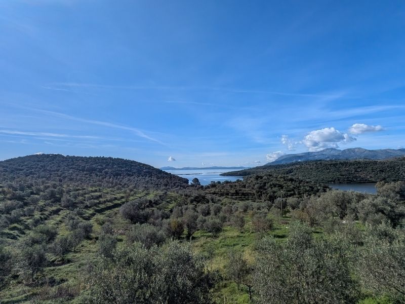
We continue following the river until the climb that takes us to Debar, from where we skirt Debar Lake (also known as Debarsko Ezero, an artificial reservoir on the Black Drin River).
There are a couple of climbs, a long flat section, and we pass through a new nature reserve area. Traffic on this road is nonexistent, but unfortunately, despite the beauty of the landscape, it’s hard not to notice the huge amount of garbage along the roadside.
As we approach Struga, on Lake Ohrid, traffic becomes intense. We continue pedaling all the way to the city of Ohrid.
Lake Ohrid is one of Europe’s oldest and deepest lakes (a UNESCO site shared with Albania), with incredibly clear, crystalline water—perfect for swimming in warmer seasons.
In Ohrid, we stop for a couple of days due to relentless rain—the joys of cycling in autumn! The lake is stunning, and the water is so clear that it must be amazing to swim in. Ohrid is a treasure trove of history and beauty: don’t miss the iconic Church of St. John at Kaneo, perched dramatically on a cliff overlooking the lake.
Samuil’s Fortress for panoramic views; the ancient Hellenistic theater; the Plaošnik archaeological site with the restored Church of St. Panteleimon and its impressive frescoes; the Church of St. Sophia with its medieval murals; and a stroll through the charming Old Town with its cobblestone streets, traditional architecture, and bazaar.
It’s often called the “Jerusalem of the Balkans” for its once 365 churches (one for each day of the year)—a perfect place to wander and soak in the atmosphere.
From Ohrid, you can head south along the road skirting the lake, or go toward Albania by passing the north of the lake and climbing to the border (at Qafë Thanë). From there, a road that—at the time of our trip—was very busy and not in great condition (perhaps also due to autumn floods) will take you to the Albanian city of Elbasan.
South Albania

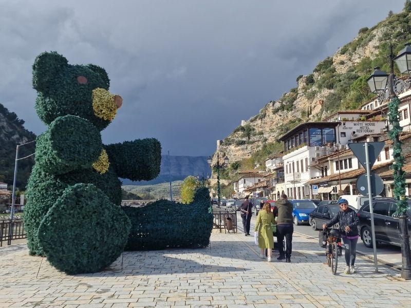
From Elbasan, we took a secondary road that crosses various rural villages until reaching Berat, the famous “City of a Thousand Windows.”
There is only one significant climb on this secondary road through the countryside.
We were impressed by the immense quantity of turkeys roaming freely in the rural areas— a common sight in Albania’s villages, where poultry farming is widespread!
Berat is definitely a nice little village, but honestly, nothing too thrilling—perhaps we’ve seen too many villages with endless stone steps and charming houses in our lives.
From Berat to Vlorë, we continue through the countryside. Vlorë strikes us as a very livable city, with a brand-new, well-designed promenade and a great bike path that takes us out of the city along the coast.
The view from the lungomare is stunning: a long palm-lined boulevard overlooking the wide Bay of Vlorë, with the sparkling Adriatic Sea (where it meets the Ionian), sandy beaches stretching out, distant views toward the Karaburun Peninsula and Sazan Island, and the dramatic backdrop of the Ceraunian Mountains rising sharply behind.
The coastal road is deserted in autumn. Just before reaching Dhërmi, there’s the Llogara Tunnel—about 6 km long (though it felt even longer on bikes!). At the time of our trip, it was operating in one direction only (the opposite of ours), so technically we could have gone through it, though we weren’t thrilled about the idea.
As an alternative, there’s the old road that climbs over the Llogara Pass at around 1,000 meters, bypassing the tunnel entirely. Right before the tunnel entrance, it starts hailing, and with incredible luck, an elderly couple in an empty pickup truck passes by and signals us to hop in.
We throw the bikes in the back and discover they’re heading exactly to a restaurant at the top of the pass. They offer us raki and coffee, and as if by magic, the sun comes out.
The descent is epic.
Dhërmi to Sarande
Upon arriving in Dhërmi, we continue along the coast—a true leg-breaker, with constant ups and downs all the way to Sarandë. This spectacular stretch of the Albanian Riviera follows the famous SH8 road, hugging the dramatic Ceraunian Mountains on one side and offering breathtaking views of the turquoise Ionian Sea on the other.
The route passes through charming villages like Vuno, Himarë (with its long pebble beach and castle), Qeparo, Borsh (home to one of the longest beaches in Albania), and Piqerras, with countless opportunities to detour to hidden coves and crystal-clear bays.
It’s about 80-90 km total, but the relentless rollercoaster profile makes it feel endless: expect around 1,000-1,200 meters of cumulative elevation gain, spread over multiple steep climbs and sharp drops.
Sarande to Igoumenitsa
The road to Butrint National Park from Saranda (or Ksamil) is a scenic, mostly flat coastal drive south along the SH81, about 15-20 km through the Albanian Riviera.
It passes through the charming seaside village of Ksamil (with its stunning turquoise bays and islands), then continues through olive groves, wetlands, and lush greenery toward the park entrance.
The road is paved and in good condition, with some traffic in peak season but generally quiet otherwise.
The standout feature is the small, old-fashioned cable-drawn ferry across the Vivari Channel (also called Butrint Canal), a narrow waterway connecting Lake Butrint to the Ionian Sea. There’s no bridge, so the ferry is essential for vehicles.
It’s a short (a few minutes) on a basic wooden platform pulled by thick steel cables—often described as rickety and rustic.
From the ferry, it’s a quick drive to the main park entrance and the ancient ruins. The Butrint National Park is a UNESCO World Heritage site. If heading onward to the Greek border (Qafë Bote / Mavromati), continue south from the ferry toward Konispol—it’s a short, quiet road with beautiful views.
We continue south along the scenic coastal road toward the Greek border at Qafë Botë (the southernmost Albania-Greece crossing, also known as Mavromati on the Greek side).
Once in Greece, the road improves significantly: a pleasant, well-paved descent through rolling hills, olive trees, and coastal plains toward the seaside village of Sagiada, then onward along quiet secondary roads to Igoumenitsa (total from the border around 30-40 km).
From Igoumenitsa, we took the ferry back to Italy. We would have liked to visit Corfu, but unfortunately, there was a flood and many roads and bridges were damaged at the time. If you want to read about our trip in Italy from Rome to Puglia, you can find it here.