Last Updated on 15 September 2025 by Cycloscope
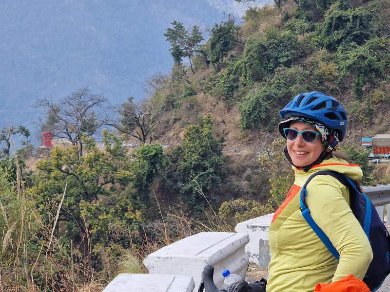
13-day cycling adventure through Uttarakhand, from Rishikesh to the Nepal border of Banbasa. Sacred river confluences, stunning Lower Himalayan landscapes, and cultural gems along the way
Uttarakhand, known as the Land of the Gods, is an incredible destination for cyclists looking for a mix of adventure, spirituality, and breathtaking landscapes.
Disclosure: Some of our articles contain affiliate links. This comes at no additional cost for you and helps us keep this website up and running. (as Amazon Associates we earn commission from qualifying purchases)

Every stretch of road offers something unique, from the turquoise waters of the Ganga to the sacred river confluences and stunning Himalayan peaks.
This guide takes you through a 13-day cycling route from Rishikesh to the Nepal border on Banbasa, highlighting key locations, challenges, and must-visit spots along the way.
We did it without rushing, stopping early to enjoy the places and walk around. The same route could easily be done in half the time.
Our Uttarakhand cycling trip is part of a longer trip to Nepal, much warmer than the Indian Himalayas (in Himachal Pradesh and Ladakh).
We began this trip at the start of February, so we primarily stayed in the lower Himalayas. Last here, we cycled from June in the higher regions of Himachal Pradesh, Ladakh, and Kashmir, starting in June.
You can have a look at our Manali-Leh bikepacking guide here or our Spiti Valley guide here. And, if you want to continue your bicycle exploration across the border, here’s our guide on bikepacking in Nepal.
Important (at least to us): Bring toilet paper with you, it is almost impossible to find!
Day 1: Tapovan to Kaudiyala
- Start Point: Tapovan
- End Point: Kaudiyala
- Elevation Gain: 500 m
- Distance: 32 km
- Highlights: Majestic views of the Ganga, low traffic (if done in low season, January and beginning of February is ideal).
- GPX Track
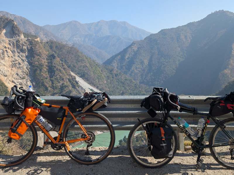
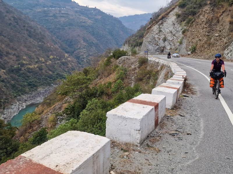
The Ganga, a stunning turquoise before the ice melt turned her brown, accompanied us. There is no traffic after passing Tapovan, at least by Indian standards.
Outside of the rafting season, the roads are much quieter, December to February is ideal.
We stopped to sleep in the small village of Kaudiyala, at a place called Meenakshi Restaurant and Lodge.
The room is not the cleanest, unfortunately a pretty common occurrence in India, but the view is one of the most beautiful I have ever seen and the food is good and very cheap, another pretty common occurrence in India.
You can take a long walk on the peaceful beach, the current is very strong so do not try to swim.
Day 2: Kaudiyala to Dev Prayag
- Distance: 32 km
- Start Point: Kaudiyala
- End Point: Dev Prayag
- Elevation Gain: 790 m
- Highlights: the sacred confluence of Bhagirathi and Alaknanda rivers, exploring Dev Prayag.
- GPX Track
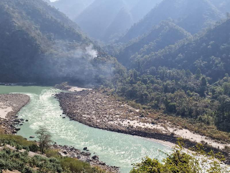
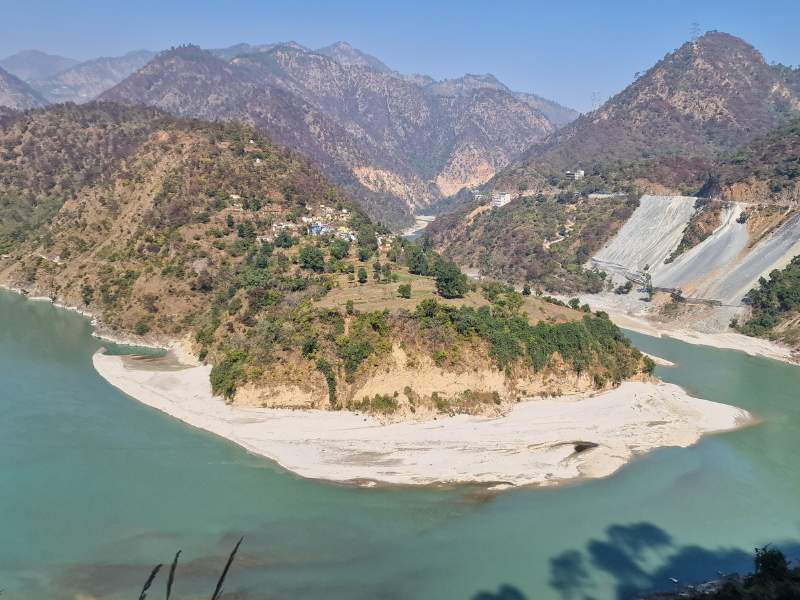
After a beautiful uphill with amazing views, you’ll descend toward Dev Prayag.
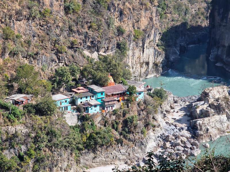
Dev Prayag is a sacred town where the Bhagirathi and Alaknanda rivers merge to form the Ganga River. It’s one of the Panch Prayags (five sacred river confluences) in Uttarakhand.
Dev Prayag has a unique spiritual atmosphere; to reach the confluence, you must descend about 300 steps through narrow alleys leading to the temple and then to the riverbank. The water is extremely cold, but many visitors immerse their feet as a symbolic purification ritual.
We stayed in a hotel that was a bit unclean, as usual, but had a good restaurant and was in an ideal location for visiting the village below, just a few hundred meters from the stairs.
What to See in Dev Prayag
- Suspension Bridge – Offers incredible views of the confluence and the surrounding mountains.
- Sangam (Confluence Point) – A stunning sight where the two rivers meet, with distinct colors visible before they merge.
- Raghunath Temple – An ancient temple dedicated to Lord Rama, said to be over 10,000 years old.
- Chandrabadni Temple (Nearby) – A short trek leads to panoramic Himalayan views.
- Vashishta Cave (En Route from Rishikesh) – A peaceful meditation spot near the Ganga.
Day 3: Dev Prayag to Srinagar
- Distance: 30 km
- Start Point: Dev Prayag
- End Point: Srinagar
- Elevation Gain: 280 m
- Highlights: Kamleshwar Mahadev Temple, local markets, unexpected peacefulness in the town.
- GPX Track
Srinagar (not to be confused with Srinagar in Kashmir) is the largest town in the Garhwal region and an important stop along the Alaknanda River.
The town surprised us with its many small and peaceful streets. It was very clean by Indian standards. Even our room was very clean.
Moving away from the plains near Rishikesh, you immediately notice a cultural shift—the sound of honking becomes less frequent, it is a bit more clean, the architecture start to be more Himalayans, and also the faces of the people.
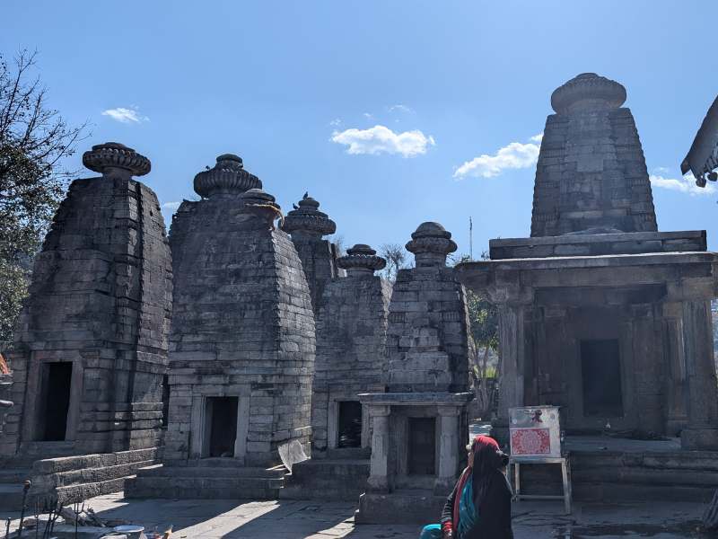
Another fascinating thing about northern India is that it’s not the part of the country with the most beautiful or impressive temples. In fact, quite the opposite. However, each temple has a story or legend that makes it interesting.
In Srinagar, you’ll find the Kamleshwar Mahadev Temple: Lord Rama performed a special Shiva Puja here. As part of the ritual, he offered 1,000 lotus flowers to Shiva. However, when he was about to complete the offering, he found that one lotus was missing.
To fulfill his vow, Rama was prepared to pluck out one of his own eyes (as he is also called “Kamal Nayan” – Lotus-Eyed). Just as he was about to do so, Lord Shiva appeared, pleased with Rama’s devotion, and granted him his blessings.
Day 4: Srinagar to Rudraprayag
- Distance: 35 km
- Start Point: Srinagar
- End Point: Rudraprayag
- Elevation Gain: 610 m
- Highlights: Landslides along the way, another sacred confluence, discovering affordable cakes.
- GPX Track
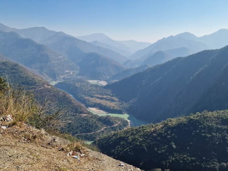
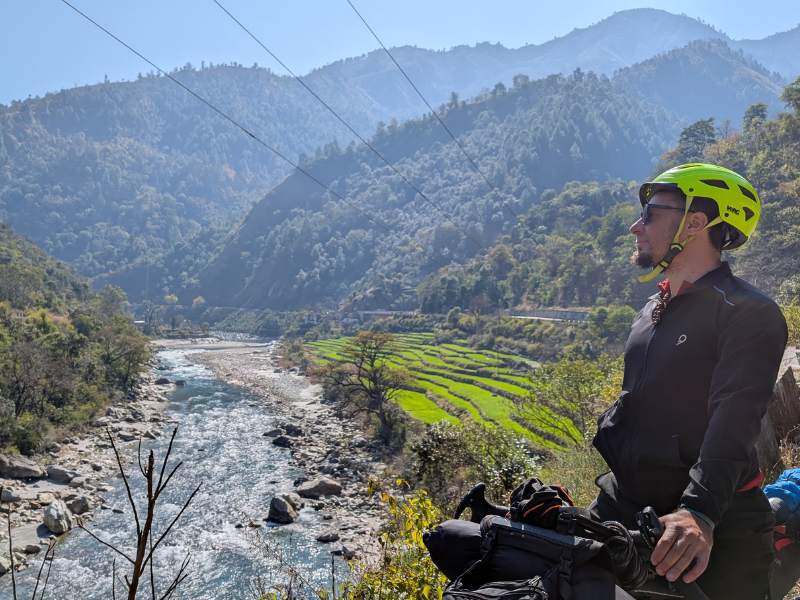
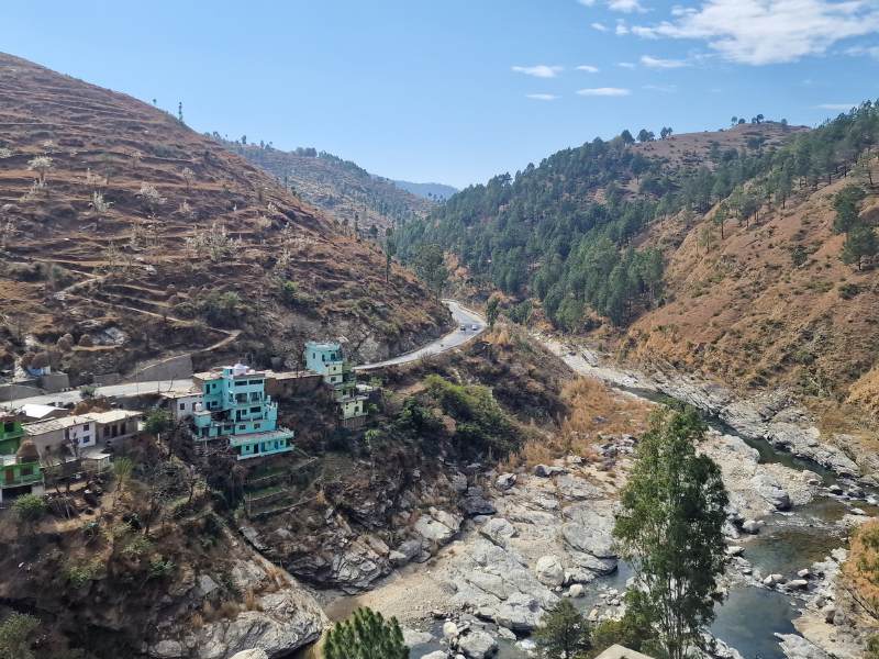
Heading towards our second Panch Prayag, we reached Rudraprayag, where the Alaknanda meets the Mandakini River. The roads were stunning but scattered with landslides. A delightful surprise? Finding truffle and red velvet cakes for just 40 cents!
Day 5: Rudraprayag to Karnaprayag
- Distance: 32 km
- Start Point: Rudraprayag
- End Point: Karnaprayag
- Elevation Gain: 560 m
- Highlights:
- GPX Track
We cycled past Shiva’s legendary Koteshwar Temple, witnessing colorful villages and simple rural life. Karnaprayag, another sacred river confluence, had visible signs of past floods. Our meal highlight? A “pizzeria” with AI-generated signboards advertising bizarre-fingered pizza lovers.
Day 6: Karnaprayag to Naraibagar
- Distance: 30 km
- Start Point: Karnaprayag
- End Point: Narainbagar
- Elevation Gain: 420 m
- Highlights: Chandika Devi Temple, women carrying enormous loads of foliage, and scenic village life.
- GPX Track
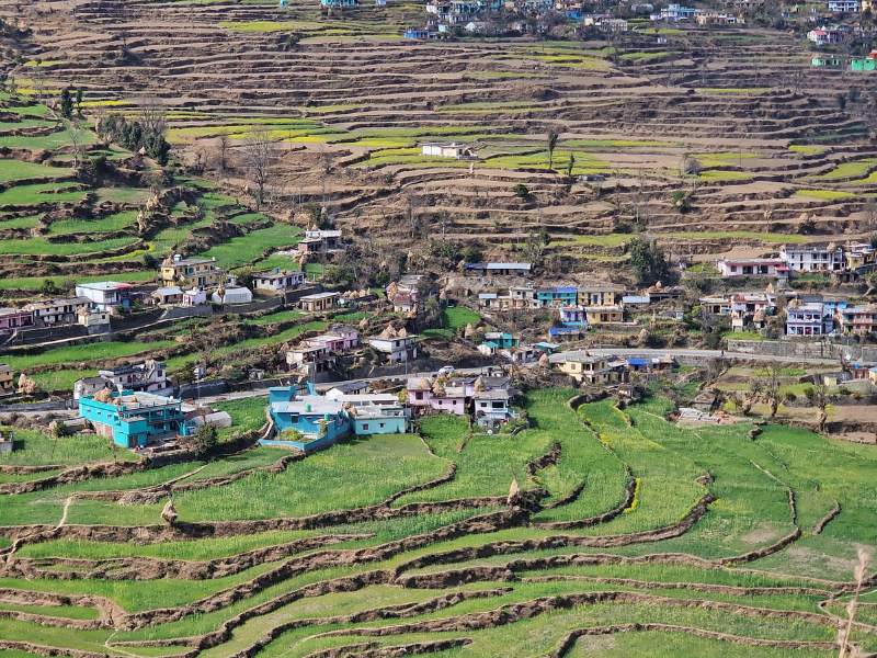
Following the Pindar River, we passed through Simli and Bagoli, seeing hardworking women balancing heavy loads on their backs. The landscapes were mesmerizing, and we stopped early in Naraibagar to immerse ourselves in village life.
Day 7: Naraibagar to Gwaldam
- Distance: 39 km
- Start Point: Narainbagar
- End Point: Gwaldam
- Elevation Gain: 1080 m
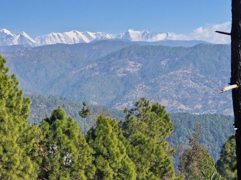
- Highlights: Climbing to 2,000m, Bhotiya community villages, a glimpse of Nanda Devi.
- GPX Track
A tough but rewarding climb led us through Deorada, home to the Bhotiya people known for wool weaving. Gwaldam greeted us with a Bollywood-style village party, and the next morning, we woke up to a clear view of Nanda Devi.
Day 8: Gwaldam to Kausani
- Distance: 40 km
- Start Point: Gwaldam
- End Point: Kausani
- Elevation Gain: 710 m
- Highlights: Baijnath Temple, aggressive temple monkeys, incredible Himalayan views.
- GPX Track
Descending from Gwaldam, we visited the historic Baijnath Temple, dodging mischievous monkeys. Cycling past terraces, we reached Kausani with breathtaking views of Nanda Devi.
Day 9: Kausani to Kosi
- Distance: 33 km
- Start Point: Kausani
- End Point: Kosi
- Elevation Gain: 120 m
- Highlights: Beautiful fruit trees, well-decorated houses, peaceful valley roads.
- GPX Track
A gentle climb to Kausani led us through stunning valleys with blooming trees and charming homes. The small village of Kosi, where we stopped for the night, felt like a hidden gem.
Day 10: Kosi to Khairna
- Distance: 40 km
- Start Point: Kosi
- End Point: Khairna
- Elevation Gain: 670 m
- Highlights: Kasar Devi Temple’s geomagnetic field, Bal Mithai dessert, long 1,000m descent.
- GPX Track
Almora, beyond its hill-station charm, boasts a temple on the Van Allen Belt, attracting spiritual seekers like Bob Dylan. We skipped the cosmic energy but indulged in Bal Mithai. A stunning descent brought us to Khairna.
Day 11: Khairna to Bhimtal
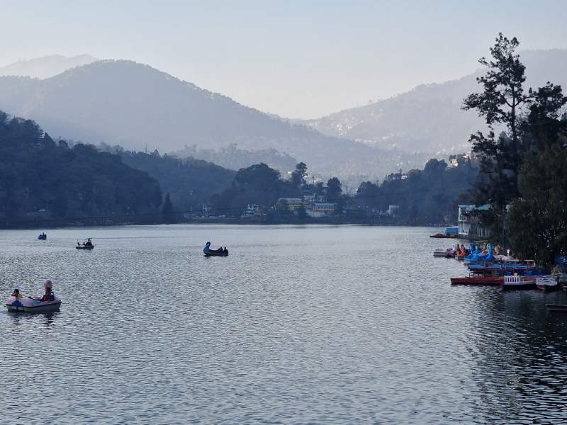
- Distance: 30 km
- Start Point: Khairna
- End Point: Bhimtal
- Elevation Gain: 840 m
- Highlights: Heavy tourist traffic, honking chaos, disappointment in mass tourism.
- GPX Track
Traffic congestion made this a stressful day. Honking cars and careless drivers dampened our spirits. We skipped Nainital and rushed to Bhimtal, craving silence.
Day 12: Bhimtal to Sitarganj
- Distance: 71 km
- Start Point: Bhimtal
- End Point: Sitarganj
- Elevation Gain: 220
- Highlights: Nandhaur Wildlife Sanctuary buffer zone, sambar deer sighting, dusty industrial roads.
- GPX Track
An early start didn’t help us escape traffic, but a peaceful stretch near a dam provided brief relief. Chocolate biscuit generosity from a scooter delivery man brightened our day before reaching dusty Sitarganj.
Day 13: Sitarganj to Nepal Border
- Distance: 56 km
- Start Point: Sitarganj
- End Point: Nepal Border
- Elevation Gain: 220
- Highlights: Sikh pilgrimage site Nanakmatta, forest road to Nepal, and a smooth border crossing.
- GPX Track
Passing Gurdwara Nanakmatta Sahib, we saw beautifully dressed Sikh families. Choosing a dirt road near the dam, we reached the border through a scenic forest. Monkeys stole our dried fruit, but the crossing itself was one of the smoothest ever.
Check our guide about bikepacking Nepal!
Final Thoughts
Cycling in Uttarakhand is an unforgettable experience. The state offers stunning landscapes, cultural richness, and challenges that make the journey rewarding. From high-altitude climbs to sacred river confluences and peaceful villages, every moment is a mix of adventure and discovery. While some stretches are marred by chaotic traffic, the beauty of this Himalayan state makes it worth the effort.
Tips for Cyclists
- Best Time to Visit: Spring (March-May) and Autumn (September-November) offer the best weather.
- Accommodation: Guesthouses are common, but rural villages may have limited options.
- Cold Weather Gear: Essential for higher altitudes; temperatures can drop below freezing.
- Road Conditions: Be prepared for landslides, rough patches, and unexpected traffic jams.
- Food: Simple but tasty. Expect a lot of lentils, paneer, and occasional pizza surprises.
Enjoy the ride through Uttarakhand!