Last Updated on 9 May 2026 by Cycloscope
A complete guide to the Ciclovia Adriatica (BI6) — Italy’s 1,300 km coastal cycling route from Trieste to Santa Maria di Leuca. Route sections, GPX download tips, practical advice, and personal notes from years of riding it stage by stage
Some journeys are too long — and too beautiful — to rush. The Ciclovia Adriatica, officially designated as route BI6 of the national Bicitalia cycling network, is one of them. Stretching for approximately 1,300 kilometres from Trieste in the north-east down to Santa Maria di Leuca, the southernmost tip of Puglia, this is one of the longest and most scenically varied cycling routes in Europe.
Disclosure: Some of our articles contain affiliate links. This comes at no additional cost for you and helps us keep this website up and running. (as Amazon Associates we earn commission from qualifying purchases)
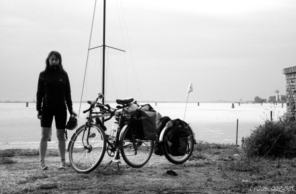
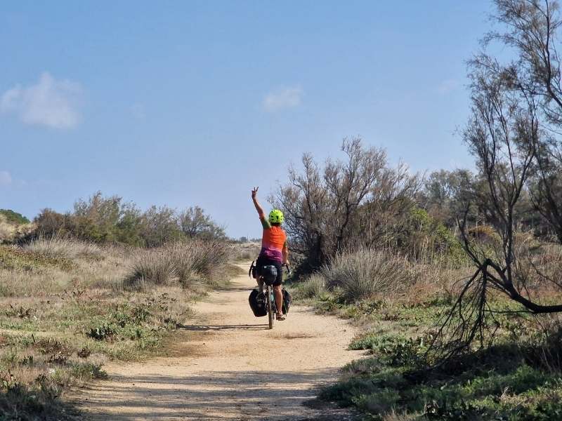
Over the years, we have pedalled it in pieces, as part of other itineraries, slowly working our way along the Adriatic shore from lagoon to trabocco, from Byzantine mosaic to white-washed masseria. This article is our attempt to collect those fragments into a coherent portrait of a route that, much like the sea it follows, rewards patience.
What Is the Ciclovia Adriatica?
The route is part of the Bicitalia network — the national cycle route system designed and promoted by FIAB (the Italian Federation of Environment and Bicycle). The northern section, from Trieste to the Po Delta, also forms part of EuroVelo 8, the pan-European Mediterranean Route.
Running parallel to the SS16 Adriatica state road in the central and southern sections, the ciclovia weaves through seven Italian regions: Friuli Venezia Giulia, Veneto, Emilia-Romagna, Marche, Abruzzo, Molise, and Puglia.
The Ciclovia Adriatica is still a work in progress. It is not a single, uninterrupted, dedicated cycle path for its entire length. Instead, it is a mosaic of dedicated cycling infrastructure, quiet secondary roads, and — in some sections — stretches of the busy SS16 that cannot yet be avoided.
The situation improves year by year as municipalities and regional governments complete new segments. As of 2026, the most complete and developed section by far is in Abruzzo, where the route is nearly continuous for its entire 132-kilometre regional extent.
GPX Tracks
The official reference GPX track for the BI6 can be downloaded from the Bicitalia website at bicitalia.org. Bear in mind that this track was not surveyed on the ground and should be treated as a general planning reference for distances and broad routing rather than a turn-by-turn navigation guide.
For the Puglia section, a dedicated road-book (available in Italian and English) was produced by the Puglia Regional Authority in collaboration with FIAB, and provides detailed cartography and road surface information for the southernmost stretch of the route.
Most of the route is easy and flat, except for the Gargano section where you’ll encounter a few climbs. The route is truly suitable for everyone, and you’ll almost always be close to the railway line in case you want to skip some sections.
Adriatic Coast Cycle Way – Section by Section
Section 1 — Friuli Venezia Giulia & Veneto: From Trieste to the Po Delta (~210 km)
The journey begins in Trieste, a city of wind, Habsburg architecture, and strong coffee, sitting at the cultural crossroads of Italy, Slovenia, and central Europe. The route initially follows the Parenzana cycleway, a former narrow-gauge railway that once connected Trieste to Poreč in what is now Croatia — a beautifully atmospheric start on converted rail infrastructure.
Heading west and then south, the route enters the flat Veneto-Friulian plain, crossing the Isonzo, Tagliamento, and Piave rivers — each laden with First World War history. The landscape here is one of uninterrupted farmland and small villages, with little shade.
The lagoons of Grado and Marano are among the highlights: long fingers of shallow, glittering water separated from the open Adriatic by thin strips of inhabited sandbar. Further south, the route passes through Lignano Sabbiadoro, Caorle, Jesolo, and the charming fishing town of Chioggia before reaching the vast, watery wilderness of the Po Delta.
Venice presents a logistical puzzle: the historic centre is entirely pedestrianised, so cyclists must use the public ferry-boat service (vaporetto), which does accept bikes. It is worth factoring extra time here, both for the practicalities and for the city itself.
The coastal stretch between Jesolo and Chioggia partly follows the SS Romea, a busy road with very little margin for cyclists — this is one of the route’s more challenging sections and one worth planning carefully.
Section 2 — Emilia-Romagna: The Riviera (~130 km)
Crossing the Po into Emilia-Romagna, the Ciclovia enters the long, flat promenade of the Italian Adriatic Riviera. This is beach-resort Italy at its most iconic: the coast is lined almost without interruption by hotels, beach clubs, and seafront bars from Comacchio to Rimini and beyond.
The landscape may be less dramatic than elsewhere on the route, but there is plenty of interest. The valleys of Comacchio — a vast lagoon system that has been producing eels since Roman times — are a highlight, especially in the off-season when the birds return.
Ravenna, just a few kilometres inland from Porto Corsini, contains one of the most extraordinary concentrations of early Christian and Byzantine mosaics in the world, including the dazzling interiors of the Basilica of San Vitale, a UNESCO World Heritage Site.
Cesenatico is a pleasant stop and a place of pilgrimage for cycling fans: the hometown of Marco Pantani, the mercurial climber known as “il Pirata”, is home to the Museo Marco Pantani. The town’s distinctive canal port, designed by Leonardo da Vinci, is also worth a visit.
A dedicated cycle path links Ravenna to Cervia, and another follows the coast from Pesaro to Fano — useful islands of traffic-free riding in an otherwise road-heavy section.
Section 3 — Marche: Monte Conero and the Riviera delle Palme (~160 km)
Crossing into Marche at Cattolica, the landscape immediately becomes more varied and the cycling more interesting. The route climbs briefly through the Parco Naturale del Monte San Bartolo, where the Adriatic appears far below, dark blue and dramatic, with views stretching to the Croatian coast on a clear day.
The standout geographical feature of this section is Monte Conero: a limestone promontory that plunges directly into the sea just south of Ancona, creating one of the most scenic interruptions anywhere on the route.
The ciclovia detours inland and upward here, rewarding the effort with panoramic views over the white-pebble coves and turquoise water below. The towns of Numana and Sirolo, tucked between cliff and sea, are two of the most beautiful on the entire route.
North of Ancona, the 13-kilometre cycle path between Pesaro and Fano is an excellent piece of infrastructure. South of Ancona, between Civitanova and San Benedetto del Tronto/Porto d’Ascoli, the route manages to avoid the SS16 almost entirely, using coastal minor roads and cycle paths — a welcome respite.
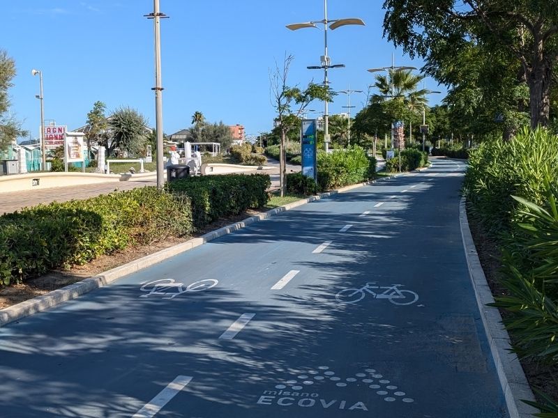
The Riviera delle Palme (the stretch around Grottammare, Cupramarittima, and San Benedetto del Tronto) is particularly pleasant, with an 18-kilometre cycle path running along the seafront.
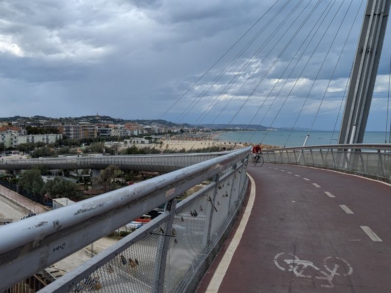
Section 4 — Abruzzo: The Trabocchi Coast (~132 km)
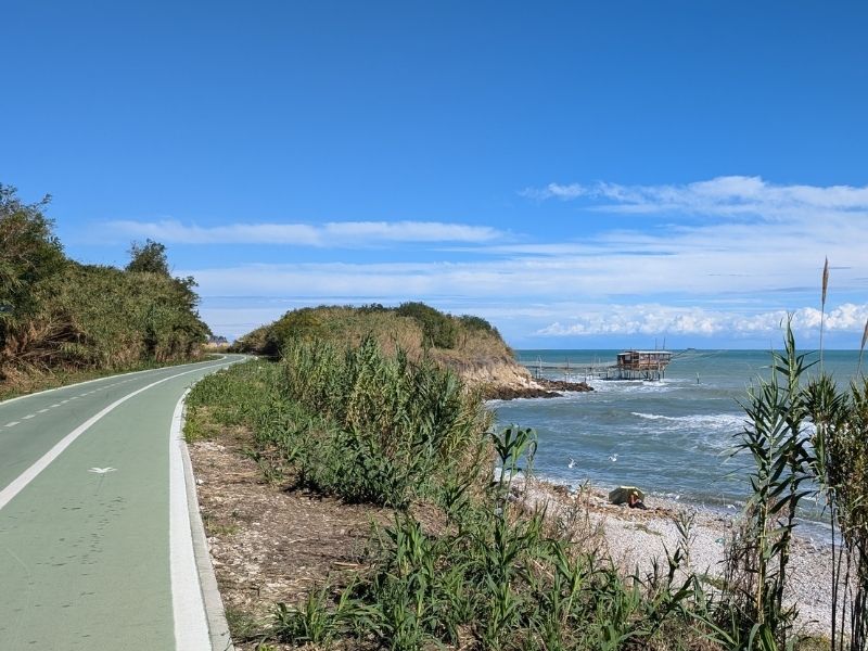
If there is one section of the Ciclovia Adriatica that has become justifiably famous, it is this one. Abruzzo is the jewel of the route, and the Via Verde della Costa dei Trabocchi — a 43-kilometre cycle path built on a former Adriatic railway line between Vasto and Ortona — is its crown.
The trabocchi are extraordinary wooden fishing machines: enormous pier-like structures built on stilts directly over the sea, projecting from the cliffs and rocky headlands of the Chieti coast. Many have been converted into restaurants, where you can eat freshly caught fish suspended above the waves.
The cycle path weaves between them, through three short tunnels in the cliff, across headlands and promontories, with the sea always visible and often audible beneath your wheels. It is one of the most exhilarating pieces of cycling infrastructure in Italy, and was inaugurated as the start of the 2023 Giro d’Italia.
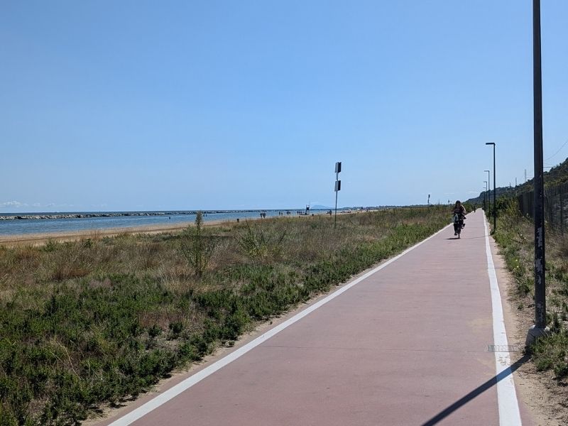
Further north, in the Teramo province, a long uninterrupted cycle path connects Martinsicuro, Alba Adriatica, Tortoreto, Giulianova, Roseto degli Abruzzi, and the provincial capital of Pescara, where the iconic Ponte del Mare cycle bridge crosses the Pescara river.
In Pescara province, the route is complete without interruption. The famous “Bike to Coast” path, which runs for 130 kilometres along the Abruzzo coast, has been described as one of the most beautiful coastal cycle routes in Italy and won Italy’s national cycle tourism award.
As of late 2023, the only remaining incomplete sections in Abruzzo are the stretch between Francavilla al Mare and Ortona, and a short section between Casalbordino and Vasto.
Section 5 — Molise: A Brief Coastal Cameo (~30 km)
Molise is Italy’s second-smallest region and one of its least visited, which is reason enough to pay attention to it. The Ciclovia skirts the coast for a short distance, with the walled old town of Termoli — its Norman castle rising directly above the harbour — as the main highlight.
A ferry from Termoli serves the Tremiti Islands, a stunning archipelago that makes for an excellent detour if you have a spare day and good legs for the return.
The Molise section of the ciclovia is still largely in development, and cycling on the SS16 is unavoidable in places. After the bridge over the Biferno river, the route turns inland on quieter roads toward the Puglia border.
Section 6 — Puglia: Gargano, Coast, and the Deep South (~670 km)
Entering Puglia, the route offers a choice that defines the character of your journey south.
Option A — the Gargano: The promontory that juts into the Adriatic like a spur on the boot of Italy is one of the most spectacular and least urbanised stretches of coastline in the country. The route passes the Lesina and Varano lagoons before climbing into the rugged limestone hills of the Gargano National Park. Here, the Foresta Umbra — a relic ancient beech forest — offers welcome shade and remarkable wildlife. The coastal road around the Gargano is demanding in terms of elevation, with significant climbs and descents, but the views over the sea and the characteristic white-walled towns of Peschici, Vieste, and Mattinata are extraordinary. A side trip by ferry to the Tremiti Islands is also possible from this coast. Traffic can be heavy in July and August.
Option B — the flat route via Foggia: For those who prefer to conserve their legs or avoid the summer crowds, the ciclovia offers an alternative flat route via Foggia and the saline flats of Margherita di Savoia — the largest salt works in Europe — before rejoining the coast.
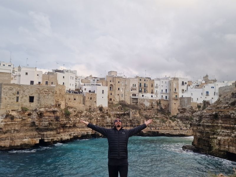
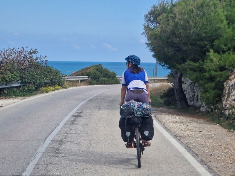
Both routes converge near Manfredonia and continue south along the coastal chain of Barletta, Trani, Bisceglie, Molfetta, Giovinazzo, and into Bari, linked by quiet secondary roads and sections of the former SS16. Trani, with its Romanesque cathedral rising directly from the sea, and Polignano a Mare — suspended on white limestone cliffs above extraordinary cobalt water — are two of the most photographed places in southern Italy.
South of Bari, the route continues to Brindisi using sections of the ancient Via Appia Traiana, the Roman road that once carried armies and pilgrims from Rome to the Adriatic. Brindisi is a point of intersection for several major cycling routes: it is the southern terminus of EuroVelo 5 (which runs to London) and a connection point for the Ciclovia dei Borboni toward Naples.
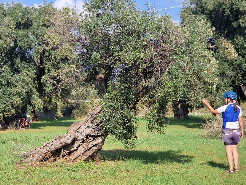
After Brindisi, the route temporarily leaves the coast to pass through the olive groves and macchia mediterranea of the Salento interior, arriving at Lecce — the baroque capital of the South, built from a warm golden limestone that glows in the afternoon light.
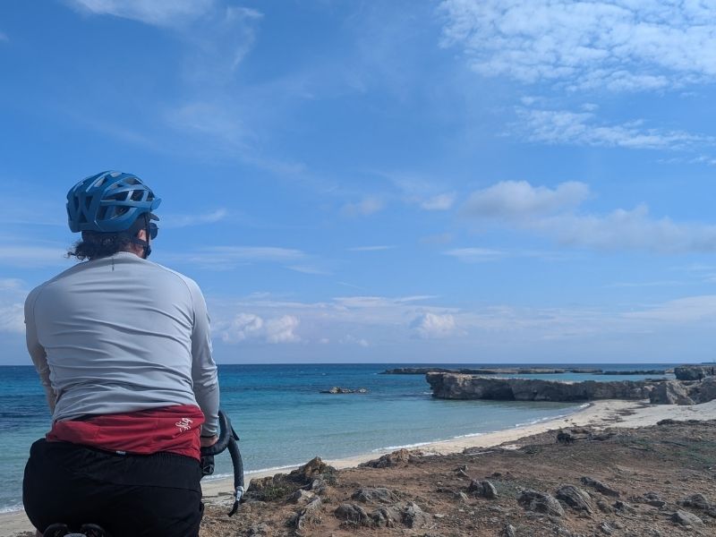
From Lecce, the ciclovia returns to the coast for the final push: south along the dramatic high clifftop road to Otranto, where the blue of the Adriatic and the darker Ionian begin to blur, and then down to Santa Maria di Leuca, where a lighthouse marks the end of Italy.
You can read our article dedicated to this section: Cycling Puglia: from Gargano to Lecce by Bike
Practical Information
Total distance: approximately 1,300 km (Trieste to Santa Maria di Leuca)
Best time to ride: Spring (April–June) and early autumn (September–October). July and August bring intense heat and heavy tourist traffic, particularly in the beach resort zones of Emilia-Romagna and along the Gargano coast.
Recommended bike: A touring bike, gravel bike, or hybrid/trekking bike. The surface varies considerably — mostly tarmac, with some light gravel on secondary roads. A pure road racing bike is not recommended.
Train & bike: The Adriatic railway line runs parallel to the route for almost its entire length and accepts bicycles on regional trains (subject to a daily supplement of around €3.50). This makes it easy to skip sections, return to a starting point, or bail out if weather or fatigue requires. Note that high-speed trains (Frecciarossa, Frecciargento) do not accept assembled bicycles; bikes must be boxed.
Navigation: Download the official GPX from bicitalia.org as a baseline, then supplement with ground-truthed tracks from Wikiloc or Komoot for specific sections. Signage is improving but remains inconsistent — good in Abruzzo and parts of Puglia, sparse or absent in other areas.
Connections with other routes: The Ciclovia Adriatica intersects with several other major European and national cycling routes: EuroVelo 8 (Mediterranean Route) at Trieste; Via Claudia Augusta and the Ciclopista del Brenta near Venice; EuroVelo 5 (Via Romea Francigena) at Brindisi; and the Ciclovia dell’Acquedotto Pugliese, which makes for an outstanding inland detour through Puglia.