Last Updated on 29 December 2025 by Cycloscope
What to see and do in Bohol, a pearl of the Visayas
An itinerary for traveling in Central Philippines by bicycle or backpacking
This article is part of our guide to budget adventure travel in the Philippines.
Check out the rest of our Philippines itinerary for more inspiration.
Disclosure: Some of our articles contain affiliate links. This comes at no additional cost for you and helps us keep this website up and running. (as Amazon Associates we earn commission from qualifying purchases)
Maybe because this was our first real encounter with rural Philippines, we developed a strong affection for this beautiful island. Bohol is, in our opinion, an unmissable destination for anyone wanting to explore the country beyond the usual tourist trail.
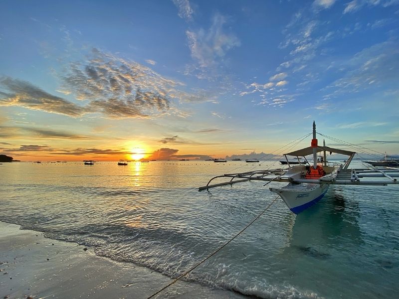
Bohol is part of the Central Visayas and is home to around 1.3 million people. It is one of the Philippines’ most popular destinations—mainly thanks to the Chocolate Hills and Panglao Island—but there is far more to discover once you move away from the hotspots.
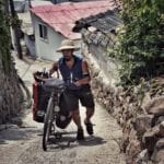
Our cycling loop around Bohol took five relaxed days, covering about 270 km, though it can easily be done faster. We reached Bohol from Cebu City by fast ferry (our short visa didn’t allow us to explore Cebu Island). Fast ferries are frequent and cost around 400 PHP, while slower boats are cheaper but less regular.
Tagbilaran City
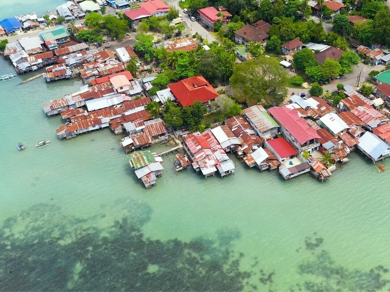
All ferries from Cebu and other islands arrive at the port of Tagbilaran, Bohol’s small and chaotic capital.
With roughly 100,000 inhabitants, it is the only real urban center on the island. Here you’ll find a few supermarkets, a large public market, and a shopping mall. If you need specific supplies, stock up here—it’s still limited by big-city standards, but much better than what you’ll find in rural areas.
Our bicycle trip in Bohol – the route
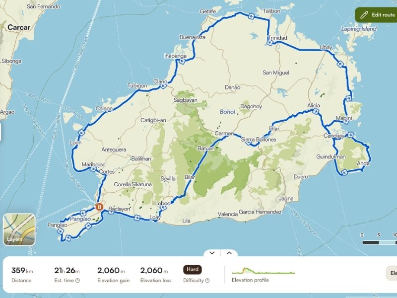
Below is the map of our loop around Bohol Island. The GPS track shows the route and elevation profile, which is mostly flat along the coast, with hillier terrain inland near the Chocolate Hills. (Click on the map to see it on Komoot)
Panglao Island
From Tagbilaran, you can head north, south, or cross the bridge to Panglao Island, Bohol’s main tourist hub. We chose to start there.
A full loop around Panglao is less than 40 km, completely flat and pleasant to ride. Despite being the most touristic area of Bohol, you won’t see many tourists outside the resort zones.
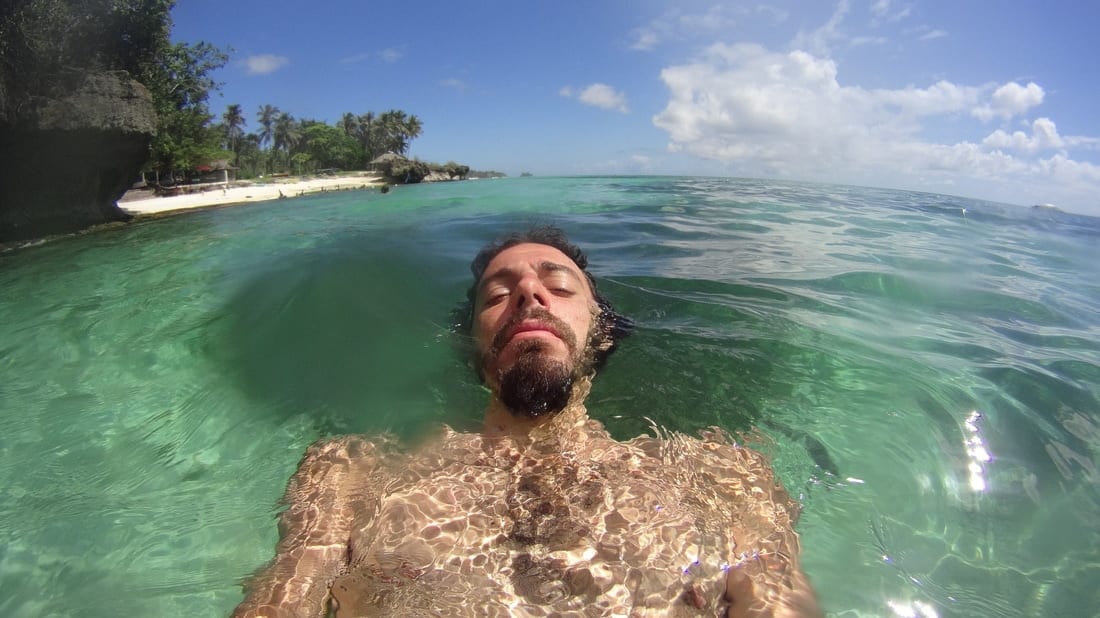
Resorts occupy many beaches, but Alona Beach, Dumaluan Beach, and several smaller access points are open to the public and offer good swimming. There’s also a large public beach on the western tip of the island; the water is shallow, but the sand is incredibly white and worth seeing.
As everywhere in the Philippines, we loved the creativity of local architecture—houses, huts, shops, and food stalls made from bamboo and rattan, each one different from the next.
Cycling Bohol’s southern coast
After Panglao, we followed advice from other cyclists and rode a loop through southern Bohol.
The first 10 km south of Tagbilaran can be noisy and stressful due to tricycles and jeepneys, but traffic thins out quickly. After that, the ride becomes pure paradise.
The sea is visible for much of this stretch, and there are plenty of spots to stop and swim, especially at high tide. At low tide, water shoes are useful.
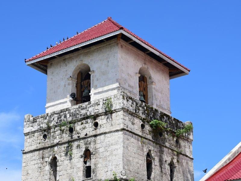
We stayed at Hilario’s, a very simple but friendly guesthouse (around 300 PHP). Along the same road, you’ll find Baclayon Church, the oldest church in Bohol, built from coral stone. Local kids often gather here to practice BMX tricks and skating.
Into the Interior: Chocolate Hills & Loboc
At Loay, we left the coast and headed inland toward the Chocolate Hills. After a few flat kilometers, the road climbs steeply to about 300 m above sea level.
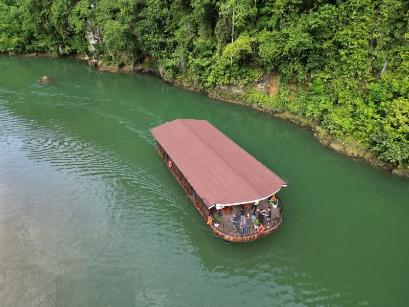
In Loboc, we stayed at Nuts Huts, a jungle lodge overlooking the Loboc River. While beautiful, it’s not ideal for cyclists: access involves a rough track and many steps, and there’s little help with luggage. The river itself can be explored by kayak or boat.
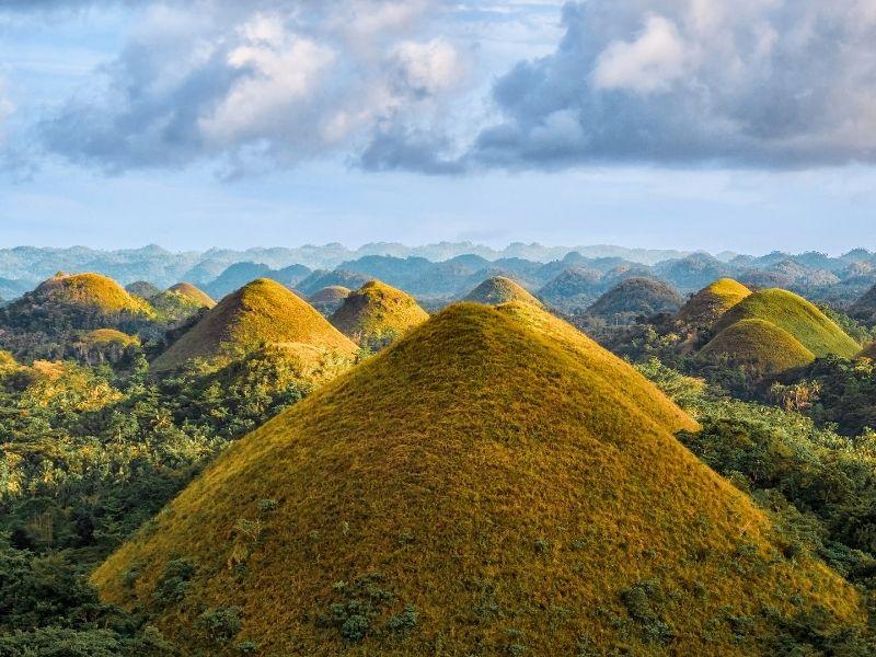
From here it’s a short ride to the Chocolate Hills, near the town of Carmen. The hills resemble giant chocolate bonbons during the dry season. The official viewpoint charges a small fee and is often crowded with tour buses. We skipped it.
What truly stood out was the ride itself: lush rice fields, limestone outcrops topped with palm trees, traditional houses, and farmers at work—a perfect snapshot of rural Philippines.
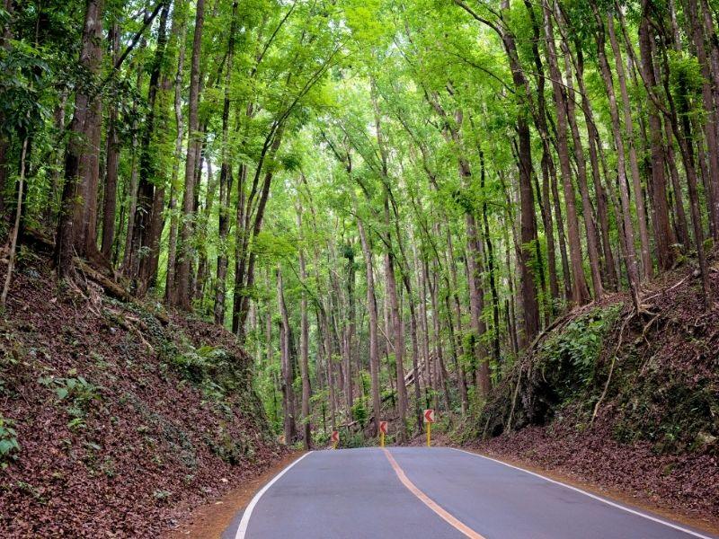
You’ll also pass through the Bilar Mahogany Forest, a shady and atmospheric stretch of road, though its ecological impact is controversial.
Beyond the Crowds: Alicia, Candijay & Anda
Past the Chocolate Hills, tourists all but disappear. Cycling remains easy and scenic through Sierra Bullones and Alicia, where we turned toward the east coast via Candijay.
This area offers some of Bohol’s best natural attractions:
- Can-umantad Falls, the tallest waterfall on the island
- Cadapdapan Rice Terraces, especially beautiful at sunrise
- Alicia Panoramic Park, with sweeping views over rolling hills
Eventually, we reached Anda, one of the most beautiful beach areas we’ve ever seen. While resorts exist, public beaches are easy to find. The water is crystal clear, the sand is powder-white, and the sea is usually calm enough to swim far offshore.
There’s a rough loop road around the Anda peninsula, but parts are steep and unpaved, so we chose to return the same way.
Back Along the East Coast

From Anda, we followed the coast back toward Tagbilaran, enjoying uninterrupted sea views through quiet, low-tourism villages.
In Jagna, we stopped at Paseo del Mar, a small resort with a dive shop. Snorkeling is possible directly from the beach (water shoes recommended). Today, snorkeling and diving gear is widely available, especially around Panglao, which has many professional dive centers.
Wildlife & Optional Detours
Near Corella, you can visit the Philippine Tarsier Sanctuary. The tarsier is the world’s smallest primate and is nocturnal. While this sanctuary is considered one of the more ethical options, visits can still feel intrusive, so we chose to skip it.
Other worthwhile side trips include:
- Blood Compact Shrine (Tagbilaran): an important historical site
- Balicasag Island (day trip from Panglao): excellent snorkeling and diving with turtles
- Hinagdanan Cave (Panglao): an easy-access cave with an underground lagoon
After returning to Tagbilaran, we continued our journey by ferry to Negros Island.
There is still much more to explore in Bohol, and this article reflects only our own (excellent) experience. For cyclists and backpackers, it’s an ideal island: scenic roads, friendly people, affordable prices, and a perfect balance between famous sights and untouched countryside.
If you know other great routes or hidden spots in Bohol, feel free to share them—we’d love to hear about them.