

Last Updated on 7 July 2026 by Cycloscope
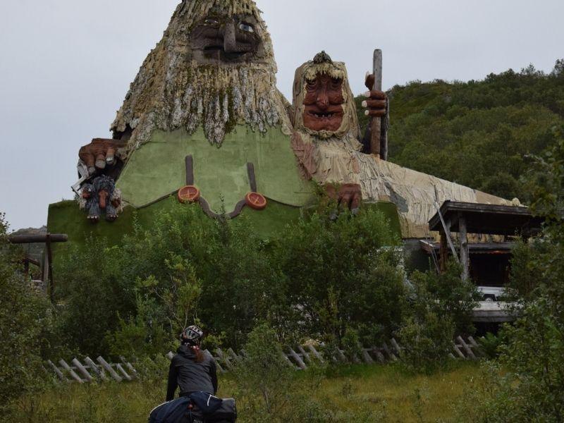
Norway’s most iconic road climb — eleven hairpins, a 320-metre waterfall, and one of those rare places where the reality is actually better than the photographs.
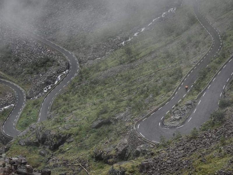
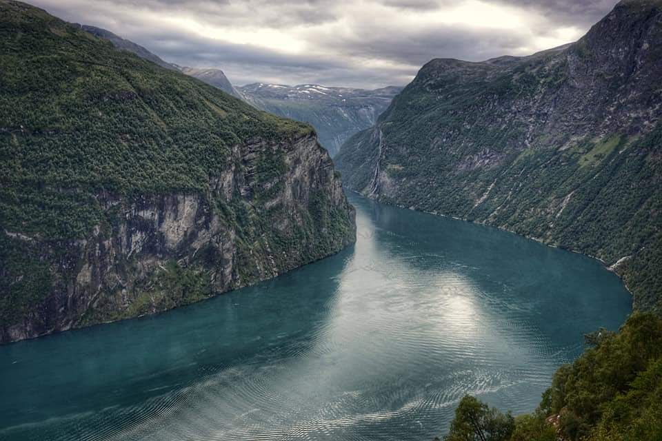
There is a moment, pedalling south out of Åndalsnes along the floor of Isterdalen, when the valley narrows, and the rock walls rise on both sides and you look up and think: there is no road up there. The cliff is vertical. There are waterfalls dropping hundreds of metres. And then you look more carefully, and there — stitched into the face of the rock like something from a fairy tale — you see the white stripe of a road, and hairpin after hairpin stacked one above the other, and a car the size of an ant crawling between them.
Disclosure: Some of our articles contain affiliate links. This comes at no additional cost for you and helps us keep this website up and running. (as Amazon Associates we earn commission from qualifying purchases)
That is the moment Trollstigen announces itself. We have ridden a lot of mountain roads, on a lot of continents, over more than twelve years in the saddle. This one is different. Not because of the gradient — there are steeper climbs — and not because of the distance — there are longer ones. It’s different because of the concentration of drama in such a small space, and because of the feeling, halfway up the hairpins with the Stigfossen waterfall crashing alongside you and the rock walls close enough to touch, that you are somewhere genuinely extraordinary.
Our cycling guide about Norway can be read here.
The Climb in Numbers
Total climb (from Åndalsnes to plateau): approximately 12.2 km / 7.6 miles
Elevation gain: ~843 m / 2,765 ft
Average gradient: 7.6% (full approach); around 9-10% on the hairpin section
Maximum gradient: 10% sustained on the switchbacks
Summit elevation: approximately 858–871 m above sea level
Number of hairpins: 11 (some sources say 11, older sources occasionally 12 — depends on where you count from)
Road type: Fv63, paved tarmac, two lanes (narrow in places), good condition
The climb is deceptive in its structure. For the first five kilometres, you ride along the valley floor through Isterdalen, and the gradient is less than 3%. This is the approach — flat, increasingly surrounded by vertical rock, with the wall ahead growing with every kilometre. In the other direction, the climb is completely different. The percentages are around 7–8% all the way up, with a few spikes on the bends. At the very beginning, you find yourself at the foot of mountains that very easily exceed 1,000 metres. They rise up in front of you with such force that they inspire fear, respect, and admiration all at once.
The climb is remarkably consistent, with 90% of the gradient in the 5–10% range. The steepest 500 metres sits at 9%.
The Name and the Legend
Trollstigen translates as “the Troll’s Path” or “Troll’s Ladder” — troll from Norse mythology, stigen from sti (steep path) or stige (ladder). Norwegian trolls are believed to be mythical creatures that live in isolated rocks or caves, alone or in small families, hostile towards humans. Looking at the cliffs that surround the road, the name seems apt. There is something genuinely otherworldly about the landscape, particularly in the shoulder seasons when mist sits in the valley, and the waterfalls are at full force.
Before becoming a major attraction for cyclists, motorcyclists, and drivers, Trollstigen used to be an important transport passage between the villages of Valldal in Indre Sunnmøre and Åndalsnes in Romsdalen. The packhorse track that preceded the current road has been partially restored and can still be walked — you can see sections of it running alongside the modern road if you know where to look.
History: Eight Years of Dynamite and Pickaxes
Construction began in 1928 and took eight years under conditions that now seem almost unimaginable: dynamite, pickaxes, and manual labour on a rock face buried under snow in winter and criss-crossed by waterfalls in summer. Each switchback was assigned to a different foreman, and all eleven still carry the name of the person who oversaw its construction.
Trollstigen was opened on 31 July 1936 by King Haakon VII after eight years of construction. He inaugurated the road before a crowd of thousands who had come from across the region. By any measure, it was a national event.
The infrastructure around the road has continued to develop since then. In the summer of 2005, the road was repaired, and about 16 million Norwegian kroner were spent to protect against rockfalls and make driving on the road safer. A major tourist facility, including a restaurant, was completed in 2012, and several viewing platforms were constructed, and older constructions improved upon. Trollstigen, along with County Road 63, was officially opened as a national tourist route on 16 June 2012.
The Two Sides
Trollstigen can be approached from two directions, and they are very different experiences.
From Åndalsnes (North) — The Classic Approach
This is the side you want for the hairpins. Starting from Åndalsnes at roughly sea level, you follow the Rauma River south through Isterdalen before the valley narrows and the wall appears ahead of you. The climbing begins in earnest at the base of the switchbacks, where the gradient quickly finds 8–9% and stays there.
The eleven hairpins are tight, numbered, and named. Each carries the name of the construction foreman responsible for that section of the 1928–1936 building project. As you climb, the Stigfossen waterfall grows louder and then becomes visible — first at a distance, then close, then directly alongside you. Stigfossen cascades 320 metres down the mountainside. There is a point, roughly two-thirds of the way up, where the road passes close enough to the waterfall that spray reaches you on the bike — one of those moments that makes you want to stop and stay.
The Åndalsnes side is the spectacular one — there’s no real argument. You spend the approach through Isterdalen staring up at the cliff face, trying to work out where the road actually goes, and then you’re in it: eleven switchbacks stacked on top of each other, Stigfossen crashing down the rock wall alongside you, and the peaks of Kongen and Bispen bracketing everything above.
At the top of the switchbacks, the road emerges onto a plateau, and the visitor centre appears on the right. Take the time to go out to the viewpoint: the largest viewing platform sits around 200 metres over the winding road, and the view back down over the hairpins and the valley is one of the best vantage points of any road we have seen anywhere.
From Valldal (South) — The Long Approach
The Valldal side is a different animal. It’s a long, gradual grind up through the Valldal valley, much less dramatic visually, and on a hot day, the climb drags. It’s the sensible way up if you’re linking Trollstigen into a longer route — but if you’re here for the hairpins, start in Åndalsnes.
The approach from Valldal via Scenic Route 63 is approximately 25 km with an average gradient of around 4%. The scenery is pleasant but entirely different in character — an agricultural valley rather than a sheer cliff. Many cyclists who ride the full Trollstigen–Geiranger route naturally approach from Valldal after the ferry crossing, which means they descend the hairpins rather than climb them. If possible, arrange your itinerary to climb from Åndalsnes. The ascent from the north is the reason Trollstigen is on every serious cyclist’s bucket list.
The Surrounding Mountains
Trollstigen is surrounded by mighty mountains. To the west: Bispen (1,450 m), Kongen (1,614 m) and Dronninga (1,701 m). To the east: Stigbottshornet (1,583 m) and Storgrovfjellet (1,629 m).
Although Stigfossen is the most famous and prominent waterfall, there is a second waterfall — Trollfossen — which is 280 metres high, making it 40 metres higher than Stigfossen. Trollfossen is visible on the western side of the climb and deserves its own moment of attention.
The geology is pure Scandinavian high mountain: granite and gneiss, the rock polished and carved by glaciers into near-vertical faces. In early season, snow still sits in the gullies above the road well into June, and meltwater from dozens of unnamed streams crosses the road continuously throughout the summer.
The Descent
The descent from the plateau to Åndalsnes is one of the most technically demanding parts of the ride and should not be underestimated after the effort of the climb.
The real risks on the descent are coach traffic and loose gravel near the edge — take it conservatively, especially on the corners. The hairpins require focused braking and careful line choice. The road is narrow enough that a campervan occupies most of the lane, and coaches are not always positioned as far left as you would like. On the positive side, the barriers on the outside of the hairpins provide some protection, and the road surface is well-maintained.
Control your speed into each hairpin well before the apex. The gravel that washes off the slope above the road tends to collect at the outside of the bends — exactly where you do not want your tyres to be when you are braking hard. Particularly in wet conditions or early season when rockfall debris has not been swept, treat every corner with appropriate caution.
After the hairpins, the descent is fast, and the road opens up considerably. The views during the descent are, in some ways, even better than during the climb — you are looking into the valley rather than at the rock face immediately in front of you.
Rockfall History and 2026 Conditions
The mountain above Trollstigen has been a source of anxiety for road administrators since the road opened. The combination of steep, exposed slopes, significant rainfall, and freeze-thaw cycling produces regular instability.
Through the early 2020s the incidents piled up: in 2021, a rock hit the bonnet of a car on the hairpins; in 2022, a winter snow avalanche damaged the café building and parts of the road; in April 2024, a landslide took out a section of the road; in June 2024, there were six rockfalls in ten days, culminating in a rock smashing through a car window.
After the June 2024 incidents, Møre og Romsdal county closed the hairpin section for the rest of the year. Emergency rassikring — rockfall mitigation — work started that autumn. Crews released unstable boulders, installed new barriers, and stabilised the worst slopes. The road reopened on 11 July 2025.
2026 update: Trollstigen opened on 27 April 2026 — record-early compared to the typical late-May to early-June opening. No major planned closures for 2026. The emergency rockfall mitigation work completed in 2025 was considered sufficient to reopen the road. A larger long-term project to secure the entire route is planned for the future, but depends on toll funding and is several years away. Short closures during heavy rain remain possible — the county road administration closes the road temporarily when rainfall raises the risk of fresh rockfall. These closures are usually measured in hours.
Before riding, always check the live status on Statens Vegvesen (vegvesen.no) or call the Norwegian Public Roads Administration on +47 22 175 175.
Traffic: The Reality and What to Do About It
Trollstigen in peak season is busy. Very busy. In July, over 2,500 vehicles — ranging from buses and campervans to motorbikes and cars — travel up or down Trollstigen each day.
If you’re planning to cycle during the high season (mid-June to late August), it’s wise to ride early in the morning or later in the evening when traffic is lighter. Daylight lasts well past 23:00, giving you plenty of time to enjoy a quieter ride.
We recommend going before 8 am or one hour before sunset. Lower traffic and hopefully beautiful light too.
On the climb, traffic is generally manageable — vehicles move slowly, drivers are almost universally respectful of cyclists, and there is enough width on the straights between hairpins to find space. The hairpins themselves are where it gets complicated, particularly on the descent: vehicles over 12.4 metres long are prohibited from driving on the road, but within that limit, there are plenty of vehicles that will test your nerve on a narrow switchback.
One practical note: the ferry crossings and tourist infrastructure on the full Trollstigen–Geiranger route mean that traffic tends to cluster in waves as ferries arrive and depart. If you can time your ride to miss the post-ferry surge (typically between 10 am and 1 pm), the road becomes substantially quieter.
The Full Trollstigen–Geiranger Route
Trollstigen is best understood as the centrepiece of a longer ride rather than an out-and-back on its own. The National Tourist Route Geiranger–Trollstigen runs from Sogge Bru in Romsdalen to Langvatnet near Strynefjellet, a total of 104 kilometres. As a cycling route, the classic direction is Åndalsnes to Geiranger:
Åndalsnes → Trollstigen (climb): 12.2 km, +843 m.
Trollstigen plateau → Valldal (descent): 25 km, -850 m.
Ferry across Norddalsfjord: Eidsdal to Linge, 5 minutes.
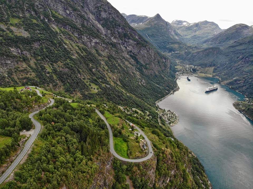
Ørnesvingen climb: the “Eagle Road”, approximately 8 km of hairpins with exceptional views over the Geirangerfjord.
Descent to Geiranger: approximately 10 km, -620 m.
After a fast descent and a ride through the valley, the short ferry crossing sets you up for the next leg. The climb to Geiranger is steep in places but offers exceptional fjord views on the way down.
For those with energy remaining after Geiranger, the continuation to Dalsnibba (1,476 m) adds the highest point accessible by road in Norway. The climb rises over 1,500 metres from sea level, with average gradients around 8–10%, variable mountain weather, and exposure to the elements — a serious test of endurance. The Dalsnibba viewpoint, when the weather cooperates, offers one of the finest elevated views of a fjord anywhere in Europe.

The Visitor Centre and What’s at the Top
The Trollstigen Visitor Centre sits at the top of the switchbacks on the plateau. The visitor centre includes a café, restrooms, and exhibitions about the history and construction of Trollstigen. The café at the top does a proper Norwegian waffle with brown cheese and jam. After 11 kilometres of climbing, it earns its place in the day.
At the top of Trollstigen, there are viewpoints and steel walkways which allow you to get close to the dramatic mountains and waterfalls. The main walkway extends out over the cliff edge on a cantilevered steel platform — the views down the hairpins and across to the waterfalls are exceptional. Give yourself at least 30 minutes here; the temptation to leave immediately after refuelling is one you will regret.
The Trollstigen Plateau and the two spectacular viewpoints are designed by Reiulf Ramstad Architects to blend into the natural surroundings. The architecture is genuinely good — angular concrete and steel that frame the landscape rather than competing with it.
When Does Trollstigen Open?
Trollstigen is a seasonal road. The opening date varies every year depending on snowfall and avalanche risk.
The highest point on the road is 858 metres, so snow clearance and avalanche assessment determine the exact date. Some years, the road clears by mid-May; in heavy-snow years, it has slipped into June.
As noted above, in 2026 the road opened unusually early — 27 April — following the completion of rockfall protection works. In a typical year, expect an opening between mid-May and early June. The road closes for winter with the first significant snowfall, usually in October but sometimes earlier in heavy years.
Check the official status at vegvesen.no or on the Statens Vegvesen live traffic map before planning your ride.
Getting There by Train
One of the genuinely underappreciated advantages of Trollstigen for cycle tourists is the railway access. From Oslo or Trondheim, you can take a train to Dombås and then a connecting train to Åndalsnes with your bike. Bikes must be prebooked on the Oslo–Dombås route. From Bergen, you can take the Hurtigruten coastal boat to Molde and ride or take a bus to Åndalsnes from there.
The Raumabanen — the Rauma Railway from Dombås to Åndalsnes — is one of the most beautiful railway lines in Norway, passing through Romsdalen and along the Rauma River gorge. Taking the train in and cycling out (or vice versa) is a completely logical way to approach the area, and means you can one-way the hairpins rather than returning by the same road.
Regional trains accept bicycles subject to a supplement. Book in advance for summer travel, as bike spaces are limited. The full journey from Oslo to Åndalsnes takes approximately 5–6 hours.
What Bike? What Gears?
Trollstigen does not require a specialist machine, but it does reward appropriate gearing.
The sustained gradient of 9–10% on the switchbacks is not extreme by alpine standards, but it is relentless within the hairpin section, and arriving at Trollstigen after a long ride from Åndalsnes means your legs will already have some kilometres in them. A compact chainset (34/50 or 36/52) with an 11-32 or 11-34 cassette will keep you comfortable on the sustained gradients. Those on touring bikes with triple chainrings will have no issues.
The road surface is generally good — a narrow two-lane road in excellent condition. A road bike or touring bike is perfectly appropriate. Wider tyres (28–32mm) provide additional confidence on the descent, particularly on the corners where gravel collects from the slopes above.
Hydraulic brakes are a significant advantage on the descent, particularly if you are carrying loaded panniers. The combination of a heavy bike, tight hairpins, and occasional wet road surface puts real demand on your stopping power. If riding a bike with cable rim brakes, check your brake pads before the descent and take the corners conservatively.
Practical Information
Distance (Åndalsnes to plateau): 12.2 km
Elevation gain (full approach): 843 m.
Average gradient: 7.6% overall, 9–10% on the switchbacks.
Road: Fv63, paved, two lanes, good condition.
Open: Typically mid-May to October, weather dependent. In 2026: opened on 27 April. Traffic: Heavy in peak season (July–August). Ride early morning or late evening. No toll for cycling Trollstigen.
Vehicles over 12.4 m are prohibited — but campervans and buses up to that length are common. Visitor Centre at the top: café, toilets, gift shop, viewing platforms (seasonal hours)
GPX: Available on Komoot, Strava, and Bikemap (search “Trollstigen”).
Live road status: vegvesen.no or +47 22 175 175.
Best season for cycling: Late May through mid-September. Early June and September are ideal — lower traffic than in July/August, generally good weather.
Connecting Routes from Trollstigen
- Geiranger–Trollstigen National Scenic Route (104 km total): The classic onward journey — south over the plateau, descent to Valldal, ferry at Eidsdal, Ørnesvingen hairpins, descent to Geiranger.
- Rauma Railway (Raumabanen): Åndalsnes is the terminus. Excellent option for combining rail and cycling.
- Romsdalen valley: East from Åndalsnes along the Rauma river, towards Dombås and the Dovrefjell plateau — a major cycle touring route connecting western fjords with the interior.
- Geirangerfjord and Dalsnibba: For those continuing south, the UNESCO-listed fjord and the Dalsnibba viewpoint road add two of Norway’s most celebrated landscapes to the same route.
- Trollveggen (Troll Wall): Approximately 25 km east of Åndalsnes in Romsdalen, the highest vertical rock face in Europe. A worthwhile detour on the approach or return, with a dedicated viewpoint area.
On the Road Itself
We first rode Trollstigen as part of a longer Norway trip, having already done Geiranger and the Ørnesvingen. We approached from Åndalsnes on a weekday in early September — cool, clear, with a westerly that put some chill in the air but also kept the air crystalline. By the time the valley narrowed and the cliff face came into full view ahead of us, we had already stopped twice to look up and try to understand where, exactly, the road went.
The climb itself is not punishing. It’s sustained and demands respect, but on a good day with appropriate gearing it flows — switchback, straight, switchback, straight, each hairpin a reset point where you can breathe and look around and check where you are on the rock face. The Stigfossen gets louder as you climb. There is a moment, on perhaps the seventh or eighth hairpin, where you are roughly level with the top of the waterfall and can look across at the full length of it — 320 metres of water dropping past you — and the road is close enough to the rock wall that you feel enclosed, sheltered, almost inside the mountain rather than on the outside of it.
At the top, the plateau opens out suddenly and the tension releases. Norwegian waffle. Brown cheese. Very strong coffee.
The descent, taken steadily, was one of the best we have had anywhere. Coming down through the hairpins with the valley laid out below you, the river threading through the green floor, the peaks above still lit in late afternoon light while the valley was already in shadow — it is the kind of thing you think about for years afterwards when somebody asks you where the best cycling has been.