Last Updated on 19 May 2026 by Cycloscope
A quiet, flat, and largely traffic-free route through canals, nature reserves, and lagoons — ending in the pine forests outside Ravenna.
There is something quietly satisfying about leaving a city by bicycle along a waterway. No traffic lights after the first few kilometres, no roundabouts, no lorries — just the path, the water beside you, and the flat Emilian countryside opening up in every direction.
Disclosure: Some of our articles contain affiliate links. This comes at no additional cost for you and helps us keep this website up and running. (as Amazon Associates we earn commission from qualifying purchases)
That is exactly how the Via del Mare begins: slipping out of Bologna along the towpath of the ancient Navile canal, almost without noticing the city falling away behind you.
The Via del Mare is a point-to-point cycling route connecting Bologna to Ravenna, covering approximately 140 kilometres through one of the most underappreciated natural landscapes in northern Italy.
It follows the historic waterways that once connected the inland city of Bologna to the Adriatic — first the Canale Navile, then the River Reno to its mouth, then the coast and pine forests into Ravenna. It is not a famous route. It does not appear on many international cycling itineraries. Which is exactly why it is worth riding.
The Route in Brief
Distance: ~140 km (Bologna to Ravenna).
Elevation gain: Minimal — entirely flat.
Surface: ~65% tarmac (secondary roads and cycle paths), ~35% unpaved (compacted gravel argine tracks, earth paths along the levees)
Difficulty: Easy to moderate — the distance and occasional rough surface are the main challenges, not the terrain.
Recommended bikes: gravel, trekking, or hybrid. A road bike with narrow tyres is possible, but uncomfortable on the unpaved sections.
Best time: Spring (April–June) and autumn (September–October). Summer is hot and humid on the plains; after heavy rain, the earth sections can become muddy and difficult.
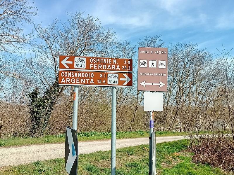
GPX: Available here and on Komoot (search “La Via del Mare da Bologna a Ravenna”). The route is not consistently signposted, so a GPS track is strongly recommended
Section by Section
Stage 1 — Bologna to Malalbergo (~55 km)
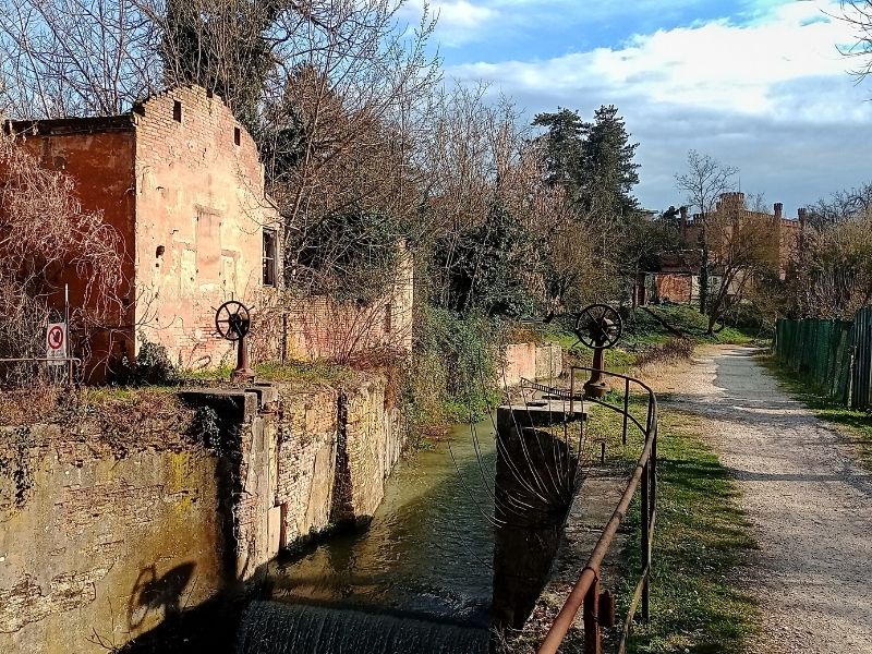
The route begins at via Bovi Campeggi, less than a kilometre from Bologna Centrale station — an easy start if you are arriving by train. From here, the towpath of the Canale Navile takes over almost immediately.
The Navile is one of Bologna’s great forgotten waterways. Constructed in the medieval period and progressively enlarged over the centuries, it once connected the city to the Po Delta and, by extension, to Venice and the entire Adriatic trading network.
The Porto of Bologna — the ancient logistical heart of the city, near Porta Lame — was linked to the canal through the Cavaticcio channel, now buried beneath the streets. Traces of this history survive along the first kilometres of the route: the Battiferro lock, a surviving hydraulic structure adjacent to the Museo del Patrimonio Industriale, is the only one of the original Navile lifting locks still in good condition.
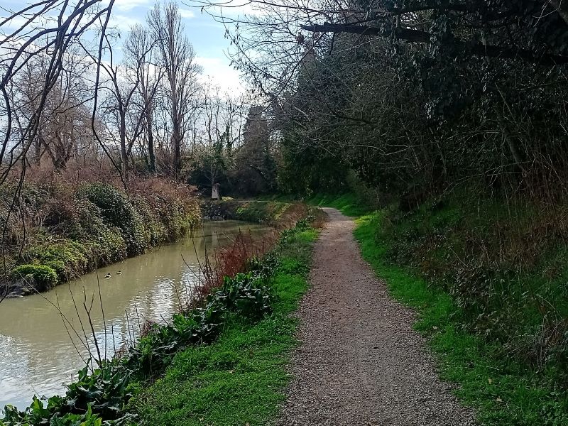
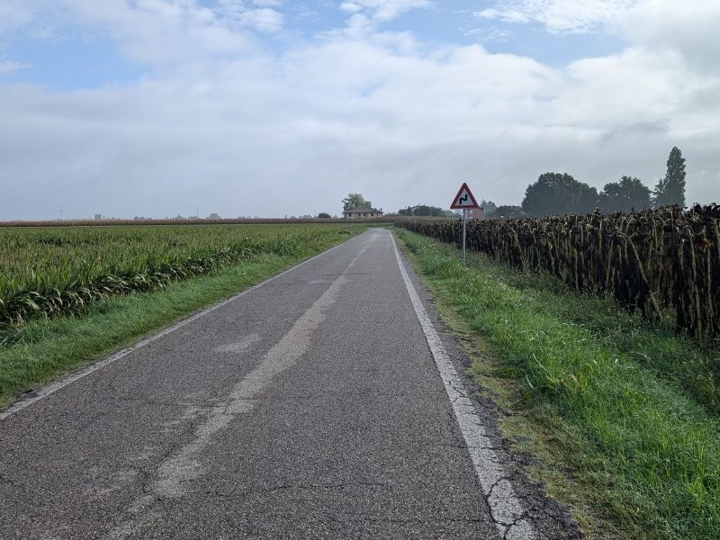
The path stays on the canal towpath, alternating between asphalt sections and compacted gravel, passing through the northern suburbs of Bologna before opening into open countryside. The atmosphere changes quickly — within 10 kilometres of the city centre, the landscape is flat fields, poplar rows, and the particular silence of the Po Plain.
After Corticella, the route passes through Castel Maggiore, Funo, Castagnolo Minore, and Santa Maria in Duno before reaching Bentivoglio, where the Castello and the Palazzo Rosso (now a public library) are worth a brief stop. Continuing north, the path crosses the Oasi della Rizza, a WWF nature reserve reclaimed from former rice paddies and marshland — a good place for birdwatching, with heron, egret, and various wading birds visible from the observation hides.
At Malalbergo, the route makes its decisive pivot eastward, leaving the Navile canal and joining the levee of the Fiume Reno. This is where the character of the ride changes. The surface becomes rougher and the landscape more open and wilder — wide skies, reed beds, and the sense that you are following a river toward the sea.
Note: at Malalbergo, there are two possible routes. The more scenic and historically authentic option follows the Via Valle along the last section of the Navile toward the sluice gates where it meets the Reno — but this section requires a mountain bike or gravel bike with wide tyres, as the track is rough and uneven. The easier alternative uses the via Scalone to Boschi, rejoining the main route at the iron bridge of via Penne.
Stage 2 — Malalbergo to Argenta (~40 km)
The second section follows the Reno levee eastward along a compacted-earth track raised above the surrounding farmland. This is the most remote and least serviced section of the route — services are sparse between Santa Maria in Duno and Argenta, so carry enough water and food.
The landscape here rewards patience. The Reno levee commands wide views over the flat countryside to the south and, increasingly, over the wetlands and water bodies that announce the approach of the Po Delta ecosystem. Herons stand motionless in the drainage ditches; egrets pick their way across flooded fields; in spring, the calls of frogs fill the evening air.
Near Argenta, a worthwhile detour is available to the Oasi di Campotto — a protected wetland area within the Parco del Delta del Po, home to flamingos, spoonbills, and dozens of migratory species.
The Central Idrovora di Saiarino, a historic pumping station that manages the hydraulic balance of the reclaimed plain, can be visited by appointment with the Consorzio della Bonifica Renana and offers a fascinating window into the engineering that makes this landscape livable.
Argenta itself is a pleasant town with bars, shops, and a good base for an overnight stop if you are riding the route over two or three days.
Stage 3 — Argenta to the Sea (~25 km)
From Argenta, the route continues northeast along the Reno levee, with the Valli di Comacchio appearing to the north — the vast, shallow lagoon system that has produced eels since Roman times and has been called the “little Camargue” of Italy.
The views across the water are extraordinary, particularly in early morning or at dusk, when the flamingos wade in the shallows, and the light turns everything gold and grey.
The Argine degli Angeli — a narrow strip of land threading through the middle of the lagoon, accessible to cyclists — is one of the most atmospheric sections of the entire route: water on both sides, horizon in every direction, and the particular silence of a landscape that has not been touched by roads.
The route reaches the Adriatic coast at Casalborsetti, where the river Reno finally meets the sea, though the last few hundred metres are inaccessible, the area being a military zone. From Casalborsetti, there are two options to reach Ravenna:
Option A (recommended): A winding path through the Pineta di San Vitale, an ancient coastal pine forest that runs for kilometres between the beach and the lagoons. The track is sandy in places — worth walking short sections rather than struggling on loaded bikes — but the atmosphere is extraordinary: silent, resinous, dappled light.
Option B: The coastal cycle path to Porto Corsini, where a small free ferry crosses the canal to Marina di Ravenna. From here, a well-surfaced and clearly signed cycle path runs directly into the centre of Ravenna.
Stage 4 — The Pine Forest to Ravenna (~20 km)
Whether you arrive via the pine forest or the coastal path, the final kilometres into Ravenna are among the most pleasant of the entire route. The cycle path from Marina di Ravenna initially runs alongside the SS67 but quickly enters a dedicated lane that carries you smoothly into the city centre — arriving, fittingly, near the train station.
Ravenna needs no introduction to anyone who has studied medieval history or Byzantine art. The city contains eight UNESCO World Heritage Sites within walking distance of each other: the Basilica di San Vitale, the Mausoleo di Galla Placidia, the Basilica di Sant’Apollinare Nuovo, the Battistero degli Ariani, and others. After 140 kilometres of flat plains and river levees, the gold and lapis lazuli of the fifth-century mosaics feel like a different world — which, in a sense, they are.
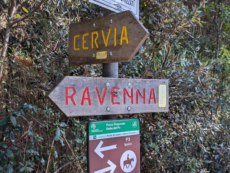
Read our full article Pineta di Ravenna Cycling Route: from Ravenna to Cervia through the Forest
Practical Information
Getting There and Back
The route is perfectly suited to a one-way trip by bicycle, returning by train. Both Bologna Centrale and Ravenna stations are on the national rail network, and regional trains between the two cities accept bicycles (subject to a supplement of around €3.50 and availability — check Trenitalia’s website in advance). Journey time by train is approximately 1h15.
If you prefer a circular route, it is possible to return to Bologna along the Ciclovia Adriatica (BI6) northward to the Po Delta and then inland — a significantly longer option that adds several days.
Overnight Options
The route can be ridden in two or three days comfortably:
Two-day version: Day 1 Bologna → Argenta (~95 km), Day 2 Argenta → Ravenna (~45 km) Three-day version: Day 1 Bologna → Malalbergo or Bentivoglio (~55 km), Day 2 → Argenta (~40 km), Day 3 → Ravenna (~45 km)
Accommodation along the route is available at Bentivoglio (Palazzo Rosso area), Malalbergo, Argenta (the most comfortable option, with several agriturismi and B&Bs), and at Marina di Ravenna or in the city centre.
Navigation
The route is not consistently signposted — this is its main practical challenge. Without a GPS track loaded on your device, it is very easy to lose the path, particularly on the Reno levee sections where the track splits repeatedly. Download the GPX before departure. The Komoot collection “La Via del Mare da Bologna a Ravenna” also provides a reliable ground-truthed version with surface data.
What Bike Do You Need?
A gravel bike or trekking bike is the ideal choice. The 35% of unpaved surface includes compacted earth levee tracks (generally rideable on anything with 35mm+ tyres) and some rougher grass or sandy sections (easier to walk). A road bike with 25mm tyres will work in dry conditions, but will be uncomfortable and potentially dangerous after rain. Panniers or frame bags work equally well — the route is flat enough that weight is not an issue.
Connections to Other Routes
The Via del Mare connects naturally with several major cycling itineraries:
- Ciclovia del Sole (EuroVelo 7) — Bologna is a key junction on this north-south route running from Capo Nord to Malta
- Ciclovia del Po (EuroVelo 8) — accessible from the Po Delta at the northern end of the Reno levee section
- Ciclovia Adriatica (BI6) — Ravenna is on the main route; from here, you can continue south along the coast toward the Marche and Abruzzo, or north toward the Po Delta and Venice
The Via del Mare is not a grand route. It does not cross any passes or follow any famous coastlines. What it offers instead is something rarer: a slow, quiet passage through a working landscape that most people drive through at 130 km/h on the A13 without ever seeing. The flamingos in the Valli di Comacchio, the smell of the pine forest at Casalborsetti, the moment the river levee narrows to a single track with water visible on both sides — these are the things you remember. Not the kilometres.