Kirishima range and Onami lake travel guide
How to get there and hike one of the best volcanoes in Kyushu, Japan
Japan, the land of volcanoes, set straight along the pacific ring of fire, there are around 118 active volcanoes here, spitfire mountains on alien landscapes.
The Kirishima range is one of them, one of the most restless, with 15 active cones (Takachihonomine, Nakadake, Ohatayama, Karakunidake, Tairoike, Ohachi, and Shinmoedake are the most notable) and 10 crater lakes. A powerful place, not to be missed if you’re in Kyushu.
The highest peak is mt. Karakuni and Onami lake is the highest crater lake in Japan, a hiking paradise all around, even though some tracks may be closed, the guys are always nervous here.
We reached the Kirishima area from Kagoshima, as one of the first destinations of our three months bicycle trip in Japan. If it’s true that the range is amazing, nevertheless the road to reach it is worth the journey itself, here is the chronicle of our trip.
Check also
For hints and trip about traveling in Japan on a very tight budget (less than 10USD per day) read our guide here.
To have a panoramic of our Japanese bicycle touring project, check our itinerary in this other article
Here are 11 off-the-beaten-path destinations to visit in Japan
Please comment, like, and share on social networks if you like! Follow our Instagram account for more pics!
At the bottom of the page there’s a map of our ride from Kagoshima to Miyazaki, click on the track to see the elevation profile.
Disclosure: Some of our articles contain affiliate links. This comes at no additional cost for you and helps us keep this website up and running. (as Amazon Associates we earn commission from qualifying purchases)
Sakurajima to a Gloomy Waterfall – 54km
We wake up in a parking lot, still at the feet of Sakurajima, Kagoshima province. The foot onsen is there for us to make for a super-pleasant warm feet breakfast! We meet a Japanese cyclist from Osaka, Masahito, super nice guy, we’ll meet again on Osaka.
The coastal road is fairly flat, we try to take a bath but the water here is greasy. On the other hand, we see a funny animal walking/crawling fast underwater. The volcano Sakurajima is yet majestic, on our left, covered with a cap of smoke.
Leaving the coastal road after 21km, we arrive at Kirishima-shi, the town, here we meet Daniel, an English teacher (and who would have thought?). His wife is Japanese and works in a hotel with a spa, for a moment we hope for a lucky strike but unfortunately no invitation. Anyway, he’s a cyclist who knows the area, his advice is to go along road 223, along Amon-gawa river, we follow the advice and he follows us.
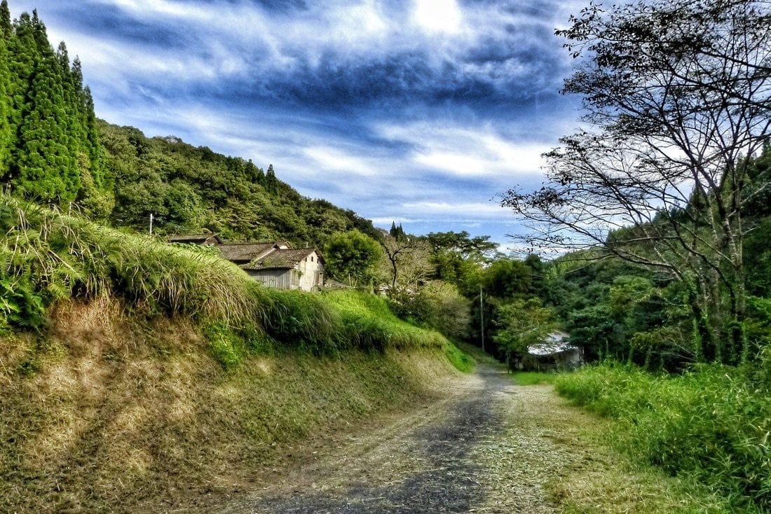
The road is beautiful (km34), slowly climbing, the river always beside us, with some amazing pools where to swim and many small waterfalls. Although we are just 100msl, it seems to be in the Alps.
Pristine pine woods left and right. And hot springs everywhere, very cheap, some for less than 1USD, but is still too hot to enjoy the Onsen. We stop to eat some eggs slowly boiled in thermal water, by the umpteenth free foot Onsen, here Daniel leaves us.
The climb gets a bit steeper, we get to 300msl at km 51. Time to find a place to sleep. We go down a steep road following the signs pointing to a waterfall and a Buddhist temple.
We find the waterfall (GPS 31.864066, 130.792223), you have to ford a river to get there. On the other side, in the woods, there are abandoned picnic areas. The atmosphere is a bit gloomy, we are surrounded by a forest of tall pines that suddenly becomes a forest of bamboo.
The trail to the waterfall is in a state of neglect, the waterfall is beautiful, about 30 meters, but we cannot sleep here, it would be complicated with bikes and there is no real place for the tent. A little further down the road and we set camp in a meadow near a rice field. There is a lot of moisture, the tent is all wet when we wake up.
Gloomy waterfall to Onami lake – 16km
Back up the steep road, to road 223. I push and Daniele rides. Along the way mosquitoes devour us. Back on the main road, the real uphill begins, it’s a 700 meters climb in 15km, not so hard really.
Just 6 km after our camping spot there’s the village of Makizonocho Takachiho (I think), where there are the last convenience stores, a camping and an information center where we meet a nice girl who gives us the usual unnecessary maps. Those are poorly made, it is not clear where the places are, too many comics (cute but not very useful), of course in Japanese only.
The climb goes on, a monkey tosses an acorn on my head. We cross an area full of abandoned hotels and onsen (hot springs). The windows are shattered, perhaps by the Shinmoedake’s eruption of 2011 when the volcano, waking after 52 years, exploded violently, damaging buildings up to 8 km away. Since then the path to this crater is closed, before it was a beautiful lake in an extinct crater. Now is a lava lake.
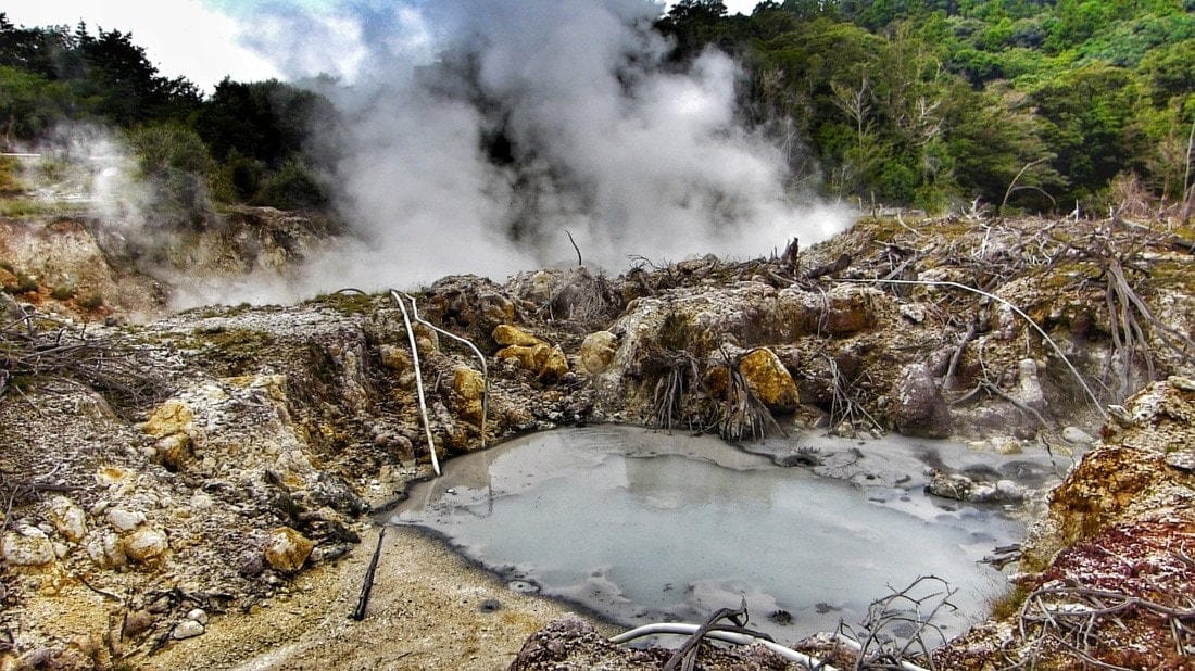
At one point, on the left side of the road we see smoke, there are pools of bubbling mud pool, Dante’s Inferno. There is a hot river, or rather nearly boiling, we try to dip a finger but it’s not possible. Large pipes collect some of this water to carry it to a near spa.
The landscape around is burned, no life form seems to stands this heat, the feeling to be on another planet overwhelm us, we lose track of time. If you pass by this place stop and have a look, impressive.
Hiking Onami lake
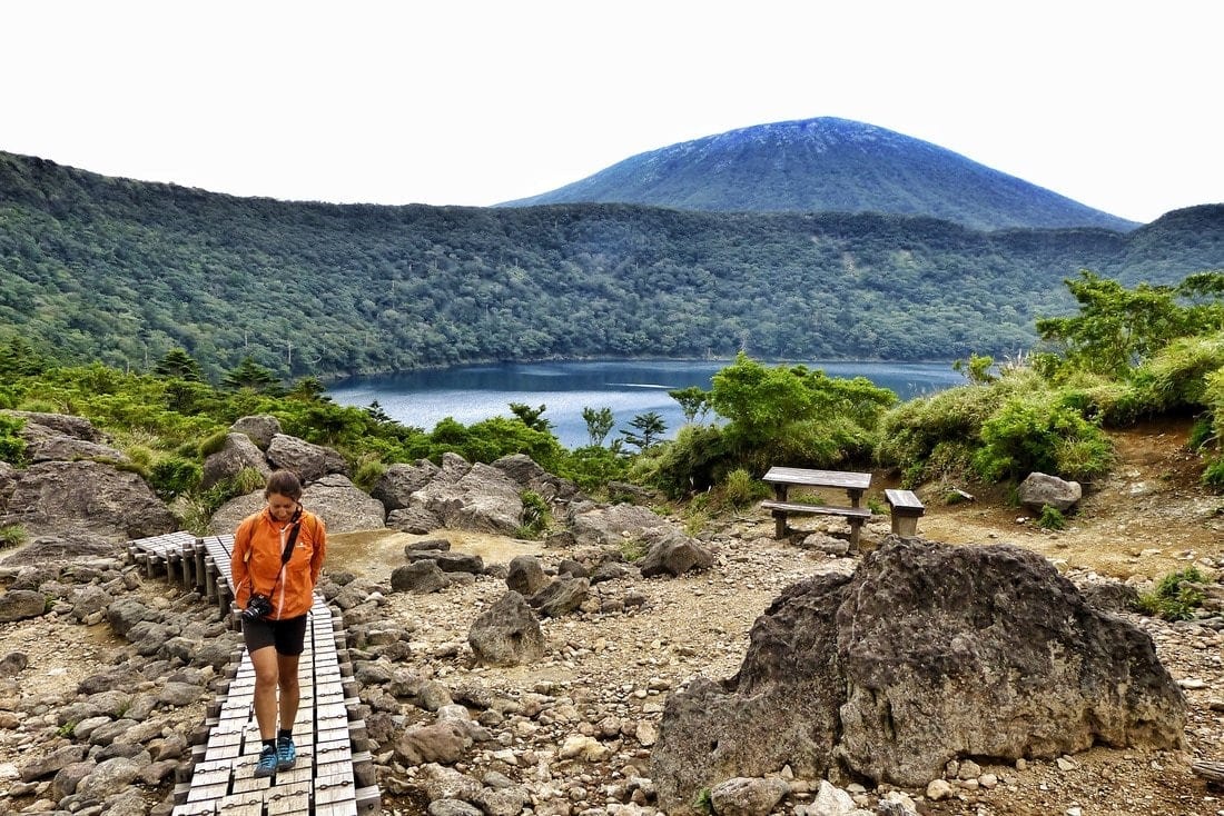
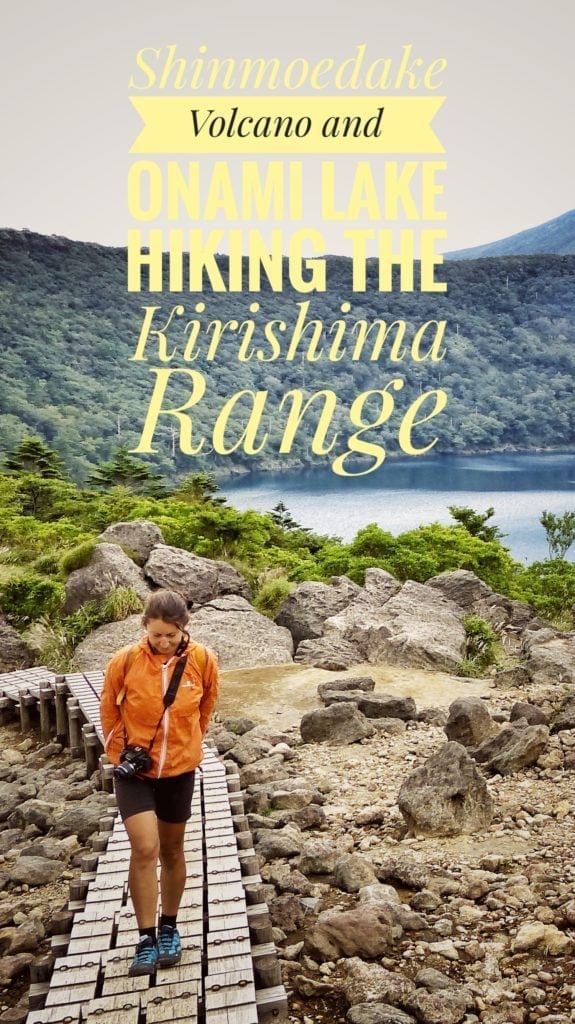
We reach the trail-head to Onami lake in the early afternoon. Onami-Ike is a lake in a volcanic crater, the highest in Japan at 1,412msl.
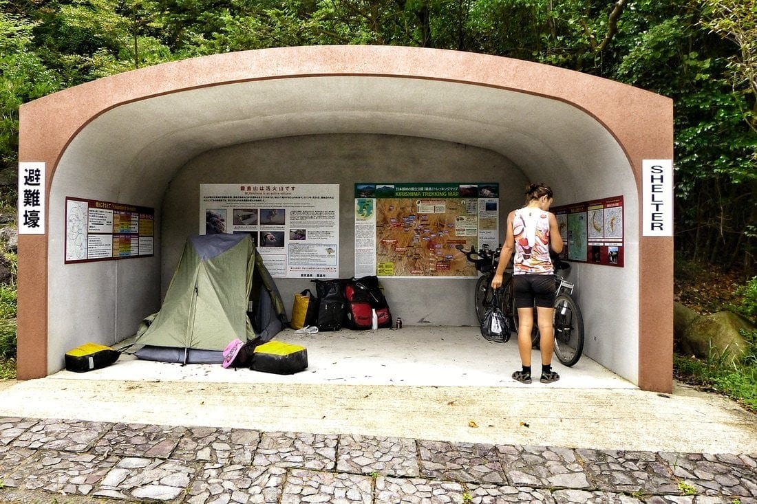
There’s a shelter where to take cover in case of an eruption, we leave the bikes there, where we plan to sleep tonight. On the move again, by foot up to the lake, we don’t have much time so we rush a bit.
The trek takes around 40 minutes, more if you take it easy, begins with a series of paved steps, and quickly becomes rougher, anyway doable almost by everybody. When finally we reach the top the view dazes us, the lake is stunning, surrounded by a sort of unnatural silence, even though it is the most natural thing there is.
Behind the pond stays Mt. Karakunidake, the highest peak, 1700msl, majestic. We stay in awe for a while, we’re alone, us, the lake and the volcanoes.
There is a trail that goes all around and even to Mt. Karakunidake but we are tired, and it’s too late. We’ll climb the Karakuni tomorrow from another trail.
We get back to the shelter to set up your tent, safest place around. As we go fill up our water bottles to the bathroom on the other side of the road (there’s always a public toilet in Japan) two deer cross the road, one is a puppy and nails in the middle of the road to look at us, maybe the first time he saw a human, it looked really amazed.
Hiking Ebino Plateau and Mt. Karakuni in Kirishima
A couple of cars, a few old men laugh to see us sleeping in the shelter. Not much traffic up here. We eat spaghetti with things that I would rather not reveal, shame on us. Quite night, silence, good sleep.
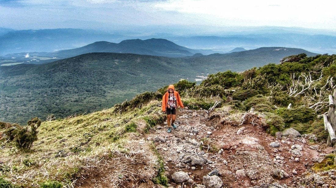
In the morning we get to the Ebino Plateau, just 4 km of easy climb further along the road. We park the bike and begin to hike the Karakunidake, about an hour’s walk.
We first meet the Io caldera (Ioyama), with its smell of sulfur in a red and white landscape. The climb is harder than the Onami’s one, but needless to say the view is of a stunning, epic quality.
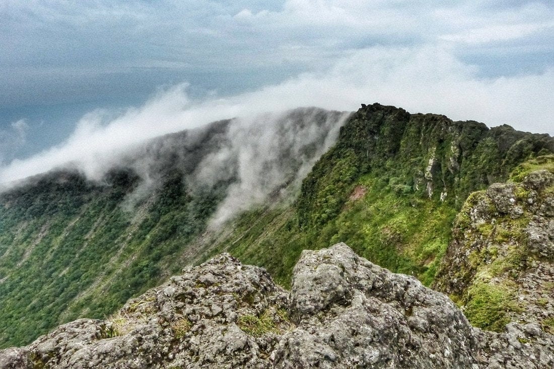
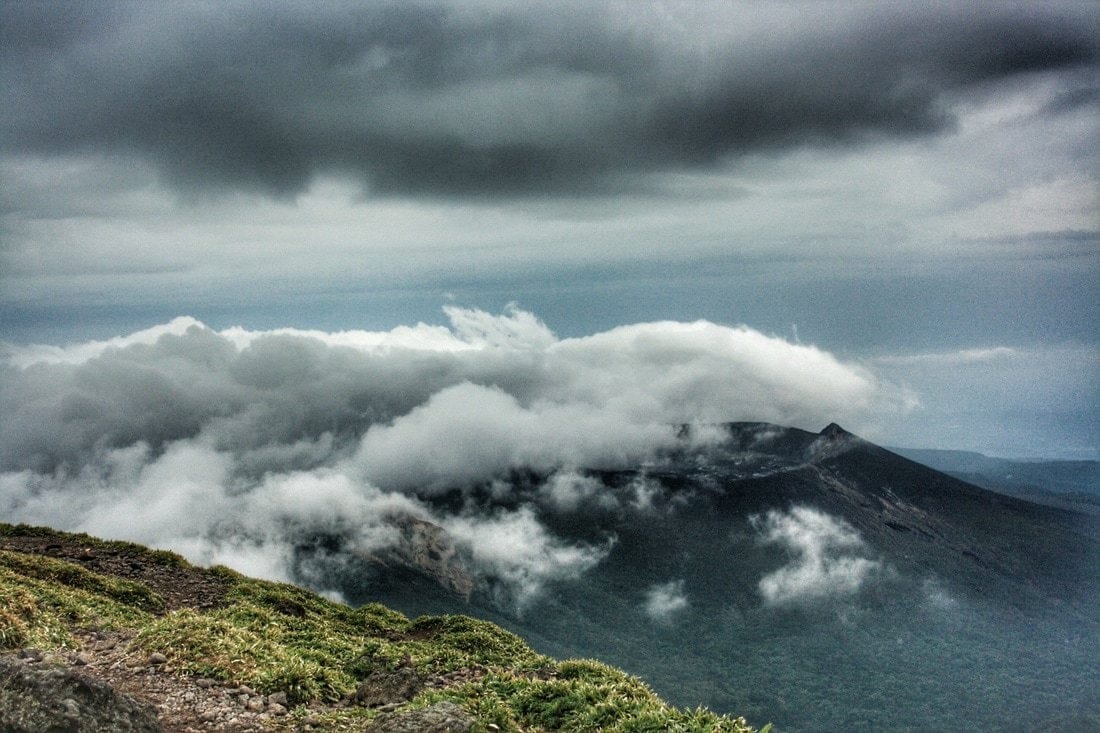
From the top at 1700msl we can see the crater who erupted in 2011, Mt. Shimonoedake, the Onami lake and three more crater lakes, and even peek inside the dormant (for now) crater of the Karakuni.
Thick smoke comes out from Shimonodake, brought here quickly with the wind, filling the crater near us in an unreal waterfall of steam.
In a few instants, we’re enveloped in a soupy mist, time to rush down the ridge, before being totally blinded. We leave with a longing of night time up here, maybe with a clement wind, there could be a chance to spot the lava lake inside the Shimonoedake.
Ebino Plateau to Miyazaki – 90km
Rain begins to fall, we ride downhill for 24 km, from 1,200 to 200msl, meadows and hills and then the forest again. We encounter no cars, maybe one. We cross the village of Ebino, famous for the hot springs, which really are everywhere here, a countryside straight out of a Studio Ghibli movie. Paddies and black soil and the volcano towering behind. Still downhill, still raining.
We stop to eat late, at 4 pm, in Kobayashi, we did not find anything for lunch along the way. We take a road along the Iwase-Gawa river, northward for a few km, and put the tent under the roof of a shed in front of a factory, wrapped in ivy, it seems abandoned but is not, just dreamy, like everything else here. Rain falls all night long but we are dry. We are happy.
The next day is a basically flat ride, for 60km, down to the coast and the city of Miyazaki, we sleep in a Buddhist cemetery, calm and peace pervades us.
Our route map, GPX track, and elevation profile of Kirishima Range, Onami Lake, and Ebino Plateau
Follow Us
Stay in touch while we get lost! Follow us on Social Media
